Middelwater
169 on the cadastre · on record 1777–1990 · show on the map
- Farm number
- No. 169
- On the cadastre
- 169, whole farmregistered as MIDDLEWATER
- District
- Prince Albert
- Extent, as the diagram states it
- 10731 morgen 100 sq roods
- Modern surveyed area
- 8944.0 ha
The historic extent and the modern surveyed area are two separate measurements and are not presented here as confirming each other. The first is what a surveyor wrote on a diagram, usually in morgen. The second is what the modern cadastre draws.
Why this farm is here
Cornelis Andries Oosthuizen held it. 7 km from Klaarstroom.
Cornelis Andries Oosthuizen is on record on this ground directly. No trace needed.
- story A written history is set on this ground Who are the two people from the loft at Klueplaas, on old Middelwater, about 1875?
- story A written history is set on this ground On 15 April 1841 loan ground becomes property
- story A written history names this ground Almero, and how it became an Oosthuizen name, 1786
- story A written history names this ground Rondawel's history: from a widow's mark to today's Marincowitz farm
- …and 2 more, listed in full further down this page.
Stories
- set here
Who are the two people from the loft at Klueplaas, on old Middelwater, about 1875?
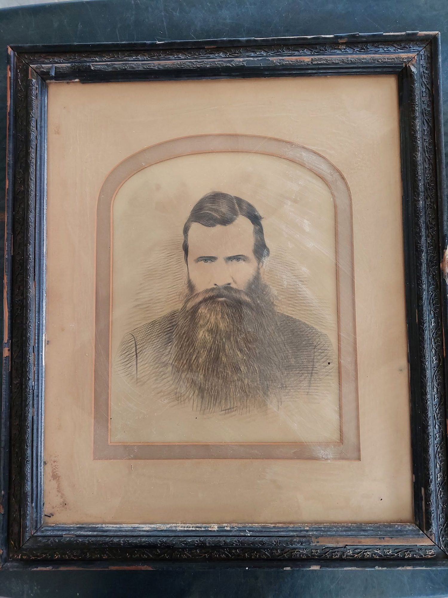
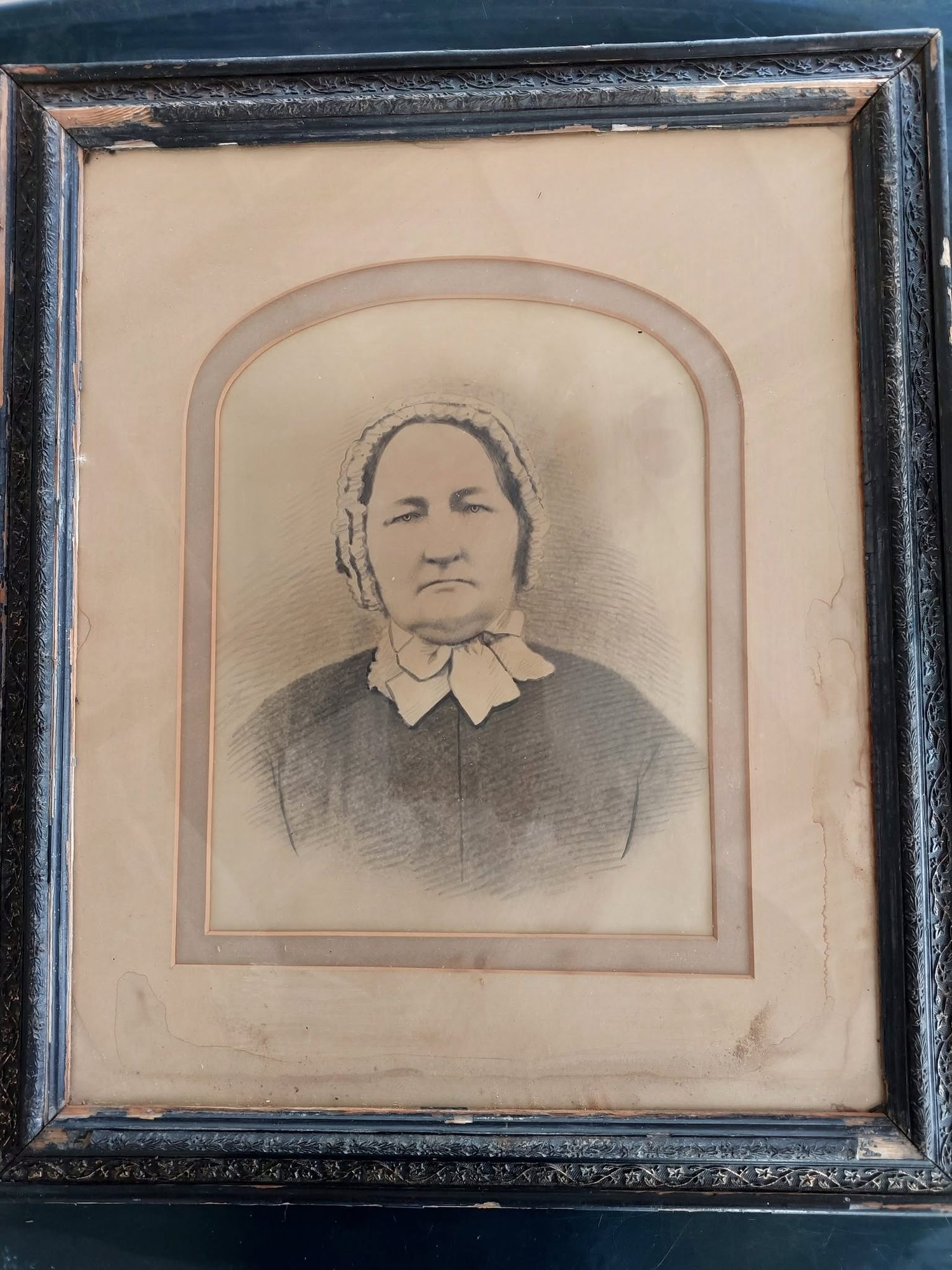
Two framed portrait sketches out of a loft on Klueplaas, which is ex-Middelwater ground. No names on the backing. A strong circumstantial case that they are Ockert Almero Oosthuizen and Aletta Hitge, and no evidence at all. The images are NOT published: permission has not been asked.
- about this farm
On 15 April 1841 loan ground becomes property
One surveyor works the Koup for two seasons. Seven years later, on a single day, the Crown converts the loan farms to perpetual quitrent: twenty-one deeds on twenty parcels, and the map of the district is set for a century.
- mentions this farm
Almero, and how it became an Oosthuizen name, 1786
A Venetian teenager in the service of the Dutch East India Company stands godfather at a Cape baptism in 1786. Six generations of Karoo farmers carry his name, and nobody remembers why.
- mentions this farm
Rondawel's history: from a widow's mark to today's Marincowitz farm
From a loan-farm widow who signed with a mark to the Marincowitz farm of today: the full documented history of Rondabel No. 124 - the Venter household of 1829, the twelve-farm grant day of 1841, the Oosthuizen-Theron partnership of 1868, the 1910-34 subdivisions, and the two graves by the huis nobody has read.
- about this farm
Middelwater's story since 1777
From a loan farm on the Zwartberg to eight cadastral parcels: the full documented history of Middelwater No. 169 - Stretch's 1833 survey for Okert Oosthuizen, the twelve-farm grant day of 1841, the 1883 resurvey and the 1884 quitrent to J.D.J. Oosthuysen 'and another', the portions cut off for a spring called Vaste Water and a place called Avondrust, and the 1990 power-line survey whose coordinates finally put the farm on a map.
- mentions this farm
Vrolykheid's story
The farm where the paper and the people disagree: Stretch's 1833 survey already carrying the names of portions not cut for another century, two titles granted on one day in 1841 - one to an Oosthuisen and one to an 'N. Hitge' whose deed four later portions cite instead - a Trieste immigrant who married a Hitge in 1844 and died holding the farm in 1890, and the death notice that finally put the Hitges on the ground.
- mentions this farm
From Petersburg to Klaarstroom, a history since 1777
The loan farm De Claar Stroom (Klaarstroom No. 178), granted 1777, is the ground Klaarstroom village stands on, not to be confused with Klaarstroom No. 184, which is Christian Hatting's grant 19 km west. Meiringspoort opened in 1858; twenty-seven erven were laid out on Petrus Oosthuizen's land and the village was called Petersburg for him. The erven were sold WITHOUT water rights. Who Petrus was is still unknown, and the one testable fact about him is a brother named Ockert.
- set here
The brother-in-law who founded a town
Two daughters of Middelwater marry two van Zyl brothers in the 1830s. One stays. The other goes north on the trek and is dead by about 1840, and her husband lives another sixty-six years and lays out the Free State town of Brandfort on his farm Keerom - described in print as a Voortrekker from Prince Albert.
- mentions this farm
Frikkie Oosthuizen builds a church at Zeekoegat, 65 km from town, 1906
Three generations of Oosthuizens in the Zwartberg church, and the rich farmer who built a chapel 65 km out on the dirt for a hundred people.
- mentions this farm
The Oosthuizen stamvader, entered in the VOC ledger, 1685
Nine fields in a Dutch East India Company ledger: a young man from Woerden - or Werden, or Werl - sails from Texel owing the Company his passage, sees Table Bay 127 days later, and five years on stops being a servant and becomes a settler. Everyone in this project descends from that decision.
- mentions this farm
Frikkie Oosthuizen's land moves on: Anna Margaretha and her three farms, 1937
On 20 December 1937 one transfer deed put three farms and 11,897 morgen into the name of Anna Margaretha Marincowitz, born Oosthuizen - Tokkie's mother, and one of only seven women in this model recorded holding ground in her own right. Her father had died fourteen months earlier and her brother took the neighbouring portion the same day.
- mentions this farm
Two Vrolykheid farms, far apart?
Two farms of one name, 400 km apart. The 1816 Tulbagh diagram names four neighbours; two of the surnames turn up in the Koup and only ONE survives being looked at. Jan de Bruin, whose 1823 estate held a farm the inventories call Rondabel, was baptised at Tulbagh in 1769, but the Theron who took Rondabel in 1868 was a Roggeveld man, and that thread is a coincidence of surname reported as one.
- mentions this farm
Oom Frikkie's eighty-one thousand morgen, 1856-1937
Frederik Simon 'Oom Frikkie' Oosthuizen died in 1936 holding, by one account, 81,000 morgen around Zwartkraal - about a quarter of all the ground on this map. This project holds not one deed in his name. What the money was probably in, what it was certainly not in, and the one document that would settle it.
- set here
Adriana Cecilia Venter's thirty-two years, 1808-1840
Adriana Cecilia Venter bore fourteen children between 1808 and about 1840. She was sixteen at the first and about forty-eight at the last, and the thirty-two years between them are exactly the period in which this family took its land.
- mentions this farm
The ground cut, and then stitched back together
This project holds 124 boundary acts: 96 subdivisions and 20 consolidations. Sorted by date they tell one story with a turning point. The district cut ground for a hundred and fifty years; from 1970 it has only stitched.
- mentions this farm
Jan Adriaan Venter and Wolwekraal
Jan Adriaan Venter was born on Wolve Kraal in 1823, orphaned off it at five, bought it at thirty-one, halved it and named half after himself at thirty-three, and spent the next thirty-seven years selling that half away.
- mentions this farm
Short years of great change, 1858-1860
Between February 1858 and February 1860 the Koup acquired a road to the sea, buried the couple the whole district descends from, laid out a village, had Crown land surveyed on its eastern edge, and met the industry that paid for the next forty years.
- mentions this farm
The words from the sources, 1753-1971
A glossary of the words these documents actually use — leeningsplaats, opstal, erfpacht, kwitrent, morgen and square roods, veldkornetskap, Weeskamer, vendue, d'oude — each illustrated by a verbatim line from the family's own papers.
- mentions this farm
Kopjes Kraal's story since 1859
Crown land surveyed in 1859 at 6,325 morgen and resurveyed four years later at 4,982 - about 1,343 morgen fewer, unexplained. Granted in 1871 to Gerolm Marincowitz of Trieste, whose surname reaches the Karoo from the Adriatic and not from the Netherlands. A stock route across it was ended by a line in a provincial gazette in 1926, and half of what was left became Kromrivier in 1934.
- mentions this farm
Four grandparents, four countries, from 1684
How four grandparents out of four lines met: three weddings in four years at Bellville and Williston, and a fourth marriage that tied two of them back together after both were widowed. Each line has its own page; this one is the join. Of the four countries the title promises, this record can point at one on a map.
- set here
The Oosthuizens of the Koup
Eight generations east, from a VOC soldier off the Land van Schouwen in 1685 to a farmer baptised at Prince Albert in 1909. An 1809 estate inventory shows a forge on the Olifants River and explains in one line why the family left: the farm was sold to the eldest son for 1 000 rixdollars, and the rest had to find ground elsewhere. After 1836 they stop moving, and title and a congregation arrive in the same two years.
- set here
From Modder Fonteyn to the Koup, 1809-1841
A clerk from the Orphan Chamber rode out to de Modder Fonteyn on the Olifants River on 23 April 1809 and wrote down what was in the house, room by room, including a complete forge in a room called the winkel. The owner had died intestate and his wife before him. Eleven children are named with their ages, and the seven youngest were placed with their eldest brother, aged twenty-five, who had promised to raise and school them. He bought the farm for a thousand rixdollars; the other ten had to find ground elsewhere. Twenty-five years later Oosthuizen households held two of three adjoining farms along the north foot of the Swartberg; the middle one was a du Preez's.
- mentions this farm
Brokkies uit oupa Almero Oosthuizen se dagboek
Almero Oosthuizen van Droogekloof, gebore 1878, skryf sy herinneringe neer op sy skoondogter se versoek: die 1885-vloed deur Meiringspoort, sy oupa wat in 1865 die Middelwaterse lemoenboord met vate natgery het, die perdevrekte van 1892, Klaarstroom se Pietersburg-jare, en die droogtes van 1914, 1926 en 1939. Woordeliks gepubliseer.
What this farm became
From 1883 this ground stopped being one farm, and the story continues on the pieces cut from it. Its own record above ends there; what happened afterwards belongs to a portion, not to the whole.
- 1883 Klein Vlei (Middelwater portion)
- 1923 Vaste Water (Middelwater No. 169 Ptn 5)
- 1926 Avondrust (Middelwater No. 169 Ptn 6)
- 19XX Rietfontein
- undated Middelwater No. 169 Ptn 1
- undated Middelwater No. 169 Ptn 2
- undated Middelwater No. 169 Ptn 3
- undated Ebeneser (Middelwater No. 169 Ptn 4)
- undated Middelwater No. 169 Ptn 7
- undated Remainder (Middelwater No. 169 Ptn 2)
Still filed here, and probably should not be. These rows are dated after this ground stopped being one farm, so under the rule above they belong on a portion. They are shown rather than hidden, because a misfiled row is only fixable once somebody can see it.
- 1884-03-24 ownership Jacobus Daniel Johannes Oosthuizen (1823-09-02–1903-06-11), Oosthuysen co-owner (unidentified)
Who stood on this ground, and how they were related
Everyone the record places here - by deed, by residence, or by burial - and the kinship between each pair of them. Two numbers are given and they are deliberately kept apart. Steps is how far apart two people are in the family graph, counting a marriage as one step. The common ancestor is the nearest one they share by blood, with the year they were born. A pair four steps apart through a couple born in the 1750s is a relationship; a pair ten steps apart through a progenitor born in the 1630s is background, because almost everybody descends from him. Read both.
- 1821 Cornelis Andries Oosthuizen held 1821~ · lived on 1821~
- 1822 Jan Louis Venter held 1822 · lived on 1822
- 1822 Johanna Jacomina Smit held 1822
- 1833 Ockert Almero Oosthuizen held 1833
- 1836 Ockert Almero Oosthuizen lived on 1836-11-27
- 1836 Susanna Catharina Oosthuizen (b.1819) lived on 1836
- 1850 Cornelis Andries Oosthuizen (b.1828) lived on 1850~
- 1865 Johannes Adriaan Oosthuizen lived on 1865~
- 1884 Jacobus Daniel Johannes Oosthuizen held 1884-03-24
- 1884 Oosthuysen co-owner (unidentified) held 1884-03-24
- — Johanna Machteld Petronella Strydom lived on
Drawn from the parentage and marriages this project holds, never from a shared surname. A pair with no common ancestor here may still be related through a link nobody has recorded yet.
Before this ground was cut out
This is the history of De Claar Stroom (the 1777 loan farm), the farm this ground was part of until 1777/1860. It is shown here because this ground was that farm, and separately from what follows because before the cut the record says the farm's name and not which part of it. Not everything below necessarily happened on this piece.
- 1777/1860 boundary subdivision: becomes Middelwater
- 1777/1860 boundary same_as: becomes De Claar Stroom (Klaarstroom No. 178)
- 1777 event De Claar Stroom loan farm granted parent farm of Middelwater and Klaarstroom This is PAR-000097, Klaarstroom No. 178. The loan farm itself is PAR-000004.
What the record holds, in order
- 1777–1860 boundary change subdivision: from De Claar Stroom (the 1777 loan farm)
-
1821~ to 188X
ownership
Cornelis Andries Oosthuizen (14 June 1792–1860)
occupation · confidence medium
-
about 1821
lived here
Cornelis Andries Oosthuizen (14 June 1792–1860)
farming
-
1822
ownership
Jan Louis Venter (1754–1824), Johanna Jacomina Smit (1760–1824)
loan farm · occupation · confidence high
-
1822
lived here
Jan Louis Venter (1754–1824)
tax roll
- 1833 boundary change consolidation: becomes Drooge Kloof
-
August 1833
document
SG diagram 349/1833
Bf.W.Q.5-7
-
1833 to 1841-04-15
ownership
Ockert Almero Oosthuizen (24 April 1786–26 February 1859)
loan farm · occupation · confidence high
-
27 November 1836
lived here
Ockert Almero Oosthuizen (27 November 1836–2 January 1922)
birth/farming
-
1836
lived here
Susanna Catharina Oosthuizen (b.1819) (31 May 1819–24 September 1856)
farming
-
15 April 1841
ownership
owner not named in the record
Perpetual Quitrent · grant · confidence medium
-
about 1850
lived here
Cornelis Andries Oosthuizen (b.1828) (1828–24 April 1871)
farming
-
18 February 1860
lived here
Johanna Machteld Petronella Strydom (5 January 1792–18 February 1860)
farming · to 1860-02-18
-
1865
event
Johannes Adriaan Oosthuizen (20 November 1816–11 August 1882)
So dry that Jan Adriaan Oosthuizen, then living on Middelwater (PAR-000001), watered the orange grove before the house with wagon and vats so the trees would not die; the only water left stood in the heights toward Kouwveldt at the steep drift. His grandson's diary carries it, from his son's telling - the only picture of daily life on Middelwater in the 1860s this record holds.
-
about 1865
lived here
Johannes Adriaan Oosthuizen (20 November 1816–11 August 1882)
memoir
- 1883 boundary change subdivision: becomes Klein Vlei (Middelwater portion)
-
October 1883
document
SG diagram 1364/1883
P.A.Q.3-3
- 1883 document SG diagram verso 1364/1883 (verso)
-
24 March 1884
ownership
Jacobus Daniel Johannes Oosthuizen (2 September 1823–11 June 1903), Oosthuysen co-owner (unidentified)
quitrent · grant · confidence high
- 1923 boundary change subdivision: becomes Vaste Water (Middelwater No. 169 Ptn 5)
- 1926 boundary change subdivision: becomes Avondrust (Middelwater No. 169 Ptn 6)
-
July 1988–August 1989
document
SG diagram L.G. 6955-90
K.354/96
-
1990
document
SG diagram L.G. 6954/90
K.354/96s
- undated boundary change subdivision: becomes Rietfontein
- undated boundary change remainder: becomes Moreson (Middelwater No. 169 Remainder)
- undated boundary change subdivision: becomes Middelwater No. 169 Ptn 1
- undated boundary change subdivision: becomes Middelwater No. 169 Ptn 2
- undated boundary change subdivision: becomes Middelwater No. 169 Ptn 3
- undated boundary change subdivision: becomes Ebeneser (Middelwater No. 169 Ptn 4)
- undated boundary change subdivision: becomes Middelwater No. 169 Ptn 7
- undated boundary change subdivision: becomes Remainder (Middelwater No. 169 Ptn 2)
Ground cut out of this farm
- Avondrust (Middelwater No. 169 Ptn 6) 876.9 ha
- Vaste Water (Middelwater No. 169 Ptn 5) 9.1 ha
- Klein Vlei (Middelwater portion)
- Moreson (Middelwater No. 169 Remainder) RE/169 · 378.4 ha
- Middelwater No. 169 Ptn 1 2351.7 ha
- Middelwater No. 169 Ptn 2 936.9 ha
- Remainder (Middelwater No. 169 Ptn 2) 382.5 ha
- Middelwater No. 169 Ptn 3 3544.8 ha
- Ebeneser (Middelwater No. 169 Ptn 4) 846.1 ha
- Middelwater No. 169 Ptn 7 554.4 ha
Bordered by, as the diagram names them
- N Remhoogte
- S Klein Vlei
- E Rondabel
- E Klaarstroom
- W Remhoogte
- W Venterskloof
- N Government ground
- S Klaar Water
- S Rondewal
- W Klein Valle
On the 1915 divisional map
As the Surveyor-General printed this farm in 1915: the registered holder, the date the title was issued and its quitrent reference, copied off the sheet as written. The whole map, farm by farm
| Farm, as printed | Holder | Title | Quitrent | Note |
|---|---|---|---|---|
| MIDDEL WATER Amended Title | J. D. J. Oosthuysen & others | 24 March 1884 | P.A.Q. 3.3 · fol. 3 |
Photographs
Also bordered by, as the modern cadastre draws it
Ground that touches this farm on the Surveyor-General's current polygons and that none of the diagrams held here names. Derived from the geometry, not read off a document.
- N Swartskraal (Rhemhoogte No. 125 Ptn 5)
- NE Middelwater No. 169 Ptn 3
- NE Rondabel No. 124 Remainder
- E Die Kruine No. 170
- S Moreson (Middelwater No. 169 Remainder)
- S Ebeneser (Middelwater No. 169 Ptn 4)
- S Wilgemond No. 179
- SW Avondrust (Middelwater No. 169 Ptn 6)
- SW Middelwater No. 169 Ptn 1
- SW Gideon's Hoop (Klein Valie No. 182 Ptn 4)
- SW Kouveld (Klein Valie No. 182 Ptn 6)
- SW Groenkraal (Klein Valie No. 182 Ptn 7)
- W Venters Kloof Annex No. 183
- NW Kareemoerhoek (Rhemhoogte No. 125 Ptn 4)
Documents
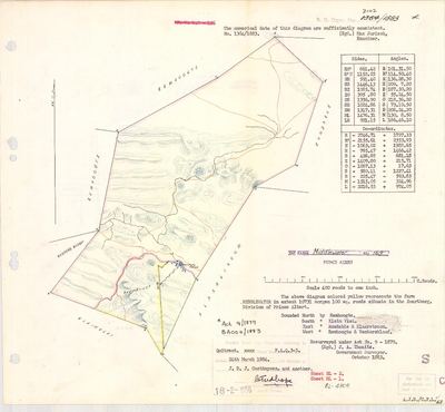 Surveyor-General diagram, 1364/1883, October 1883
11572715.PDF
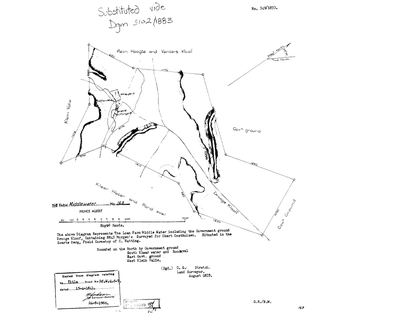 Surveyor-General diagram, 349/1833, August 1833
10JCGZ01.TIF
11572716.PDF
10JC2D01.TIF
10VGXQ01.jpg
Cadastre
Surveyor-General diagram index for this parcel
Research notes
Oosthuizen ancestral farm [29 Jul 2026] Neighbour Reim Hoogte (No.167) confirmed as N/W boundary via its own 1833 diagram, DOC-0070 - not itself a tracked parcel. [30 Jul 2026] All eight cadastral parcels on farm 169 are now in the model (PAR-000075-081 plus Vaste Water and Avondrust). THIS ROW REMAINS THE WHOLE FARM as granted, and its outline therefore overlaps its own portions - the two are different claims about the same ground, a century apart, and both are kept. AREA, AND THE UNIT TRAP THAT GOES WITH IT. The grant is 10,731 MORGEN 100 roods, which is 9,191.6 ha; the bare number 10,731 read as hectares overstates the farm by a sixth, and these sheets change units mid-table (DOC-0219 has one row in morgen and the next in hectares). Note also that PAR-000077 and PAR-000078 are Portion 2 and Portion 2 Remainder, so summing every row on farm 169 counts that ground twice. WHAT THE ARITHMETIC ACTUALLY SAYS, corrected 9 Aug 2026 after THEY ARE NOT. The cadastre holds both: Portion 2 at 936.9 ha (...169000020) and its Remainder at 382.5 (...169000021), and the 554.4 ha between them is PORTION 7 to the tenth of a hectare. Both rows had been pinned to the Remainder's key, which is why the site showed two parcels at one area. THE FARM TILES LIKE THIS: Remainder 378.4 + Ptn 1 2,351.7 + PTN 2 REMAINDER 382.5 + Ptn 3 3,544.8 + Ptn 4 846.1 + Ptn 5 9.1 + Ptn 6 876.9 + PTN 7 554.4 = 8,943.9 ha, against this outline's 8,944.0 and its polygon's 8,949.9. Count the Remainder of Portion 2 and Portion 7, or count Portion 2 whole, never both. An earlier version of this paragraph reached the same total by dropping PAR-000078 as a duplicate and keeping PAR-000077 at 382.5 - the right number from the wrong two rows. The only real gap left is between the 1883 grant, 9,191.6 ha, and the modern outline, 8,949.9: 241.7 ha or 2.6%. A chain-and-compass survey of 1883 read against modern coordinates will differ by about that much, and no deduction is needed to account for it, but this project has not proved which it is. [TO VERIFY]
[SRC-010, Rose Willis Klaarstroom cameo. TERTIARY, TO VERIFY] 'The original farmhouse at Middelwater is also an interesting building. It has yellowwood ceilings, wall cupboards and ancient stairs to its loft.' It says the KLUE FAMILY hold it, and hold a nearby farm with an old Devonshire cob-style straw and mud-brick house under a brakdak. We hold no modern owner for Middelwater. Klue/Klueplaas is already in this project.
[1 Aug 2026, SRC-186] A PRIMARY PLACE FOR THE ARRIVAL YEAR. The Beaufort West baptism register has Cornelis Andries Oosthuijzen and Johanna Magdalena Petronella Strijdom's son born 'AAN KRIEDOUW' on 26 July 1821 and baptised 19 August. This model dates the Oosthuizen establishment at Middelwater to about 1821 (EVT-000002) - so here is the same couple, dated, in that year, at a named place that is not Middelwater. It either corroborates the arrival, refines it or moves it, and Kriedouw has to be located first. See LEAD-0052.
[6 Aug 2026, SRC-294] [FAMILY] A VAN ZYL HOUSEHOLD LIVING HERE BETWEEN THE SURVEY AND THE GRANT. Fred van Zyl states that his great-grandfather Jan Adriaan van Zyl was born on Middelwater on 9 November 1839 - so Wynand van ZylM and Johanna Jacomina OosthuizenM (PER-000122), Ockert Almero and Adriana Cecilia's eldest daughter, were living on her father's farm after their marriage, in the years between Stretch's 1833 survey and the 1841 quitrent grant. This model held the marriage and not the residence. A married daughter's household on the home farm is entirely ordinary and that is rather the point: it is the kind of fact deeds never record and only a family remembers. The November 1839 baptism entry names the farm. [TO VERIFY] LEAD-0110.
[8 Aug 2026] THE FARM LEAVES THE FAMILY IN JUNE 1884. Thwaits's resurvey (DOC-0001) and its verso (DOC-0039) have now both been read. The quitrent title P.A.Q.3-3 issued to "J. D. J. Oosthuysen, and another" on 24 March 1884; the verso's first deduction transfers 9,264 morgen 180 roods away on 26 June 1884, THREE MONTHS LATER AND 86% OF THE FARM. What remains is exactly 477 morgen, the south-western quarter carrying the werf, the vineyard, Vaste Water and Avondrust. Sale or partition between the two co-grantees is undecided and the co-grantee is unnamed: LEAD-0136. The farm also GREW between its two surveys, from Stretch's 8,843 morgen in 1833 to 10,731 morgen 100 roods in 1883, and its 1833 "Government ground" neighbours to the north and east are named farms by 1883.
The research behind this page, kept separate from it: dated working notes, open questions, and what is not yet settled.
Open questions
-
The 1821 Beaufort West opgaafrol
priority 1 · LEAD-0003
Which field cornetcy were the Oosthuizens in when they first appear in the Koup - and does the roll name their loan place?
What would settle it The roll entry itself. Tax rolls are organised BY FIELD CORNETCY - the residential unit - not by town, which is exactly why they beat baptism registers for this question.
-
Morgen or hectares? extent_text may be inconsistent
priority 1 · LEAD-0007
Are the figures in parcels.extent_text really morgen, or are some of them hectares mislabelled as morgen?
What would settle it Reading the figure and its unit directly off the diagrams for the nine flagged parcels.
-
Was Middelwater Portion 3 known as Droge Kloof?
priority 1 · LEAD-0023
Portion 3 is 4,251 ha, two fifths of the original Middelwater, and no document we hold names it. A homestead called Droge Kloof stands on it. Is that the portion's name, and who took it off the farm, and when?
What would settle it A diagram or deed naming the portion. The cadastre already gives it a key (3/169), so the SG holds a diagram for it - ordering that one sheet probably answers the whole question.
-
Is Venters Kloof named for Adriana Cecilia Venter's family - and did the Oosthuizens follow them to the Koup?
priority 1 · LEAD-0027
Venters Kloof No. 168 lies immediately north of Middelwater No. 169, and the root ancestor Ockert Almero OosthuizenL married ADRIANA CECILIA VENTER. Did her family hold that kloof, and is that why the Oosthuizens ended up on the ground next to it?
What would settle it A Venter named as holder or grantee of No. 168. Equally decisive the other way: a grantee of another surname, which would make the name a fossil of an earlier occupier and kill the family connection.
-
Who was Petrus Oosthuizen of Klaarstroom, and how is he related?
priority 1 · LEAD-0029
The village at the centre of this project's anchor was laid out on his land in 1858-60 and originally named Petersburg for him. He is not in the model's family. Where does he sit, and is he a descendant of Ockert Almero and Adriana Cecilia?
What would settle it The death notice - it names parents, spouses and surviving children.
-
Where is Drooge Kloof, the house Frans's father grew up in?
priority 1 · LEAD-0064
Drooge Kloof is a werf name in family use - Frans's father grew up in the house - and it is NOT a farm name in the Prince Albert cadastre. It appears twice in the paper, on two DIFFERENT pieces of ground: as the Government ground annexed into Middelwater No. 169 by the 1833 diagram, and as a struck-through 'Droege Kloof' against Portion 3 of Bloemendal Annex No. 164 on its 1913 verso. Which one is the family's?
What would settle it Frans saying which farm the house is on, or a coordinate.
-
Was a van Zyl household living on Middelwater in 1839, and was Jacobus Johannes on Vrolikheid in 1809?
priority 1 · LEAD-0110
Fred van Zyl states that his great-grandfather Jan Adriaan van Zyl was born on Middelwater on 9 November 1839, and that Ockert Jacobus OosthuizenL was born on Vrolikheid in 1809. Both would put named households on this project's core ground a generation earlier than its documents do.
What would settle it The two baptism entries. Each names the farm and the parents in the same line.
-
Who was the "and another" who took 86% of Middelwater in June 1884
priority 1 · LEAD-0136
The 1884 quitrent title to Middelwater No. 169 issued to "J. D. J. Oosthuysen, and another", and the co-grantee is not named on the diagram. Three months later 9,264 morgen 180 roods - 86% of the farm - transferred away under transfer 304 of 26 June 1884. Who was the second grantee, and was that transfer a sale out of the family or a partition between the two of them?
What would settle it The grant P.A.Q.3-3 or transfer 304, either of which names the second party.
-
Were the three farms of the 1833 survey season taken up by three brothers?
priority 1 · LEAD-0215
Middelwater was surveyed for "Okert Oosthuizen" (PER-000054), Vrolykheid for "Jacobus Johannes OosthuizenL As. son" (PER-000043), and De Claar Stroom between them belonged to "Petrus Oosthuizen" (PER-000505). Are these three men Ockert Almero (PER-000001), Jacobus Johannes (PER-000208) and Pieter Marthinus (PER-000146), three of the eighteen children of Ockert Jacobus OosthuizenL (PER-000118)?
What would settle it A deed or a register naming any one of the three with a patronymic or a father, on the farm. Failing that, an estate file for Pieter Marthinus that names De Claar Stroom.
-
Who held De Claar Stroom between 1777 and 1833, and why did the Oosthuizens come to this ground?
priority 1 · LEAD-0216
The loan farm De Claar Stroom was granted in 1777 and ran from Middelwater to Vrolikheid. No holder is recorded for it before Petrus Oosthuizen in 1858. Who had it in between, and is there a tie between that household and the Oosthuizens of the Olifants River that would explain why they came to exactly this ground rather than anywhere else in the Karoo?
What would settle it A named holder of De Claar Stroom in the 1810s, and any tie of marriage, witnessing or trade between that household and the Oosthuizens before 1818.
-
Wilgemond's diagram number: 150/1833, or 350 mis-transcribed in 1952?
priority 2 · LEAD-0025
Every other farm in Stretch's August 1833 run carries a diagram number between 348 and 369, and their quitrent folios rise with them. Wilgemond is numbered 150/1833 yet holds folio 5-9, which falls exactly inside that run. Is the number wrong?
What would settle it The original diagram, or the SG's index of 1833 Prince Albert diagrams.
-
Who does the 1841 Middelwater deed actually name?
priority 2 · LEAD-0099
Middelwater No. 169's 1841 quitrent title, Bf.W.Q. 5-7, names no grantee on the copy this project holds. Who does the register name?
What would settle it The register page: volume 5, folio 7.
-
Middelwater in 1822: the Venters hold the loan place, but the model has Cornelis Andries Oosthuizen there from 1821
priority 2 · LEAD-0291
OWN-000001 puts Cornelis Andries OosthuizenL on Middelwater from 1821~. SRC-559's roll puts the LOAN PLACE in Jan Louis VenterL d'oude's name in 1822. Which is it, and are they in conflict at all?
What would settle it A later roll showing the column change from Venter to Oosthuizen, which would date the handover.
-
Diagram 6954/90 is not held
priority 3 · LEAD-0016
Middelwater carries two 1990 Eskom servitude diagrams, 6955-90 and 6954/90, under one survey record E 131/90. We hold 6955-90 in full and only the endorsement sheet of 6954/90. What ground does 6954/90 cover?
What would settle it The diagram itself; it will carry its own Lo23 coordinate table.
-
De Claar Stroom: one parcel or two?
priority 3 · LEAD-0039
PAR-000004 is the 1777 loan farm De Claar Stroom and PAR-000097 is cadastral farm 178, the ground Klaarstroom village stands on. Should they be one parcel row or two?
What would settle it The extent on the 178 title, compared with the loan farm's described run. If they are the same ground, one row; if 178 is a part, two.
-
Is Arthur Kleu the painter one of the Kleus of Klueplaas? And is Kleu the same surname as Klue?
priority 3 · LEAD-0125
Frans holds a painting of MEIRINGSPOORT by ARTHUR LIONEL KLEU (1915-2008), a shopkeeper, inherited from his grandfather. Middelwater carries the werf name KLUEPLAAS. Are they one family, and are Kleu and Klue one surname?
What would settle it A common ancestor, or a Kleu/Klue baptism at Prince Albert or Klaarstroom in the nineteenth century that ties either line to the district.
-
Identify Pieter Olckers's Oosthuizen grandmother, buried in the Klaarstroom / Prince Albert area
priority P2 · LEAD-0340
[FAMILY] Pieter Olckers's grandmother was an Oosthuizen, buried in this district.. Olckers is the source of SRC-118, the Klueplaas portrait find and the 1915 Prince Albert registry map. Which Oosthuizen woman is she, and does the family tie explain his access to Klueplaas / Middelwater?
What would settle it Olckers's own parentage, one generation at a time back to the Oosthuizen grandmother.
What the record is missing
-
The record stops in 1884 and never resumes
second order · B2 trail-ends
Middelwater was worked as far as 1884-03-24, with Jacobus Daniel Johannes OosthuizenH and Oosthuysen co-ownerH (unidentified) the last owner on record. 142 years follow with nothing. Who held it after that, and is it still one farm?
What would settle it The current title deed traced backwards, each transfer names the one before it, or the Surveyor-General's subdivision diagrams, which are what usually explain a farm going quiet.
-
43 years, and the ground changes hands to nobody we can follow
second order · B1 succession
On Middelwater, an unnamed holder is the last owner recorded from 1841-04-15, and the next entry is Jacobus Daniel Johannes OosthuizenH and Oosthuysen co-ownerH (unidentified) from 1884-03-24, 43 years later, with no person in common. DOC-0001 records the later arrival but not the 43 years before it.
What would settle it The Deeds Office transfer register for this farm between 1841 and 1884. A transfer names its predecessor in title, so one deed closes the whole gap.
-
A tenure with no one in it
second order · B7 no-owner
OWN-000027 records a grant on Middelwater from 1841-04-15 and names no party. Either the holder was never read off the document, or the publishing rule withheld them, the page cannot tell you which, and neither can this.
What would settle it Re-read DOC-0038.
-
“Klaar Water” is named as a neighbour 2 times and we hold no parcel for it
third order · B3 unheld-farm
2 separate surveys in this model put Klaar Water on the boundary of ground we do hold (PAR-000001, PAR-000087). It has no parcel of its own here, so nothing is known about who held it or when, while it borders farms at the centre of the project.
What would settle it The Surveyor-General's farm index for the registration division will give it a farm number and a diagram; the cadastre pull in `fetch_cadastre.py` then places it on the map.
Found by breaks.py reading the model against itself, not written by hand,
each one is a shape of missing record, not a fault in the data.
The whole set is on the
questions page.