Varsche Fontein
27 on the cadastre · on record 1834–1925 · show on the map
- Farm number
- No. 27
- On the cadastre
- 27, whole farm
- District
- Prince Albert
- Extent, as the diagram states it
- 13869 morgen 347 sq roods
- Modern surveyed area
- 10367.3 ha
The historic extent and the modern surveyed area are two separate measurements and are not presented here as confirming each other. The first is what a surveyor wrote on a diagram, usually in morgen. The second is what the modern cadastre draws.
Why this farm is here
J.R.G. Luttig held it, a blood relative of the Oosthuizen, Marincowitz or Van der Merwe lines, 3 steps away. 62 km from Klaarstroom.
- J.R.G. Luttig
- parent of Jan Roeland Georg LUTTIG
- parent of Susanna Catharina LUTTIG
- parent of June Oosthuizen
Each step is a recorded parentage or marriage in this model, and the shortest one the record supports, follow the names to check it.
- story A written history names this ground The aardvark's hole and the Gatsplaas gold rush, 1871-1892
- story A written history is set on this ground On 15 April 1841 loan ground becomes property
- story A written history names this ground Rondawel's history: from a widow's mark to today's Marincowitz farm
- story A written history names this ground The men who drew the boundary lines
- …and 2 more, listed in full further down this page.
Stories
- mentions this farm
The aardvark's hole and the Gatsplaas gold rush, 1871-1892
An aardvark turns up a nugget on Spreeuwfontein in 1871; twenty years later a shepherd finds a second one and five hundred people arrive. 1,042 claims yield 504 ounces. The diggers' village was called Gatsplaas.
- about this farm
On 15 April 1841 loan ground becomes property
One surveyor works the Koup for two seasons. Seven years later, on a single day, the Crown converts the loan farms to perpetual quitrent: twenty-one deeds on twenty parcels, and the map of the district is set for a century.
- mentions this farm
Rondawel's history: from a widow's mark to today's Marincowitz farm
From a loan-farm widow who signed with a mark to the Marincowitz farm of today: the full documented history of Rondabel No. 124 - the Venter household of 1829, the twelve-farm grant day of 1841, the Oosthuizen-Theron partnership of 1868, the 1910-34 subdivisions, and the two graves by the huis nobody has read.
- mentions this farm
The men who drew the boundary lines
Every farm here passes through two officials: a veldkornet who knew the ground, and a surveyor paid by the sheet. Forty-two surveyor signatures over 172 years, a century of ward officers, and a ward boundary changing by hand on a 1934 diagram. The first surveyor, C. Lennox Stretch, was later dismissed for taking the Xhosa side.
- set here
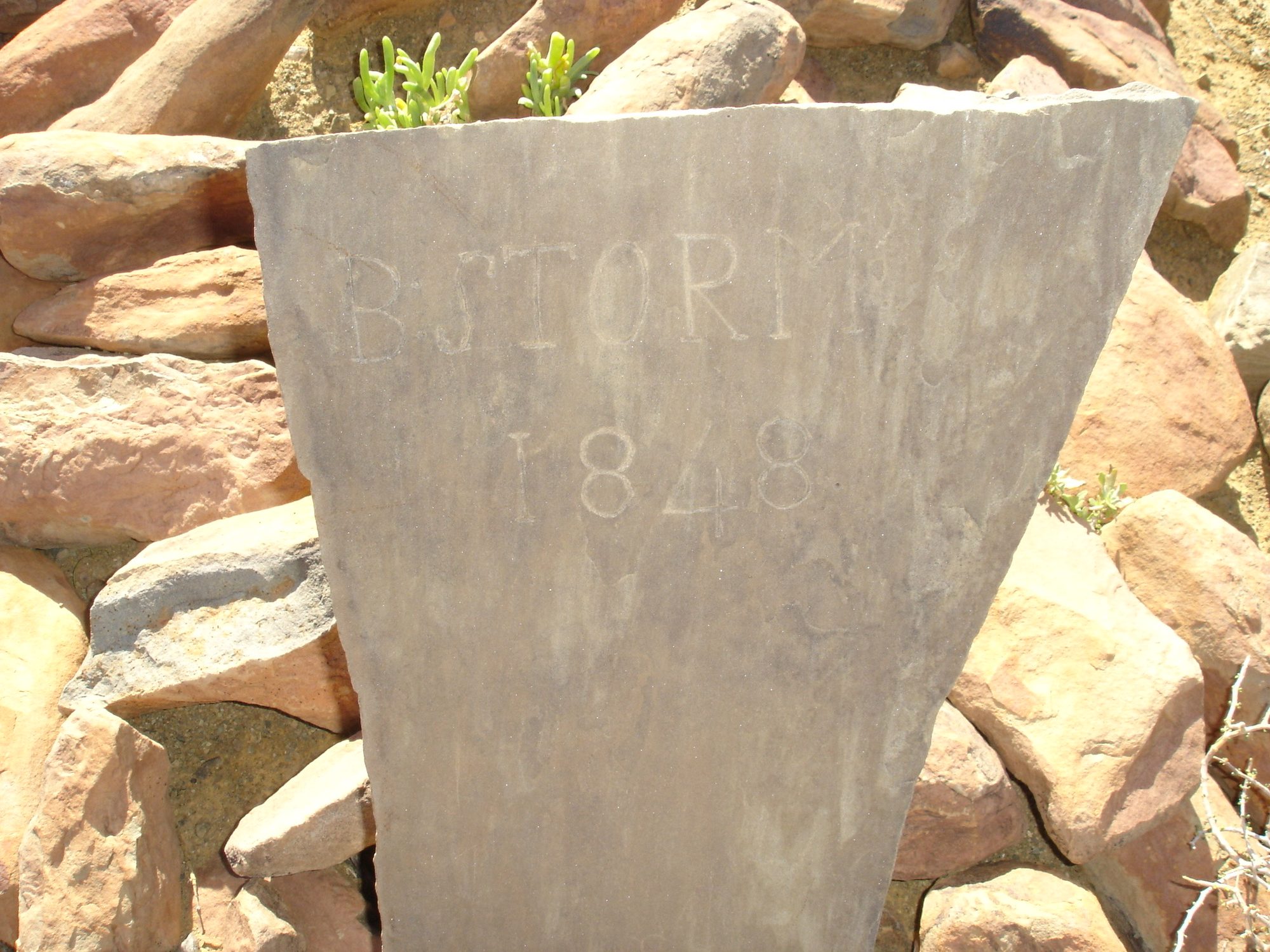
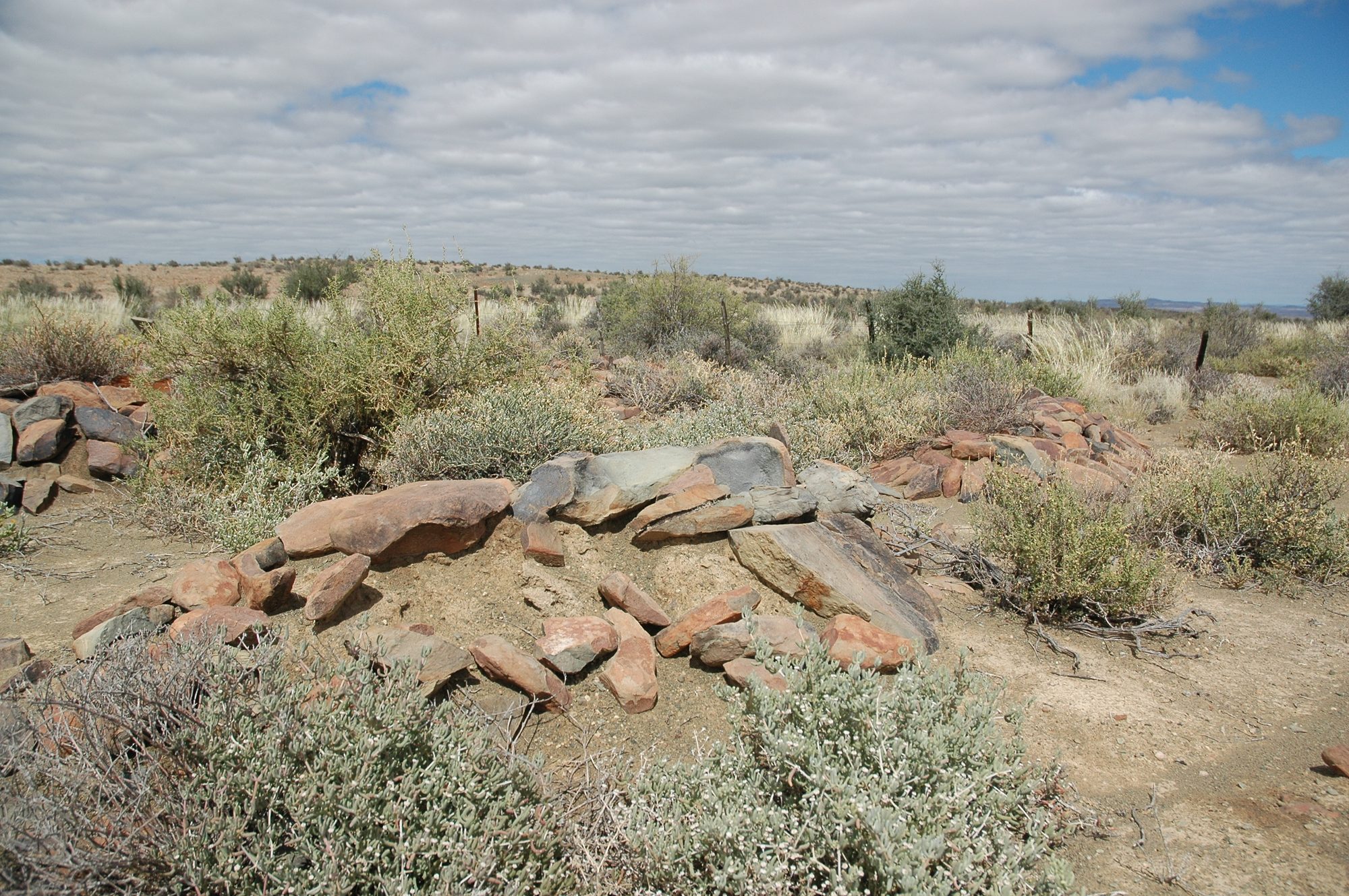
Eight stone graves on Varsche Fontein, 1848-1922
Eight marked graves on the Remainder of Varsche Fontein, from 1848 to 1922. Two Storms in consecutive years seven years after the grant, an infant of 1874 buried apart from the rest, three more children, and finally the patriarch under the only bought stone in the cemetery. None of the families in it appears in the farm's title deeds. A second burial ground twenty kilometres away, on Vredendal, carries the same surnames and shows the families are one intermarried community rather than six.
- mentions this farm
Vredendal and its people
Vredendal is a werf name on Spreeufontein No. 26, the farm the district called Gatsplaas. Five graves carrying three surnames, an 1886 slate slab whose inscription dates a woman to the day and whose line runs unbroken back to Enkhuizen in 1744, and then a household: the van der Merwes, and a man who died on his own birthday.
- mentions this farm
The van der Merwes of the Hantam
The maternal line, from Paarl in 1735 to Vredendal in about 1950, with every kinship spelled out. The crossing from the Piketberg district into the Hantam is dated to a fourteen-year window by two death notices; three farms were surveyed for the Commissie van Inspectie by one man in 1820 and 1823; a man called Kwaai Koos is named after his farm; and twice in three generations the family is standing on ground that came in through a woman.
- mentions this farm
Four grandparents, four countries, from 1684
How four grandparents out of four lines met: three weddings in four years at Bellville and Williston, and a fourth marriage that tied two of them back together after both were widowed. Each line has its own page; this one is the join. Of the four countries the title promises, this record can point at one on a map.
- mentions this farm
The van Rensburgs
Nine generations, of which eight are names and years, and then a boy orphaned sixteen months apart in 1896 and 1898, given to a family called Vos, and turned out at twenty-five with a horse. He bought a boring machine and sold windpumps through the worst droughts the region records. The line that lost the Janse from its surname in one generation.
What this farm became
From 1913 this ground stopped being one farm, and the story continues on the pieces cut from it. Its own record above ends there; what happened afterwards belongs to a portion, not to the whole.
- 1913 Lot A (Varsche Fontein No. 27 Ptn 1)
- 1922 Groot Rivier (Varsche Fontein No. 27 Ptn 2)
- 1923 Plaat Fontein (Varsche Fontein No. 27 Ptn 3)
- 1925 Welbedacht (Varsche Fontein No. 27 Ptn 4)
Who stood on this ground, and how they were related
Everyone the record places here - by deed, by residence, or by burial - and the kinship between each pair of them. Two numbers are given and they are deliberately kept apart. Steps is how far apart two people are in the family graph, counting a marriage as one step. The common ancestor is the nearest one they share by blood, with the year they were born. A pair four steps apart through a couple born in the 1750s is a relationship; a pair ten steps apart through a progenitor born in the 1630s is background, because almost everybody descends from him. Read both.
- 1841 Charl du Toit held 1841-04-15
- 1903 J.R.G. Luttig held 1903
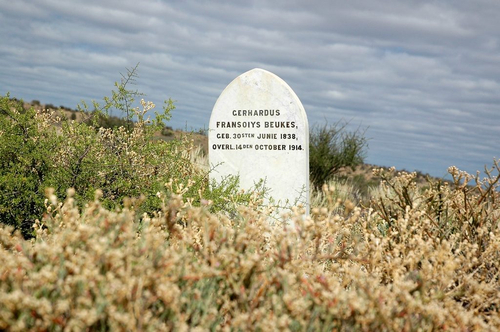
- 1914 Gerhardus Fransoiys Beukes buried on 1914
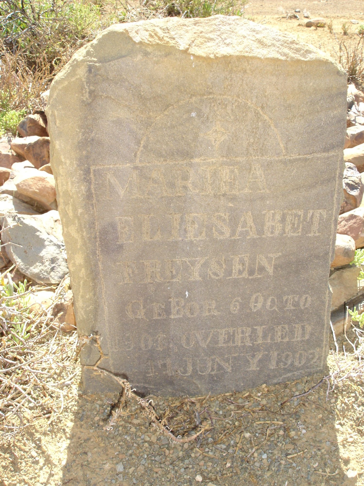
- — Maria Elizabeth Freysen (infant) buried on
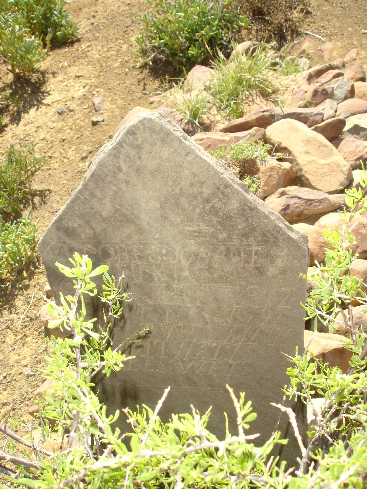
- — Jacobus Johannes Beukes (infant) buried on
- — Aletta Sophia Jacoba Opperman (born Beukes) buried on
| Steps | Between | Nearest common ancestor by blood |
|---|---|---|
| 1 | Gerhardus Fransoiys Beukes · Aletta Sophia Jacoba Opperman (born Beukes) | Catharina Elizabeth Lotriet born 1793 (1+2 generations up) |
| 2 | Gerhardus Fransoiys Beukes · Maria Elizabeth Freysen (infant) | Catharina Elizabeth Lotriet born 1793 (1+3 generations up) |
| 3 | Maria Elizabeth Freysen (infant) · Aletta Sophia Jacoba Opperman (born Beukes) | Aletta Sophia Jacoba Niemann born 1844 (2+1 generations up) |
Drawn from the parentage and marriages this project holds, never from a shared surname. A pair with no common ancestor here may still be related through a link nobody has recorded yet.
What the record holds, in order
-
1834
document
SG diagram 353/1834
Bf.W.Q.6-23
-
15 April 1841
ownership
Charl du Toit (17 September 1797–?)
Perpetual Quitrent · grant · confidence high
-
1848
burial
B. Storm
Varsche Fontein farm cemetery, B. STORM 1848, scratched on a slate slab set upright in a stone kerb. Nothing else is cut on the stone.
-
1849
burial
M. Storm
Varsche Fontein farm cemetery, M STORM / 1849, read across two fragments of one broken slab: 'M S' and '18' on the left piece, 'TORM' and '49' on the right. Deeply and neatly cut, in plain capitals, with no other text.
-
June 1874
burial
G.F. Beukes
Varsche Fontein - the single grave in the veld, 1874 / G F / BEU / KES / Juny, and below it what appears to be 15. Cut by hand into a thin sandstone slab, the letters shallow and irregular and the surname broken across three lines because the stone is narrow. Frans's reading; the 15 is the least certain part.
-
April 1897
document
SG diagram No.2 1903 (CL-7)
PA folio 1048
- April 1897 document SG diagram verso 2/1903 (verso)
-
June 1902
burial
Maria Elizabeth Freysen (infant) (6 October 1901–June 1902)
Varsche Fontein farm cemetery, MARIHA ELIESABET FREYSEN, GEBOR 6 OCTO[BER] 1901, OVERLEID [4?] JUNY 1902. Above the panel, a rayed sun or star inside an arch.
-
1903
ownership
J.R.G. Luttig (about 1824–4 February 1914)
amended-title · confidence high
-
3 August 1907
burial
M.J. Beukes, or a child of M.J. Beukes
Varsche Fontein farm cemetery, [Ter ge]dachtenis aan / [illegible word] M·J·BEUKES / O[verlede] 3. 8. 1907. Cut by hand into a sandstone slab in a mixed script - the first line in cursive, the name in capitals - with a ruled border and an incised cross or star above. The word before the initials is not legible and it is the word that decides who is buried here.
- 1913 boundary change subdivision: becomes Lot A (Varsche Fontein No. 27 Ptn 1)
-
March 1913
burial
Jacobus Johannes Beukes (infant) (26 May 1912–10 March 1913)
Varsche Fontein farm cemetery, JACOBES : JOHANES / BEUKES / GEB 26 MAAIE 1912 / [O]VER[L] 10 MAART 191[3] / IS HET WEL MET / 'T KIND / HET IS ALLES WEL.
-
14 October 1914
burial
Gerhardus Fransoiys Beukes (30 June 1838–14 October 1914)
Varsche Fontein farm cemetery, GERHARDUS FRANSOIYS BEUKES, GEB. 30STEN JUNIE 1838, OVERL. 14 DEN OCTOBER 1914
- 1922 boundary change subdivision: becomes Groot Rivier (Varsche Fontein No. 27 Ptn 2)
-
January 1922
burial
Aletta Sophia Jacoba Opperman (born Beukes) (15 April 1872–13 January 1922)
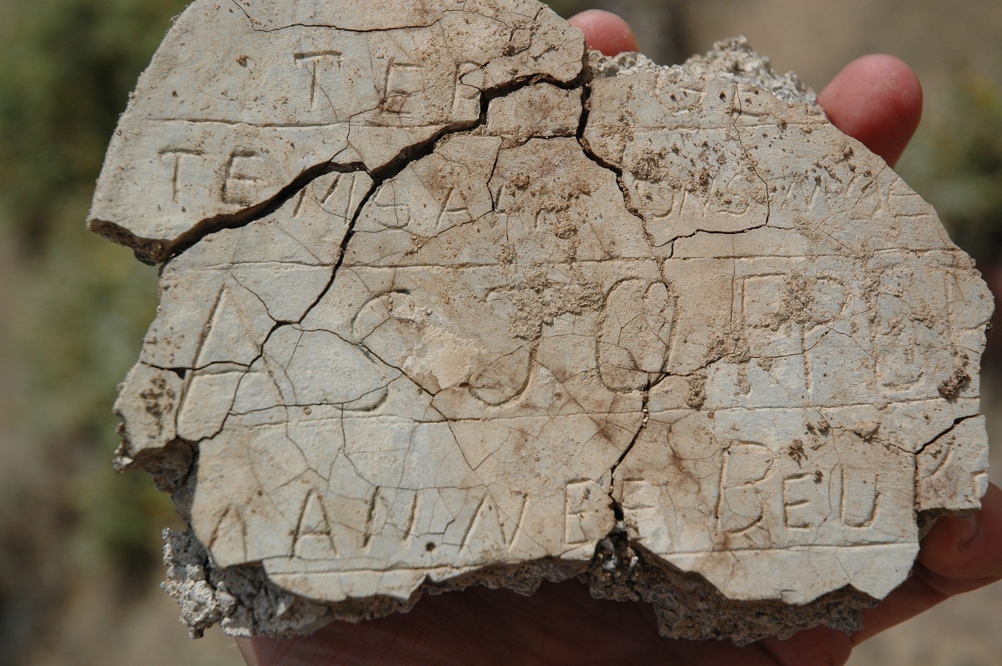
Varsche Fontein farm cemetery, A BROKEN FRAGMENT AND MOSTLY UNREADABLE. Letters scratched into cement before it set, in at least four lines. What can be read with any confidence: 'TER' on the top line, and 'BEU' at the end of the bottom line. Scattered capitals between them include what may be A, G, J, C, E, R and N, in no order that can be trusted. NOTHING ELSE IS TRANSCRIBED.
- 1923 boundary change subdivision: becomes Plaat Fontein (Varsche Fontein No. 27 Ptn 3)
- 1925 boundary change subdivision: becomes Welbedacht (Varsche Fontein No. 27 Ptn 4)
- 1925 boundary change remainder: becomes Varsche Fontein No. 27 Remainder
Ground cut out of this farm
- Lot A (Varsche Fontein No. 27 Ptn 1)
- Groot Rivier (Varsche Fontein No. 27 Ptn 2) 2565.2 ha
- Plaat Fontein (Varsche Fontein No. 27 Ptn 3) 1786.2 ha
- Welbedacht (Varsche Fontein No. 27 Ptn 4) 2184.2 ha
- Varsche Fontein No. 27 Remainder RE/27 · 3831.8 ha
Bordered by, as the diagram names them
- NE Jan Willems Fontein
- NE Klein Knoffels Fontein
- E Spreeuw Fontein
- SW Klein Fontein
- SW Blaauw-Krantz (part)
- W Abrahams Kraal
- NW Jan Willems Fontein
- NE Jan Willems Fontein
- NE Klein Knoffels Fontein
- E Spreeuw Fontein
- SW Klein Fontein
- SW Blaauw-Krantz (part)
- W Abrahams Kraal
- NW Jan Willems Fontein
On the 1915 divisional map
As the Surveyor-General printed this farm in 1915: the registered holder, the date the title was issued and its quitrent reference, copied off the sheet as written. The whole map, farm by farm
| Farm, as printed | Holder | Title | Quitrent | Note |
|---|---|---|---|---|
| VARSCH FONTEIN Amended Title | J. R. G. Luttig | 19.6.190[?3] | · fol. 104[?8] | in the Gamka field cornetcy beside Spreeuw Fontein; "Groot River" runs through |
Buried on this ground
- Varsche Fontein farm cemetery 7 graves recorded, 4 identified in this project
- Varsche Fontein - the single grave in the veld 1 graves recorded · no coordinate yet
The burials also appear on this farm's timeline above, each at its own date.
Photographs
Also bordered by, as the modern cadastre draws it
Ground that touches this farm on the Surveyor-General's current polygons and that none of the diagrams held here names. Derived from the geometry, not read off a document.
- N Plaat Fontein (Varsche Fontein No. 27 Ptn 3)
- NE Lammers Kraal No. 11
- E Varsche Fontein No. 27 Remainder
- E Lot A (Spreeufontein No. 26 Ptn 3)
- SE Welbedacht (Varsche Fontein No. 27 Ptn 4)
- SE Bokfontein No. 94 (formerly Waterfall)
- SW Groot Rivier (Varsche Fontein No. 27 Ptn 2)
- SW Bloukrans No. 31
Documents
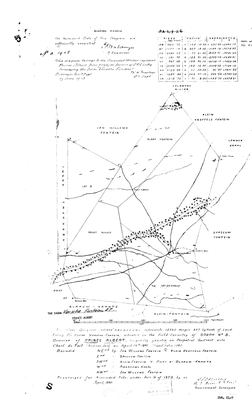 Surveyor-General diagram, No.2 1903 (CL-7), April 1897
11046771.TIF
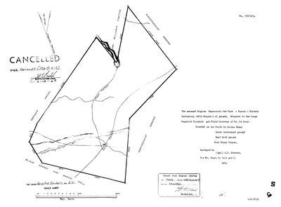 Surveyor-General diagram, 353/1834, 1834
SCAN208 (3).TIF
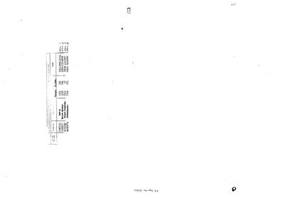 Diagram verso, 2/1903 (verso), April 1897
11046772.TIF
Cadastre
Surveyor-General diagram index for this parcel
Research notes
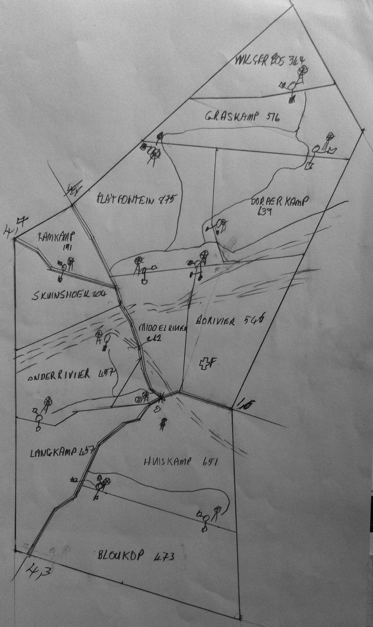
Frans's parents' farm. Originally 12,074 morgen (1834 survey); 13,869 mg 347 sq rds after the 1897 resurvey. Four portions deducted 1913-1925 (PAR-000015..18), leaving the Remainder PAR-000019. Camp plan IMG-0002 records 12 camps totalling 5,795 units; if hectares that is ~6,766 morgen, which exceeds the 1925 Remainder of 4,498mg - so ground was later bought back. [TO VERIFY]
[7 Aug 2026, FS] THE BEUKES WERE ON THIS FARM LONGER THAN THE OWNERSHIP ROWS SHOW. Gerhardus Francois Beukes (PER-000029) was buried here in 1914 and his daughter ALETTA SOPHIA JACOBA, by then married to Pieter Jozua OppermanM, DIED AT VARSCH FONTEIN ON 13 JANUARY 1922 - the place is on her death notice. So a Beukes and then an Opperman household was here into the 1920s. THE OWNERSHIP ROWS RUN du Toit 1841, Luttig 1903, van Rensburg 1973, and the Beukes appear in none of them. Whatever their tenure was - bywoners, lessees, an unrecorded transfer inside the 62-year gap between 1841 and 1903 - the burials say they were here and the deeds do not. That gap is worth reading as a question about the ownership record rather than about the family.
[7 Aug 2026, SRC-308] eGGSA record this cemetery as Cemetery ID 6614 at -32.946167, 22.109533, 118 m from this project's coordinate. Their album has TWO images and ONE headstone; this project holds EIGHT marked graves here. Their note reads 'There are many graves, but only one headstone', which is the same observation this project's own page is built on, reached independently.
[11 Aug 2026] A NEARLY-IDENTICAL NAME HAS BEEN REMOVED FROM THIS PROJECT, and the removal is recorded here because this is the farm it kept being confused with. VARSFONTEIN No. 254 in the BEAUFORT WEST division, formerly PAR-000003, was consolidated in 1921 out of parts of Welgebosch Drift and Hoogeveld Lot B (formerly PAR-000011 and PAR-000012, which existed only to explain it) and transferred to M.M.A. de JagerM in 1922. NOTHING TIED IT TO THIS FAMILY EXCEPT ITS NAME. Varsche Fontein No. 27 in the Prince Albert division is Frans's parents' farm; Varsfontein No. 254 is a different farm in a different division made a century later for a different family. [FAMILY] It has no relevance other than a name similar to Varsche Fontein.. THE IDS PAR-000003, PAR-000011, PAR-000012, DOC-0003 AND OWN-000006 ARE RETIRED AND MUST NOT BE REUSED. The 1921 diagram itself, SG 4103, stays on disk at sources/diagrams/DOC-0003-varsfontein-beaufortwest-no254-1921.tif in case the question ever comes back.
[14 Aug 2026, WinDeed Deeds Office property report, farm 27 ptn 0, searched 20:50] AN INDEPENDENT REPORT DISAGREES WITH THIS EXTENT AND IS WRONG. It gives the previous description of Varsche Fontein as 13569 morgen 347 square roods; this row says 13869. THE MODEL'S FIGURE CLOSES AND THEIRS DOES NOT: the five parcels this farm was cut into - RE 4498 mg 166 sr, Lot A 1731 mg 181, Groot Rivier 3003 mg 284, Plaat Fontein 2100 mg 25, Welbedacht 2536 mg 291 - add to 13869 morgen 347 square roods exactly, to the rood, which is 300 morgen more than the report allows. The disputed field is one the report itself marks with an asterisk, meaning enriched from WinDeed's own database rather than supplied by the Deeds Office, so the two are not equally weighted. NOTHING IS CHANGED HERE; the disagreement is recorded because a later reader will meet the same report.
The research behind this page, kept separate from it: dated working notes, open questions, and what is not yet settled.
Open questions
-
Who is buried in the Varsche Fontein cemetery? Five of seven now named
priority 1 · LEAD-0122
Four marked graves are now recorded and only one is identified. Who are Mariha Eliesabet Freysen (1901-1902), Jacobes Johanes Bukes, and B. STORM 1848? Frans has undertaken to give names.
What would settle it Names from Frans, or a burial register entry. For the stones themselves: straight-on photographs in raking light, which would probably give the Beukes dates and the Freysen day and surname outright.
-
Two Storms on Varsche Fontein, 1848 and 1849 - who were they, and what put them there?
priority 1 · LEAD-0124
Who is the B. STORM buried on Varsche Fontein in 1848 (GRV-0030), and does the grave connect to either of the two Storm lines this family already touches?
What would settle it THE LIQUIDATION AND DISTRIBUTION ACCOUNT OF MAGDALENA STORM BORN BOTES, died Prince Albert 10 April 1884. Her death notice says she left IMMOVEABLE PROPERTY to be 'all sold immediately and the account filed'. That account names the land. It is now the single most direct route to whether the Storms held ground on or near Varsche Fontein. Failing that, the estate papers of her husband, died Prince Albert 19 August 1855.
-
Is the lone 1874 stone on Varsche Fontein a thirteenth Beukes child?
priority 1 · LEAD-0126
A hand-cut stone standing apart from the cemetery reads 1874 / G F BEUKES / Juny [15?]. Is it an infant son of Gerhardus Francois Beukes whose name was reused in 1877, and why is he buried away from the others?
What would settle it A baptism or burial entry, or a death notice.
-
Read the graves ACROSS the farms, and against the online grave indexes
priority 1 · LEAD-0127
Storm, Botes, Niehaus, Botma, Beukes and Freysen appear on stones on Varsche Fontein and on Vredendal/Spreeufontein, and they intermarry. What does the picture look like when the burial grounds are read as one body of evidence rather than farm by farm, and what do the published grave indexes add?
What would settle it Nothing settles a question this shape. What it produces is a map: which families are buried where, who married whom, and which farms they moved between.
-
Are the Varsche Fontein Beukes related to Christa's Beukes, or is it only the surname?
priority 2 · LEAD-0123
This project has recorded the Varsche Fontein Beukes as 'a cousin line on Frans's wife's side'. Is there an actual path, or was that inferred from the surname?
What would settle it A shared ancestor with both descents documented, or a demonstration that the two Beukes families are separate at the Cape.
-
Searching a noemnaam against display_name finds nobody
priority P3 · LEAD-0314
Closed on the day it was opened, on a false premise.
What would settle it Frans's word that she should be in, and her full name.
What the record is missing
-
The record stops in 1903 and never resumes
second order · B2 trail-ends
Varsche Fontein was worked as far as 1903, with J.R.G. LuttigH the last owner on record. 123 years follow with nothing. Who held it after that, and is it still one farm?
What would settle it The current title deed traced backwards, each transfer names the one before it, or the Surveyor-General's subdivision diagrams, which are what usually explain a farm going quiet.
-
62 years, and the ground changes hands to nobody we can follow
second order · B1 succession
On Varsche Fontein, Charl du ToitH is the last owner recorded from 1841-04-15, and the next entry is J.R.G. LuttigH from 1903, 62 years later, with no person in common. DOC-0002 records the later arrival but not the 62 years before it.
What would settle it The Deeds Office transfer register for this farm between 1841 and 1903. A transfer names its predecessor in title, so one deed closes the whole gap.
-
“Klein Fontein” is named as a neighbour 4 times and we hold no parcel for it
second order · B3 unheld-farm
4 separate surveys in this model put Klein Fontein on the boundary of ground we do hold (PAR-000002, PAR-000018, PAR-000020). It has no parcel of its own here, so nothing is known about who held it or when, while it borders farms at the centre of the project.
What would settle it The Surveyor-General's farm index for the registration division will give it a farm number and a diagram; the cadastre pull in `fetch_cadastre.py` then places it on the map.
-
“Klein Knoffels Fontein” is named as a neighbour 3 times and we hold no parcel for it
second order · B3 unheld-farm
3 separate surveys in this model put Klein Knoffels Fontein on the boundary of ground we do hold (PAR-000002, PAR-000017). It has no parcel of its own here, so nothing is known about who held it or when, while it borders farms at the centre of the project.
What would settle it The Surveyor-General's farm index for the registration division will give it a farm number and a diagram; the cadastre pull in `fetch_cadastre.py` then places it on the map.
-
“Blaauw-Krantz (part)” is named as a neighbour 2 times and we hold no parcel for it
third order · B3 unheld-farm
2 separate surveys in this model put Blaauw-Krantz (part) on the boundary of ground we do hold (PAR-000002). It has no parcel of its own here, so nothing is known about who held it or when, while it borders farms at the centre of the project.
What would settle it The Surveyor-General's farm index for the registration division will give it a farm number and a diagram; the cadastre pull in `fetch_cadastre.py` then places it on the map.
Found by breaks.py reading the model against itself, not written by hand,
each one is a shape of missing record, not a fault in the data.
The whole set is on the
questions page.