Part of Rondabel
Rondawel (Rondabel No. 124 Ptn 1)
· on record 1872–2026 · show on the map
The farm's own history, the grant, the original survey, sits on that page.
- Farm number
- No. 124
- Portion
- 1
- Also recorded as
- RondawelSRC-436, the 2023 valuation roll, and the 1997 transfer, which vests it in the Rondawel TrustRondabelthe original name of the farm, which the parent row keeps
- District
- Prince Albert
- Extent, as the diagram states it
- 12 529 morgen 470 sq roods
- Modern surveyed area
- 3456.0 ha
The historic extent and the modern surveyed area are two separate measurements and are not presented here as confirming each other. The first is what a surveyor wrote on a diagram, usually in morgen. The second is what the modern cadastre draws.
Why this farm is here
Gert Annis Oosthuizen Marincowitz held it. 21 km from Klaarstroom.
Gert Annis Oosthuizen Marincowitz is on record on this ground directly. No trace needed.
- story A written history names this ground Rondawel's history: from a widow's mark to today's Marincowitz farm
- parcel Cut out of Rondabel
- document A document in the collection describes this ground DOC-0186
- document A document in the collection describes this ground DOC-0241
- …and 1 more, listed in full further down this page.
Stories
- mentions this farm
Rondawel's history: from a widow's mark to today's Marincowitz farm
From a loan-farm widow who signed with a mark to the Marincowitz farm of today: the full documented history of Rondabel No. 124 - the Venter household of 1829, the twelve-farm grant day of 1841, the Oosthuizen-Theron partnership of 1868, the 1910-34 subdivisions, and the two graves by the huis nobody has read.
Who stood on this ground, and how they were related
Everyone the record places here - by deed, by residence, or by burial - and the kinship between each pair of them. Two numbers are given and they are deliberately kept apart. Steps is how far apart two people are in the family graph, counting a marriage as one step. The common ancestor is the nearest one they share by blood, with the year they were born. A pair four steps apart through a couple born in the 1750s is a relationship; a pair ten steps apart through a progenitor born in the 1630s is background, because almost everybody descends from him. Read both.
- 1954 Charles Patrick "Pat" Marincowitz held 1954
- 1954 ds Freddie S Marincowitz held 1954
- 1954 Gert Annis Oosthuizen Marincowitz held 1954 · held 1988
| Steps | Between | Nearest common ancestor by blood |
|---|---|---|
| 2 | Charles Patrick "Pat" Marincowitz · ds Freddie S Marincowitz | Anna Margaretha Oosthuizen born 1879 (1+1 generations up) |
| 2 | Charles Patrick "Pat" Marincowitz · Gert Annis Oosthuizen Marincowitz | Anna Margaretha Oosthuizen born 1879 (1+1 generations up) |
| 2 | ds Freddie S Marincowitz · Gert Annis Oosthuizen Marincowitz | Anna Margaretha Oosthuizen born 1879 (1+1 generations up) |
Drawn from the parentage and marriages this project holds, never from a shared surname. A pair with no common ancestor here may still be related through a link nobody has recorded yet.
Before this ground was cut out
This is the history of Rondabel, the farm this ground was part of until 1872-07-17. It is shown here because this ground was that farm, and separately from what follows because before the cut the record says the farm's name and not which part of it. Not everything below necessarily happened on this piece.
- 1818-05-02 document estate inventory MOOC8/64.12a
- 1818-05-02 inventory estate inventory: Ignatius Michael du Plessis & Aletta Elisabeth Dorothea van Heerden MOOC8/64.12a · loan farm Rondabel, on the Tarka
- ../1818 to 1823 ownership Ignatius Michael du Plessis (–1818), Jan de Bruin (1769–1822-12-23) loan farm · occupation · confidence medium
- 1823-06-13 document estate inventory MOOC8/38.12
- 1823-06-13 inventory estate inventory: Jan de Bruin & Aletta Johanna Oosthuizen MOOC8/38.12 · loan farm Rondabel, in the Tarka
- 1829-10-29 document estate inventory MOOC8/44.48
- 1829-10-29 inventory estate inventory: Jan Adriaan Venter & Maria Catharina Elisabeth Venter MOOC8/44.48 · the place Rondavel, field cornetcy of Hermanus van der Westhuisen, Traka, district of Beaufort
- ../1829 ownership Jan Adriaan Venter (1794-09-14–1829-07-23), Maria Catharina Venter (1783–) loan farm · occupation · confidence high
- 1833-08 document SG diagram 366/1833 Bf.W.Q.5-2?
- 1841-04-15 to 1868 ownership David Jan Strydom (Daniel son) (1798-08-12–1882-01-11) Perpetual Quitrent · grant · confidence high
- 1863-11 document SG diagram 502/1867 P.A.Q.1-21
- 1868-01-21 ownership Jan Adriaan Oosthuizen, Stephanus Johannes Theron (1828-09-03–1879-01-07) Perpetual Quitrent · grant · confidence high
- 1872-07-17 boundary subdivision: becomes Rondawel (Rondabel No. 124 Ptn 1)
- 1872-07-17 ownership Stephanus Johannes Theron (1828-09-03–1879-01-07) transfer · confidence high
- undated boundary subdivision: becomes Visgat (Rondabel No. 124 Ptn 2)
- undated boundary subdivision: becomes Driehoek (Rondabel No. 124 Ptn 4)
- undated boundary subdivision: becomes Rondabel No. 124 Ptn 8
- undated boundary subdivision: becomes Rondabel No. 124 Remainder
- undated document SG diagram verso 502/1867 (verso)
- undated grave Rondabel werf graves
What the record holds, in order
- 17 July 1872 boundary change subdivision: from Rondabel
-
6 June 1872
document
SG diagram 922/1872
Transfer 208 of 17.7.1872; P.A.Q. 1-21, folio 1066
- 6 June 1872 document SG diagram verso 922/1872 (verso)
-
1954 to 1988
ownership
Charles Patrick "Pat" Marincowitz (17 March 1924–2020), ds Freddie S Marincowitz (2 January 1921–7 May 2008), Gert Annis Oosthuizen Marincowitz (17 February 1919–4 July 2003)
freehold · owner · confidence high
-
1988 to 1997
ownership
Gert Annis Oosthuizen Marincowitz (17 February 1919–4 July 2003)
freehold · owner · confidence high
-
11 June 1997
ownership
owner not named in the record
trust · owner · confidence high
-
13 August 2026
document
deeds report
T101545/1997
Photographs
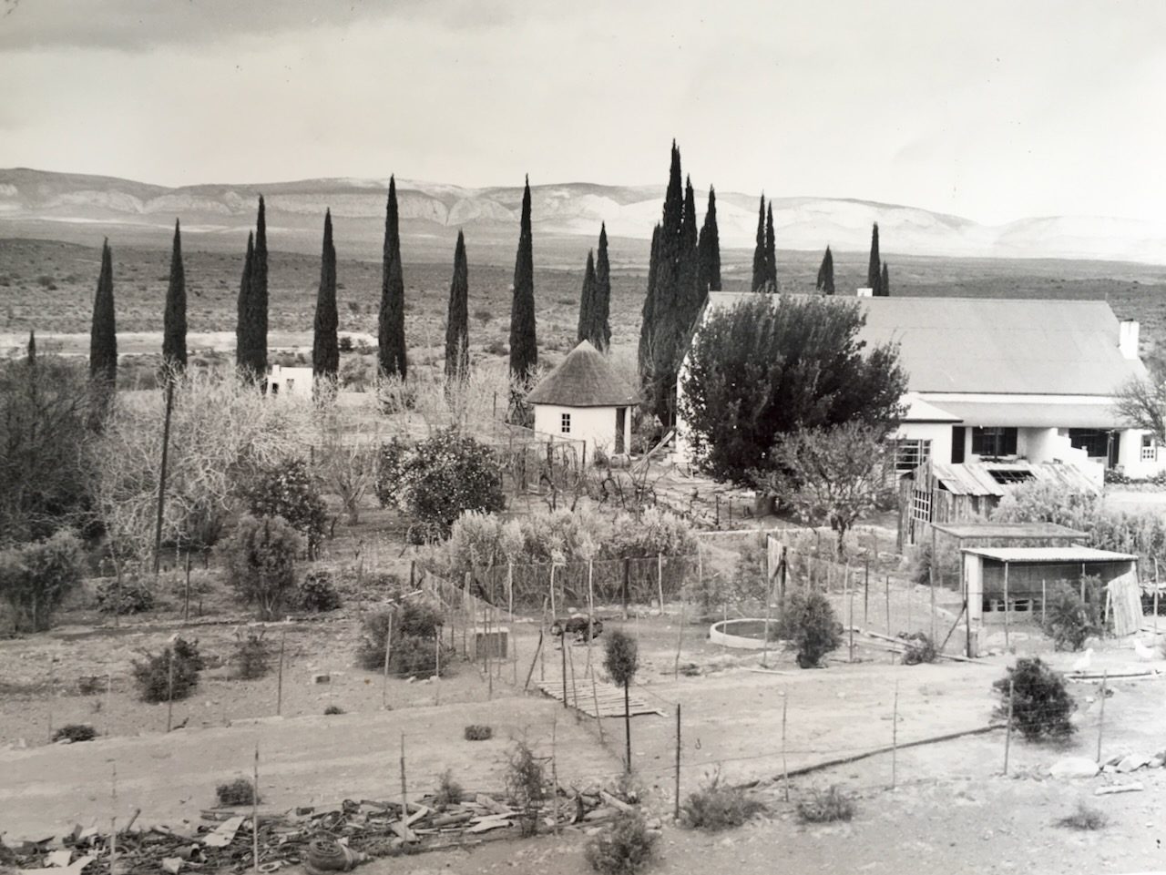
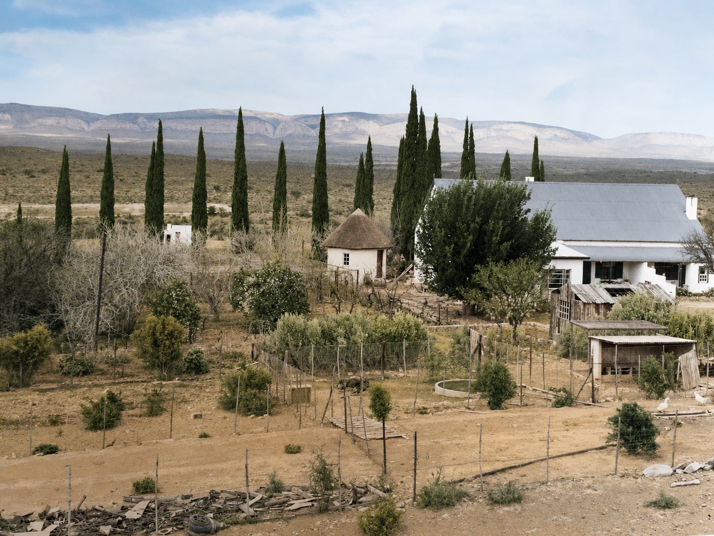
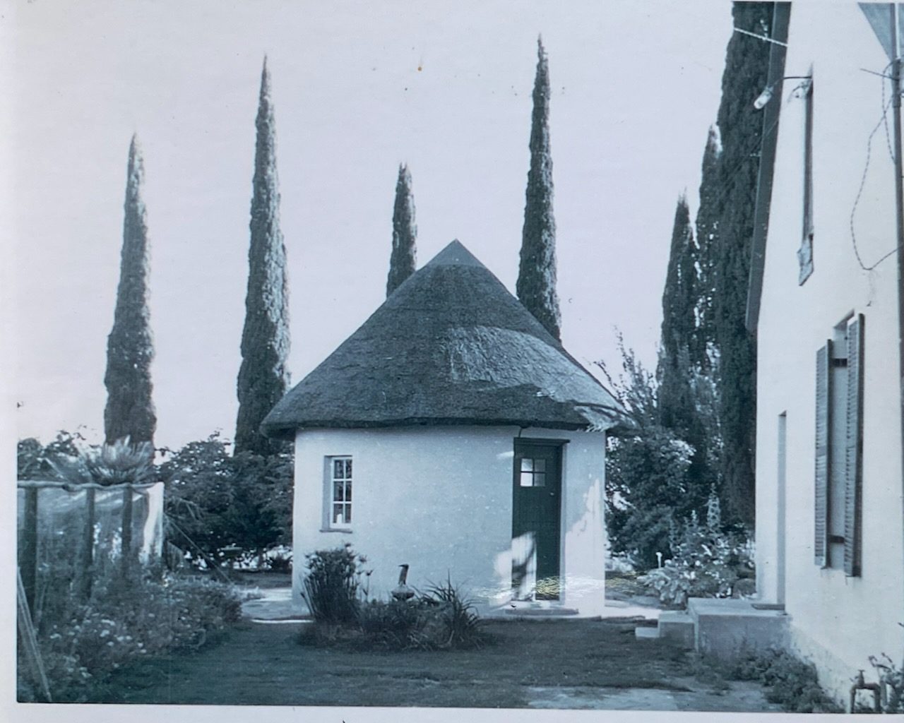
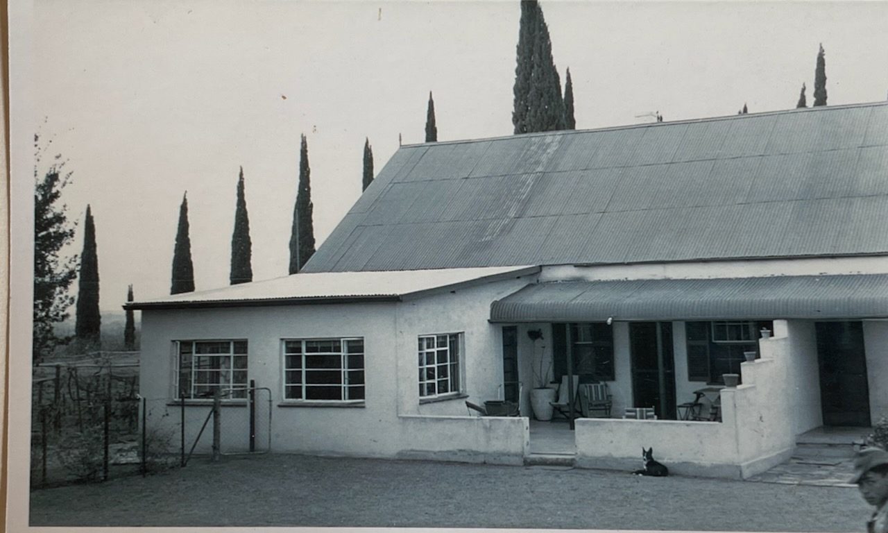
Also bordered by, as the modern cadastre draws it
Ground that touches this farm on the Surveyor-General's current polygons and that none of the diagrams held here names. Derived from the geometry, not read off a document.
- N Brand Kraal (Rondabel No. 124 Ptn 3)
- N Klipgat No. 114
- N Kalkgat (Klipgat No. 114 Ptn 7)
- E Kopjes Kraal
- E Kromrivier (Kopjes Kraal No. 123 Ptn 1)
- SE Kopjes Kraal No. 123 Remainder
- SE Driehoek (Rondabel No. 124 Ptn 4)
- S Elandsfontein (Rondabel No. 124 Ptn 6)
- S Klein Elandsfontein (Rondabel No. 124 Ptn 7)
- SW Rondabel
- SW Visgat (Rondabel No. 124 Ptn 2)
- W Rhemhoogte No. 125
- W Rhemhoogte No. 125 Ptn 8
- W Swartskraal (Rhemhoogte No. 125 Ptn 6)
Documents
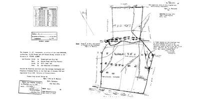 Surveyor-General diagram, 922/1872, 6 June 1872
10JDF101 124 1.jpg
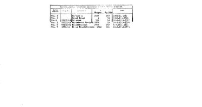 Diagram verso, 922/1872 (verso), 6 June 1872
10JDF501.jpg
361023618_Document.Pdf
Cadastre
Surveyor-General diagram index for this parcel
Surveyor-General diagram index for the whole farm, where the original survey of this ground sits.
Research notes
[1 Aug 2026] IN THE MODEL FROM THE CADASTRE PULL ONLY. The Surveyor-General has a polygon for it and this project has no document that names it, so it carries geometry, an extent and a name and no history. It is here because RONDABEL IS A CORE FARM of this project and the map was showing the parent outline with four of its nine modern parcels named, which reads as an absence in the record and is not one. It was absent purely because nobody had made the row, not because anything was missing from the pull: data/geo/prince_albert_farm_portions.geojson has held this polygon all along and match_cadastre.py can only match parcels that exist. Cadastre: 4,141.5 ha, LPI C06100000000012400001. The model already holds Ptn 3 Brand Kraal (PAR-000042), Ptn 5 Hartebeest Voedpad (PAR-000043), Ptn 6 Elandsfontein (PAR-000044) and Ptn 7 Klein Elandsfontein (PAR-000045), each off its own diagram. This row has no diagram behind it and no name beyond the cadastre's. [TO VERIFY] what it was called and who held it, from the Rondabel deduction tables and the CSG diagram index.
[3 Aug 2026, SRC-220] ITS DIAGRAM, AND THE GRANT. Dgm 922/1872, surveyed 6 June 1872 by J.W. du T. MelvillM: 12 529 morgen 470 square roods, bounded N by Rhemhoogte and Klipgat, E by Kopjes Kraal and Klipfontein, S by Government Land, W by the Remainder of Rondabel. The face records the grant itself - perpetual quitrent to JAN ADRIAAN OOSTHUYSEN and STEPHANUS JOHANNES THERON, 21 January 1868, folio 1066 - which matches EVT-000062 exactly and adds the folio. Transfer Deed 208 of 17.7.1872. A right of way across it was cancelled under Ord. 13 of 1917 and gazetted 5 March 1926.
[13 Aug 2026] Renamed to the one form this model uses for every portion - the portion's own name, then the parent farm, its number and the portion in brackets - so that a name is legible in a list, a search result and a map popup without the reader having to know which farm number is which. It read "Rondabel Portion 1 (No. 124 Ptn 1)" before. Nothing about the ground changed.
[13 Aug 2026, FAMILY] [FAMILY] The original was Rondabel - we cannot change the past. Portion 1 is now known as Rondawel. So the farm keeps the name every nineteenth-century document gives it and this portion carries the name it goes by now, and the two forms stand together on both pages rather than one being corrected into the other.
[22 Aug 2026] THE NAME IS OLDER THAN THE PORTION. [FAMILY] At that time it was already rondavel, close to rondawel today. The death notice of Cecilia Maria Theron, 10 April 1895 (DOC-0333), writes RONDAVEL three times - as her usual place of residence, as the place she died, and as the place of burial, all in Ward Kredouw. That is 1895, on a form filled in by her husband, and it spells the werf the way this portion is spelled today. So 'Rondawel' is not a modern respelling of Rondabel by a surveyor: the household on the ground was already saying Rondavel, and the cadastre later fixed one portion under a form of that name while the parent farm kept Rondabel. Same discipline as 5 second rule - the cadastre records title, not what people call the ground they live on.
The research behind this page, kept separate from it: dated working notes, open questions, and what is not yet settled.
Open questions
-
Nine diagram sheets named in the model that no longer exist on disk
priority 2 · LEAD-0095
Re-pull nine Surveyor-General sheets whose archive references this model records but whose images were never kept. What do their versos carry?
What would settle it Re-pulling the nine files. Each then gets its OWN DOC- row per 8, never a second filename on an existing row.
What the record is missing
-
A tenure with no one in it
second order · B7 no-owner
OWN-000103 records a owner on Rondawel (Rondabel No. 124 Ptn 1) from 1997-06-11 and names no party. Either the holder was never read off the document, or the publishing rule withheld them, the page cannot tell you which, and neither can this.
What would settle it Re-read DOC-0296.
Found by breaks.py reading the model against itself, not written by hand,
each one is a shape of missing record, not a fault in the data.
The whole set is on the
questions page.