Part of Rondabel
Visgat (Rondabel No. 124 Ptn 2)
· on record 1899 · show on the map
The farm's own history, the grant, the original survey, sits on that page.
- Farm number
- No. 124
- Portion
- 2
- Also recorded as
- VisgatSRC-436, 2023 valuation rollVischatFAMILY, the spelling this project has carried since 2 Aug 2026
- District
- Prince Albert
- Extent, as the diagram states it
- 2107 morgen 267 sq roods
- Modern surveyed area
- 1800.3 ha
The historic extent and the modern surveyed area are two separate measurements and are not presented here as confirming each other. The first is what a surveyor wrote on a diagram, usually in morgen. The second is what the modern cadastre draws.
Why this farm is here
A piece of a farm already in this model. 15 km from Klaarstroom.
- parcel Cut out of Rondabel
- parcel Related to Vischat
- document A document in the collection describes this ground DOC-0187
- document A document in the collection describes this ground DOC-0242
Before this ground was cut out
This is the history of Rondabel, the farm this ground was cut from, on a date the record does not give. It is shown here because this ground was that farm, and separately from what follows because before the cut the record says the farm's name and not which part of it. Not everything below necessarily happened on this piece.
- 1818-05-02 document estate inventory MOOC8/64.12a
- 1818-05-02 inventory estate inventory: Ignatius Michael du Plessis & Aletta Elisabeth Dorothea van Heerden MOOC8/64.12a · loan farm Rondabel, on the Tarka
- ../1818 to 1823 ownership Ignatius Michael du Plessis (–1818), Jan de Bruin (1769–1822-12-23) loan farm · occupation · confidence medium
- 1823-06-13 document estate inventory MOOC8/38.12
- 1823-06-13 inventory estate inventory: Jan de Bruin & Aletta Johanna Oosthuizen MOOC8/38.12 · loan farm Rondabel, in the Tarka
- 1829-10-29 document estate inventory MOOC8/44.48
- 1829-10-29 inventory estate inventory: Jan Adriaan Venter & Maria Catharina Elisabeth Venter MOOC8/44.48 · the place Rondavel, field cornetcy of Hermanus van der Westhuisen, Traka, district of Beaufort
- ../1829 ownership Jan Adriaan Venter (1794-09-14–1829-07-23), Maria Catharina Venter (1783–) loan farm · occupation · confidence high
- 1833-08 document SG diagram 366/1833 Bf.W.Q.5-2?
- 1841-04-15 to 1868 ownership David Jan Strydom (Daniel son) (1798-08-12–1882-01-11) Perpetual Quitrent · grant · confidence high
- 1863-11 document SG diagram 502/1867 P.A.Q.1-21
- 1868-01-21 ownership Jan Adriaan Oosthuizen, Stephanus Johannes Theron (1828-09-03–1879-01-07) Perpetual Quitrent · grant · confidence high
- 1872-07-17 boundary subdivision: becomes Rondawel (Rondabel No. 124 Ptn 1)
- 1872-07-17 ownership Stephanus Johannes Theron (1828-09-03–1879-01-07) transfer · confidence high
- 1895-04-10 document death notice
- 1895-04 grave Cecilia Maria Theron Rondabel werf graves, CECILIA MARIA THERON / GEBOREN DU P[LESSIS] / den 9 January 18[illegible] / overleden den 1[?9] April 1895 // Vrome vroeg gestorven vrienden / slechts zij [illegible] / [illegible] zult allen wederom [illegible] / als ons Jezus 't graf ontsluit
- 1901 residence Gert Jan Oosthuizen Marincowitz (1875-09-09–1952-10-08) family testimony
- 1910 boundary subdivision: becomes Brand Kraal (Rondabel No. 124 Ptn 3)
- 1910-08 document SG diagram 1654/1910 8326
- 1910-09-16 document beacon report 1654/1910
- 1919 boundary subdivision: becomes Hartebeest Voedpad (Rondabel No. 124 Ptn 5)
- 1919-01 document SG diagram 270/1919
- 1919 document SG diagram 1872-23-208
- 1919 document SG diagram
- 1919 document SG diagram 1872-23-208 (p 2)
- 1919 document SG diagram 1872-23-208 (p 3)
- 1921 boundary subdivision: becomes Elandsfontein (Rondabel No. 124 Ptn 6)
- 1921 document SG diagram 891/1921
- 1933 boundary subdivision: becomes Klein Elandsfontein (Rondabel No. 124 Ptn 7)
- 1936 residence Frederik Simon Oosthuizen (1856-05-29–1936-10-10) farming · to 1936
- 1999 residence Roy Don Oosthuizen (1923-12-09–1999-09-20) farming · to 1999
- 2003 residence Gert Annis Oosthuizen Marincowitz (1919-02-17–2003-07-04) farming · to 2003
- 202X ownership Gerhard Jan Oosthuizen Marincowitz (1946-08-17–), Christiaan Wilhelm Joubert Marincowitz (1949-06-19–) owner · confidence high
- undated boundary subdivision: becomes Visgat (Rondabel No. 124 Ptn 2)
- undated boundary subdivision: becomes Driehoek (Rondabel No. 124 Ptn 4)
- undated boundary subdivision: becomes Rondabel No. 124 Ptn 8
- undated boundary subdivision: becomes Rondabel No. 124 Remainder
- undated document SG diagram verso 502/1867 (verso)
- undated grave Rondabel werf graves
What the record holds, in order
-
March 1899
document
SG diagram 88/1900
Transfer 1082 of 7.3.1900
- March 1899 document SG diagram 88/1900 (part 2)
- undated boundary change subdivision: from Rondabel
- undated boundary change same_as: from Vischat
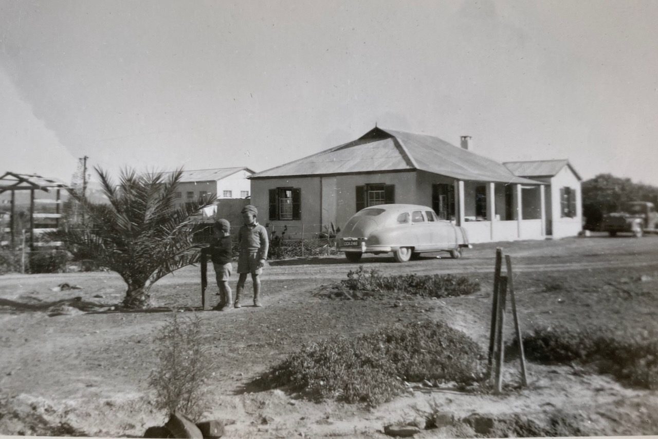
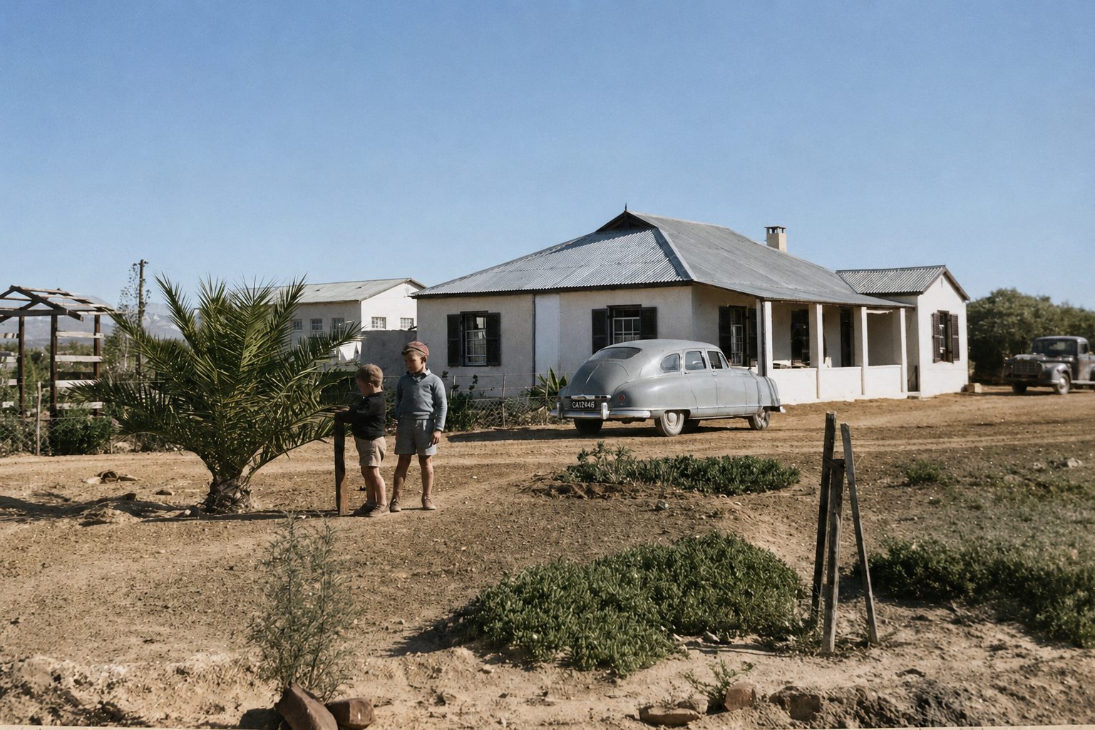
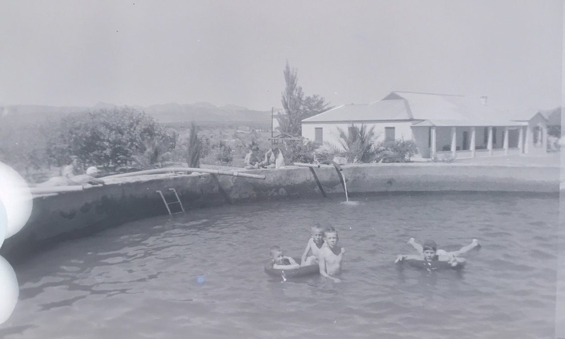
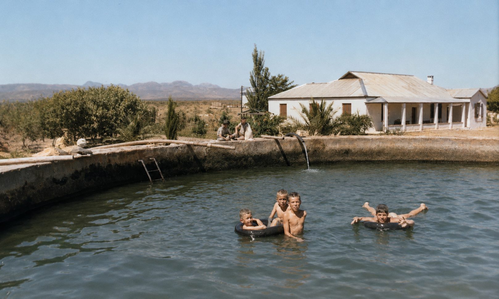
Photographs
Also bordered by, as the modern cadastre draws it
Ground that touches this farm on the Surveyor-General's current polygons and that none of the diagrams held here names. Derived from the geometry, not read off a document.
- NE Rondawel (Rondabel No. 124 Ptn 1)
- SE Rondabel
- SE Elandsfontein (Rondabel No. 124 Ptn 6)
- S Hartebeest Voedpad (Rondabel No. 124 Ptn 5)
- SW Rondabel No. 124 Remainder
- W Rhemhoogte No. 125
- NW Rondabel No. 124 Ptn 8
- NW Rhemhoogte No. 125 Ptn 8
- NW Swartskraal (Rhemhoogte No. 125 Ptn 6)
Documents
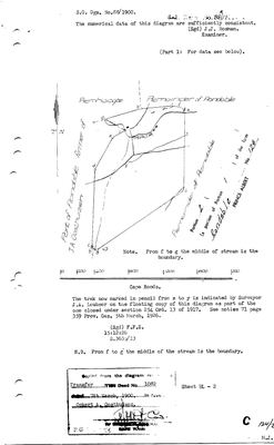 Surveyor-General diagram, 88/1900, March 1899
10TSV901 124 2.jpg
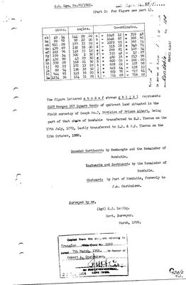 Surveyor-General diagram, 88/1900 (part 2), March 1899
10TSVB01.jpg
Cadastre
Surveyor-General diagram index for this parcel
Surveyor-General diagram index for the whole farm, where the original survey of this ground sits.
Research notes
[1 Aug 2026] IN THE MODEL FROM THE CADASTRE PULL ONLY. The Surveyor-General has a polygon for it and this project has no document that names it, so it carries geometry, an extent and a name and no history. It is here because RONDABEL IS A CORE FARM of this project and the map was showing the parent outline with four of its nine modern parcels named, which reads as an absence in the record and is not one. It was absent purely because nobody had made the row, not because anything was missing from the pull: data/geo/prince_albert_farm_portions.geojson has held this polygon all along and match_cadastre.py can only match parcels that exist. Cadastre: 2,158.5 ha, LPI C06100000000012400002. The model already holds Ptn 3 Brand Kraal (PAR-000042), Ptn 5 Hartebeest Voedpad (PAR-000043), Ptn 6 Elandsfontein (PAR-000044) and Ptn 7 Klein Elandsfontein (PAR-000045), each off its own diagram. This row has no diagram behind it and no name beyond the cadastre's. [TO VERIFY] what it was called and who held it, from the Rondabel deduction tables and the CSG diagram index.
[3 Aug 2026, SRC-221] ITS DIAGRAM AND ITS TRANSFER. Dgm 88/1900, a portion of Portion 1, transferred on Deed 1082 of 7 March 1900 IN FAVOUR OF OCKERT A. OOSTHUIZEN. The map labels the ground beside it "Part of Rondable formerly of J A Oosthuizen" - the 1868 grantee. So Rondabel passes within the family across thirty-two years. WHICH Ockert and WHICH Jan Adriaan is NOT established: fourteen and ten men of those names respectively were alive and adult in this model in 1900. The Traka River is the boundary from f to g.
Part 2 of the same diagram gives the extent - 2107 morgen 267 square roods of QUITRENT land in the field cornetcy of GOUPH No. 3 - and the tenure: this is part of the THERON share of Rondabel, transferred to S.J. Theron 17 July 1872 and to S.J. & P.J. Theron 11 October 1888 before reaching an Ockert A. Oosthuizen in 1900. Surveyed March 1899 by H.J. Lustig.
[13 Aug 2026, SRC-436] NAMED FROM THE 2023 VALUATION ROLL, which gives this portion as "Visgat" (1805.0940 ha). This row previously read "Rondabel Portion 2 (No. 124 Ptn 2)", which was a farm-and-portion label rather than a name. The roll is a rates document and good evidence for what the ground is called now; it says nothing about what it was called when the portion was cut. This is the cadastral home of VISCHAT, which 5 has carried since 2 Aug 2026 as a vernacular name with no cadastral match: the roll's Visgat extent of 1805.094 ha and this row's deed extent of 1804.7 ha are the same ground to 0.02 per cent. Whether this row and PAR-000008 (Vischat, recorded separately) are one parcel recorded twice is a merge for Frans and is NOT assumed here. LEAD-0018.
[14 Aug 2026, WinDeed Deeds Office property report, farm 124 ptn 2, searched 20:55] CONFIRMED FROM OUTSIDE. The report gives the extent as 1805.0941 ha, the diagram deed as T1082/1900 and the previous description as PTN OF 1. All three were already here from SRC-221 and SRC-436 - the 1900 transfer on Deed 1082 to Ockert A. Oosthuizen, cut from Portion 1. A registry report and an 1899 diagram agreeing on the parcel a valuation roll names Visgat is as close to settled as this ground gets.
The research behind this page, kept separate from it: dated working notes, open questions, and what is not yet settled.
Open questions
-
Nine diagram sheets named in the model that no longer exist on disk
priority 2 · LEAD-0095
Re-pull nine Surveyor-General sheets whose archive references this model records but whose images were never kept. What do their versos carry?
What would settle it Re-pulling the nine files. Each then gets its OWN DOC- row per 8, never a second filename on an existing row.
What the record is missing
-
Nobody is on record as ever having held this
third order · B8 never-held
Visgat (Rondabel No. 124 Ptn 2) is in the model and drawn on the map, and carries no ownership record of any kind, not a grant, not a transfer, not an occupation.
What would settle it The Surveyor-General's diagram for the farm number names the grantee and the date; the deed reference on it opens the transfer chain.
Found by breaks.py reading the model against itself, not written by hand,
each one is a shape of missing record, not a fault in the data.
The whole set is on the
questions page.