Varsche Fontein
27 op die kadaster · op rekord 1834–1925 · wys op die kaart
- Plaasnommer
- Nr. 27
- Op die kadaster
- 27, heel plaas
- Distrik
- Prince Albert
- Grootte, soos die kaart dit stel
- 13869 morgen 347 sq roods
- Moderne opgemete oppervlakte
- 10367.3 ha
Die historiese grootte en die moderne opgemete oppervlakte is twee aparte metings en word hier nie aangebied asof hulle mekaar bevestig nie. Die eerste is wat 'n landmeter op 'n kaart geskryf het, gewoonlik in morg. Die tweede is wat die moderne kadaster teken.
Waarom hierdie plaas hier is
J.R.G. Luttig het dit gehou, 'n bloedverwant van die Oosthuizen, Marincowitz of Van der Merwe-lyne, 3 treë weg. 62 km van Klaarstroom.
- J.R.G. Luttig
- ouer van Jan Roeland Georg LUTTIG
- ouer van Susanna Catharina LUTTIG
- ouer van June Oosthuizen
Elke tree is 'n aangetekende afkoms of huwelik in hierdie model, en die kortste een wat die rekord ondersteun; volg die name om dit na te gaan.
- storie 'n Geskrewe geskiedenis noem hierdie grond The aardvark's hole and the Gatsplaas gold rush, 1871-1892
- storie 'n Geskrewe geskiedenis speel op hierdie grond af On 15 April 1841 loan ground becomes property
- storie 'n Geskrewe geskiedenis noem hierdie grond Rondawel's history: from a widow's mark to today's Marincowitz farm
- storie 'n Geskrewe geskiedenis noem hierdie grond The men who drew the boundary lines
- …en nog 2, volledig gelys verder af op hierdie bladsy.
Stories
- mentions this farm
Die erdvarkgat en die Gatsplaas-goudstormloop, 1871–1892
'n Erdvark krap in 1871 'n goudklont op Spreeuwfontein uit; twintig jaar later tel 'n skaapwagter 'n tweede een op en vyfhonderd mense daag op. Uit 1 042 kleims kom 504 ons. Die delwersdorpie het Gatsplaas geheet, na daardie eerste gat.
- about this farm
Op 15 April 1841 word huurgrond plaaseiendom
Een landmeter meet die Koup twee seisoene lank op. Agt jaar later, op een dag, maak die Kroon 'n dosyn leningsplase titelgrond - en die distrik se kaart lê vir 'n eeu vas.
- mentions this farm
Rondawel se geskiedenis: van 'n weduwee se kruisie tot vandag se Marincowitz-plaas
Van 'n weduwee wat met 'n merk geteken het tot die Marincowitz-plaas van vandag: die gedokumenteerde geskiedenis van Rondabel Nr. 124 - die Venter-huishouding van 1829, die toekenningsdag van 1841, die Oosthuizen-Theron-vennootskap van 1868, die onderverdelings van 1910-34, en die grafte by die opstal, waarvan een nou 'n naam het.
- mentions this farm
Die manne wat die grenslyne getrek het
Elke plaas hier kom deur twee manne se hande: 'n veldkornet wat die grond en die mense geken het, en 'n landmeter wat per blad betaal is. Twee-en-veertig landmetersname oor 172 jaar, 'n eeu se wyksbeamptes, en 'n wyksgrens wat met die hand op 'n 1934-kaart verskuif word. Die eerste landmeter, C. Lennox Stretch, is later deur sy eie regering afgedank omdat hy die Xhosa se kant gekies het.
- set here
Agt klipgrafte op Varsche Fontein, 1848–1922
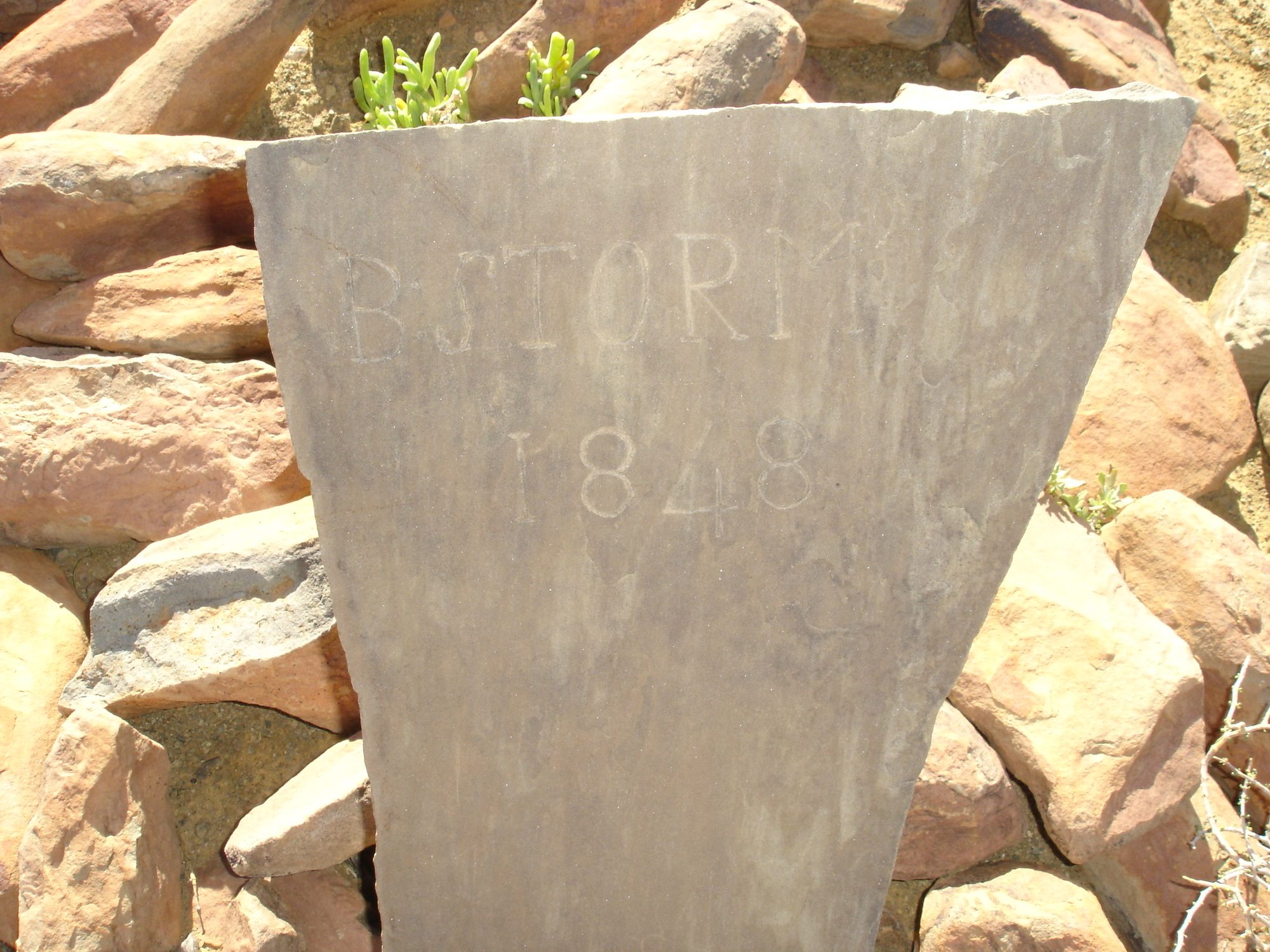
Eight marked graves on the Remainder of Varsche Fontein, from 1848 to 1922. Two Storms in consecutive years seven years after the grant, an infant of 1874 buried apart from the rest, three more children, and finally the patriarch under the only bought stone in the cemetery. None of the families in it appears in the farm's title deeds. A second burial ground twenty kilometres away, on Vredendal, carries the same surnames and shows the families are one intermarried community rather than six.
- mentions this farm
Vredendal en sy mense
Vredendal is a werf name on Spreeufontein No. 26, the farm the district called Gatsplaas. Five graves carrying three surnames, an 1886 slate slab whose inscription dates a woman to the day and whose line runs unbroken back to Enkhuizen in 1744, and then a household: the van der Merwes, and a man who died on his own birthday.
- mentions this farm
Die van der Merwes van die Hantam
Van Frans se vier grootouerlyne was die van der Merwes die laaste om die Prins Albert-distrik te bereik, en hulle het van die verste af gekom. Agt geslagte van 'n doop op die Paarl in 1735 tot Vredendal omstreeks 1950, met 'n opmeting van 1823 wat die trekker self by die naam noem.
- mentions this farm
Vier grootouers, vier lande, vanaf 1684
Elkeen van die vier grootouers het sy eie bladsy. Hierdie een gaan oor hoe hulle bymekaargekom het, wat drie troues, vier jaar en een man wat in twee van hulle ingetrou het, gekos het. En oor die titel se belofte: vier lande, waarvan net een op 'n kaart aangewys kan word.
- mentions this farm
Die van Rensburgs
Van Frans se vier grootouerlyne is dit die een met die minste plase en die beste storie. Nege geslagte, waarvan agt uit niks meer as name en jare bestaan, en dan 'n seun wat op ses 'n weeskind word, weggegee word, op vyf-en-twintig met een perd wegloop, en 'n boormasjien koop in 'n land waar water alles is.
Wat die rekord hou, in volgorde
-
1834
document
SG diagram 353/1834
Bf.W.Q.6-23
-
15 April 1841
ownership
Charl du Toit (17 September 1797–?)
Perpetual Quitrent · grant · confidence high
-
1848
burial
B. Storm
Varsche Fontein farm cemetery, B. STORM 1848, scratched on a slate slab set upright in a stone kerb. Nothing else is cut on the stone.
-
1849
burial
M. Storm
Varsche Fontein farm cemetery, M STORM / 1849, read across two fragments of one broken slab: 'M S' and '18' on the left piece, 'TORM' and '49' on the right. Deeply and neatly cut, in plain capitals, with no other text.
-
Junie 1874
burial
G.F. Beukes
Varsche Fontein - the single grave in the veld, 1874 / G F / BEU / KES / Juny, and below it what appears to be 15. Cut by hand into a thin sandstone slab, the letters shallow and irregular and the surname broken across three lines because the stone is narrow. Frans's reading; the 15 is the least certain part.
-
April 1897
document
SG diagram No.2 1903 (CL-7)
PA folio 1048
- April 1897 document SG diagram verso 2/1903 (verso)
-
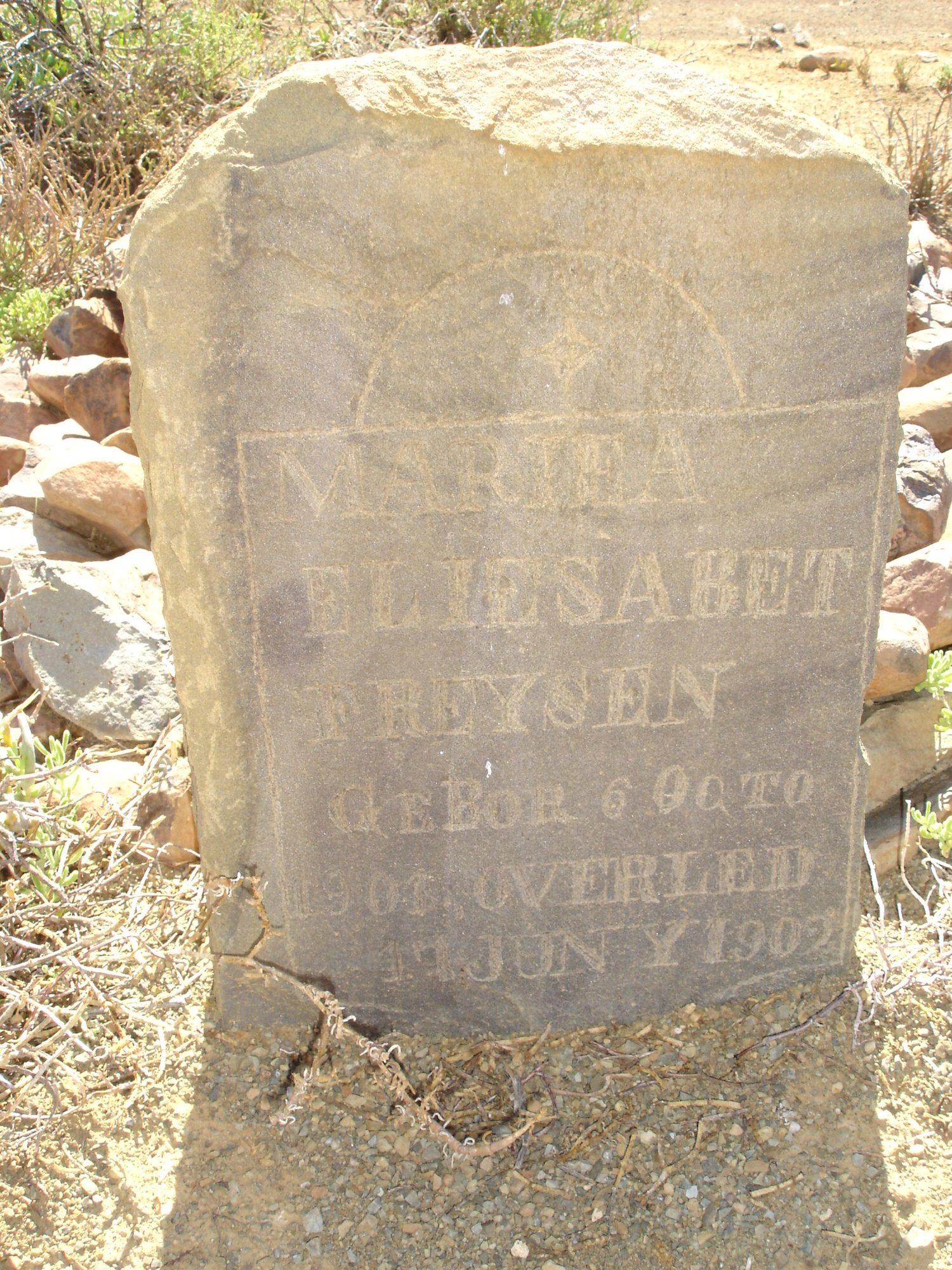
Junie 1902
burial
Maria Elizabeth Freysen (infant) (6 Oktober 1901–Junie 1902)
Varsche Fontein farm cemetery, MARIHA ELIESABET FREYSEN, GEBOR 6 OCTO[BER] 1901, OVERLEID [4?] JUNY 1902. Above the panel, a rayed sun or star inside an arch.
-
1903
ownership
J.R.G. Luttig (omstreeks 1824–4 Februarie 1914)
amended-title · confidence high
-
3 Augustus 1907
burial
M.J. Beukes, or a child of M.J. Beukes
Varsche Fontein farm cemetery, [Ter ge]dachtenis aan / [illegible word] M·J·BEUKES / O[verlede] 3. 8. 1907. Cut by hand into a sandstone slab in a mixed script - the first line in cursive, the name in capitals - with a ruled border and an incised cross or star above. The word before the initials is not legible and it is the word that decides who is buried here.
- 1913 boundary change subdivision: becomes Lot A (Varsche Fontein Nr. 27 Gdlt 1)
-
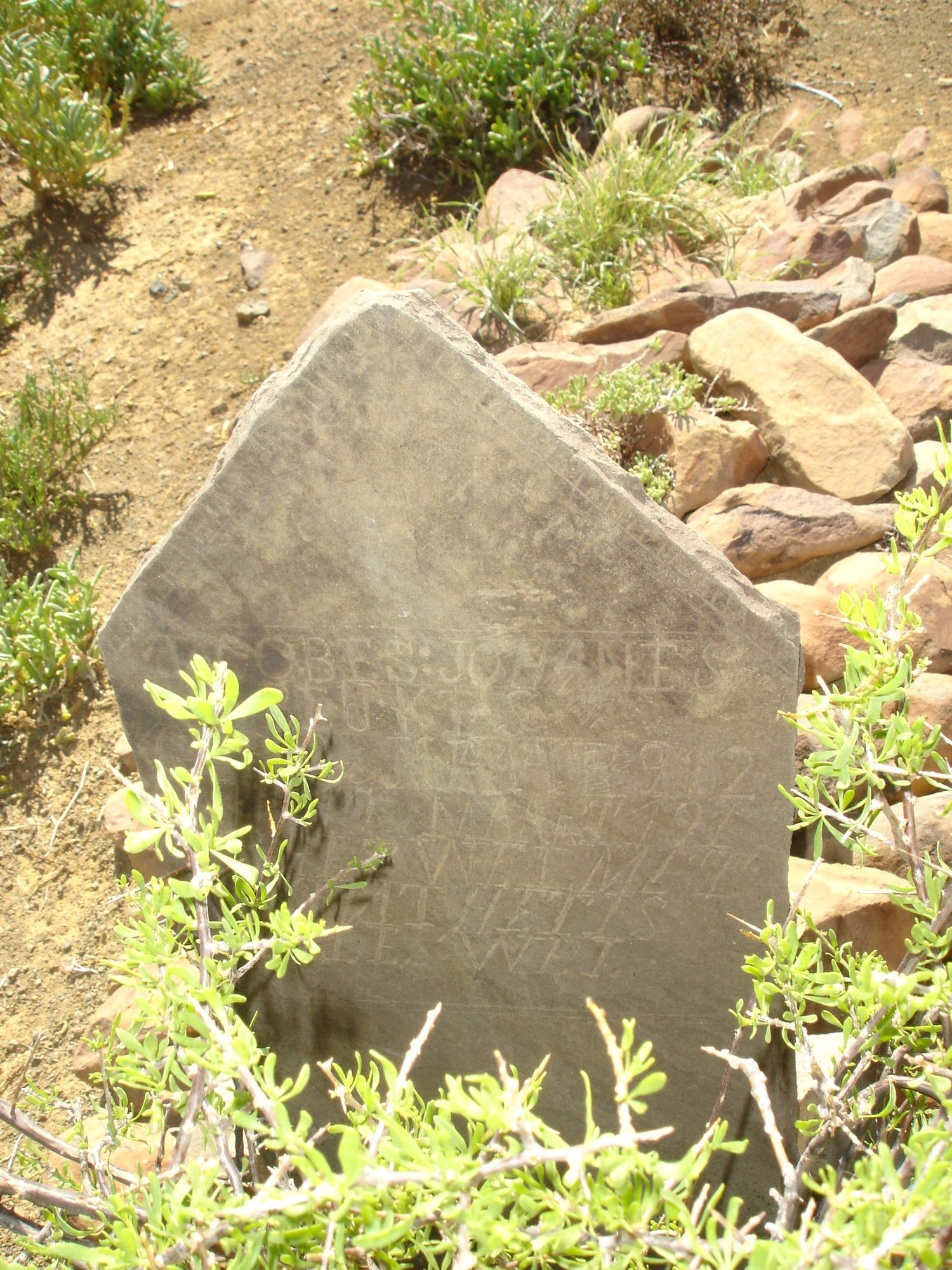
Maart 1913
burial
Jacobus Johannes Beukes (infant) (26 Mei 1912–10 Maart 1913)
Varsche Fontein farm cemetery, JACOBES : JOHANES / BEUKES / GEB 26 MAAIE 1912 / [O]VER[L] 10 MAART 191[3] / IS HET WEL MET / 'T KIND / HET IS ALLES WEL.
-
14 Oktober 1914
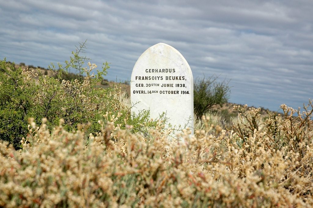
burial
Gerhardus Fransoiys Beukes (30 Junie 1838–14 Oktober 1914)
Varsche Fontein farm cemetery, GERHARDUS FRANSOIYS BEUKES, GEB. 30STEN JUNIE 1838, OVERL. 14 DEN OCTOBER 1914
- 1922 boundary change subdivision: becomes Groot Rivier (Varsche Fontein Nr. 27 Gdlt 2)
-
Januarie 1922
burial
Aletta Sophia Jacoba Opperman (born Beukes) (15 April 1872–13 Januarie 1922)
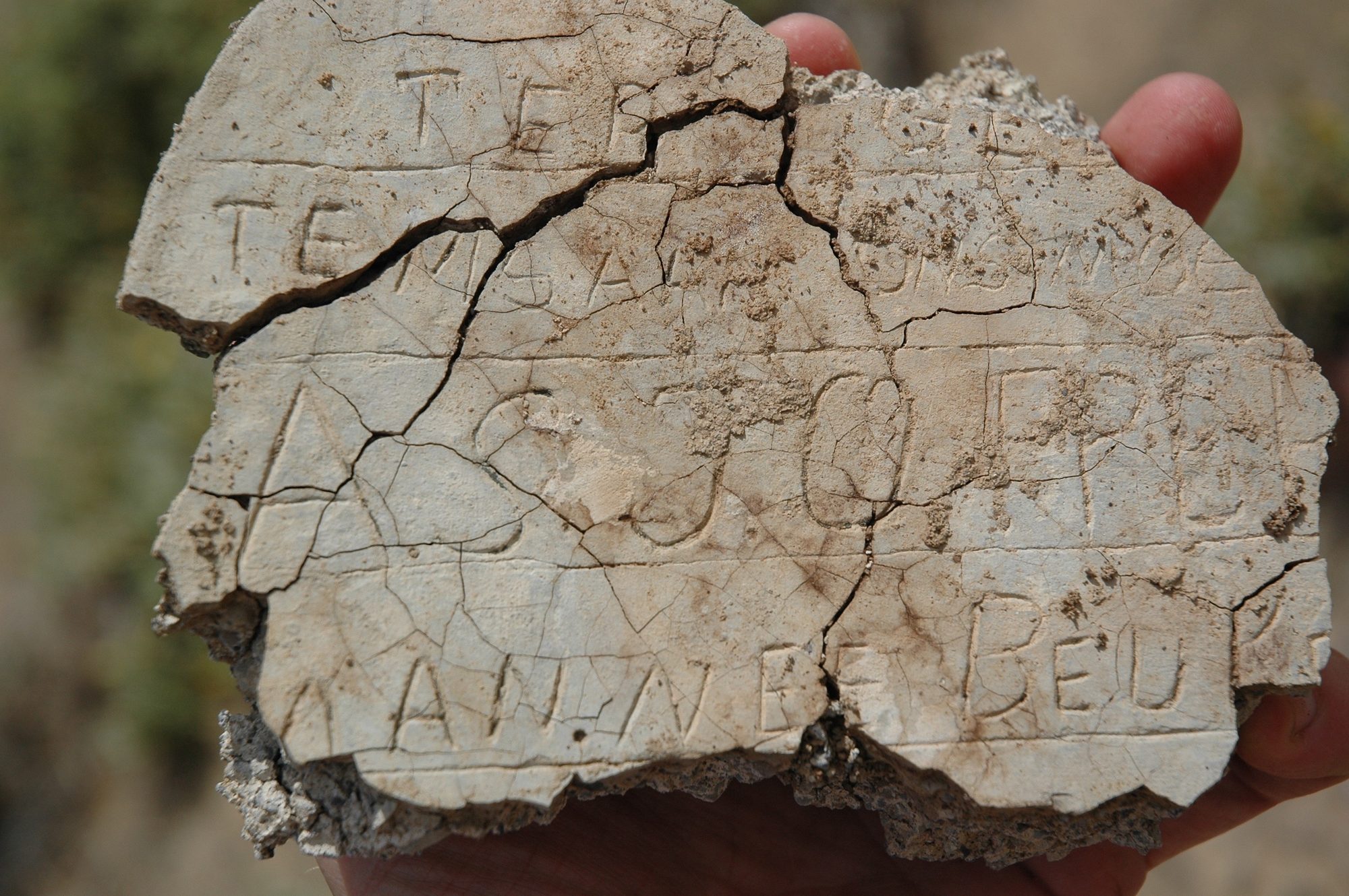
Varsche Fontein farm cemetery, A BROKEN FRAGMENT AND MOSTLY UNREADABLE. Letters scratched into cement before it set, in at least four lines. What can be read with any confidence: 'TER' on the top line, and 'BEU' at the end of the bottom line. Scattered capitals between them include what may be A, G, J, C, E, R and N, in no order that can be trusted. NOTHING ELSE IS TRANSCRIBED.
- 1923 boundary change subdivision: becomes Plaat Fontein (Varsche Fontein Nr. 27 Gdlt 3)
- 1925 boundary change subdivision: becomes Welbedacht (Varsche Fontein Nr. 27 Gdlt 4)
- 1925 boundary change remainder: becomes Varsche Fontein Nr. 27 Restant
Grond uit hierdie plaas gesny
- Lot A (Varsche Fontein Nr. 27 Gdlt 1)
- Groot Rivier (Varsche Fontein Nr. 27 Gdlt 2) 2565.2 ha
- Plaat Fontein (Varsche Fontein Nr. 27 Gdlt 3) 1786.2 ha
- Welbedacht (Varsche Fontein Nr. 27 Gdlt 4) 2184.2 ha
- Varsche Fontein Nr. 27 Restant RE/27 · 3831.8 ha
Begrens deur, soos die kaart hulle noem
- NE Jan Willems Fontein
- NE Klein Knoffels Fontein
- E Spreeuw Fontein
- SW Klein Fontein
- SW Blaauw-Krantz (part)
- W Abrahams Kraal
- NW Jan Willems Fontein
- NE Jan Willems Fontein
- NE Klein Knoffels Fontein
- E Spreeuw Fontein
- SW Klein Fontein
- SW Blaauw-Krantz (part)
- W Abrahams Kraal
- NW Jan Willems Fontein
Op die afdelingskaart van 1915
Soos die Landmeter-generaal hierdie plaas in 1915 gedruk het: die geregistreerde titelhouer, die datum waarop die titel uitgereik is en die erfpagverwysing, net so van die kaart oorgeskryf. Die hele kaart, plaas vir plaas
| Plaas, soos gedruk | Titelhouer | Titel | Erfpag | Aantekening |
|---|---|---|---|---|
| VARSCH FONTEIN Amended Title | J. R. G. Luttig | 19.6.190[?3] | · fol. 104[?8] | in the Gamka field cornetcy beside Spreeuw Fontein; "Groot River" runs through |
Op hierdie grond begrawe
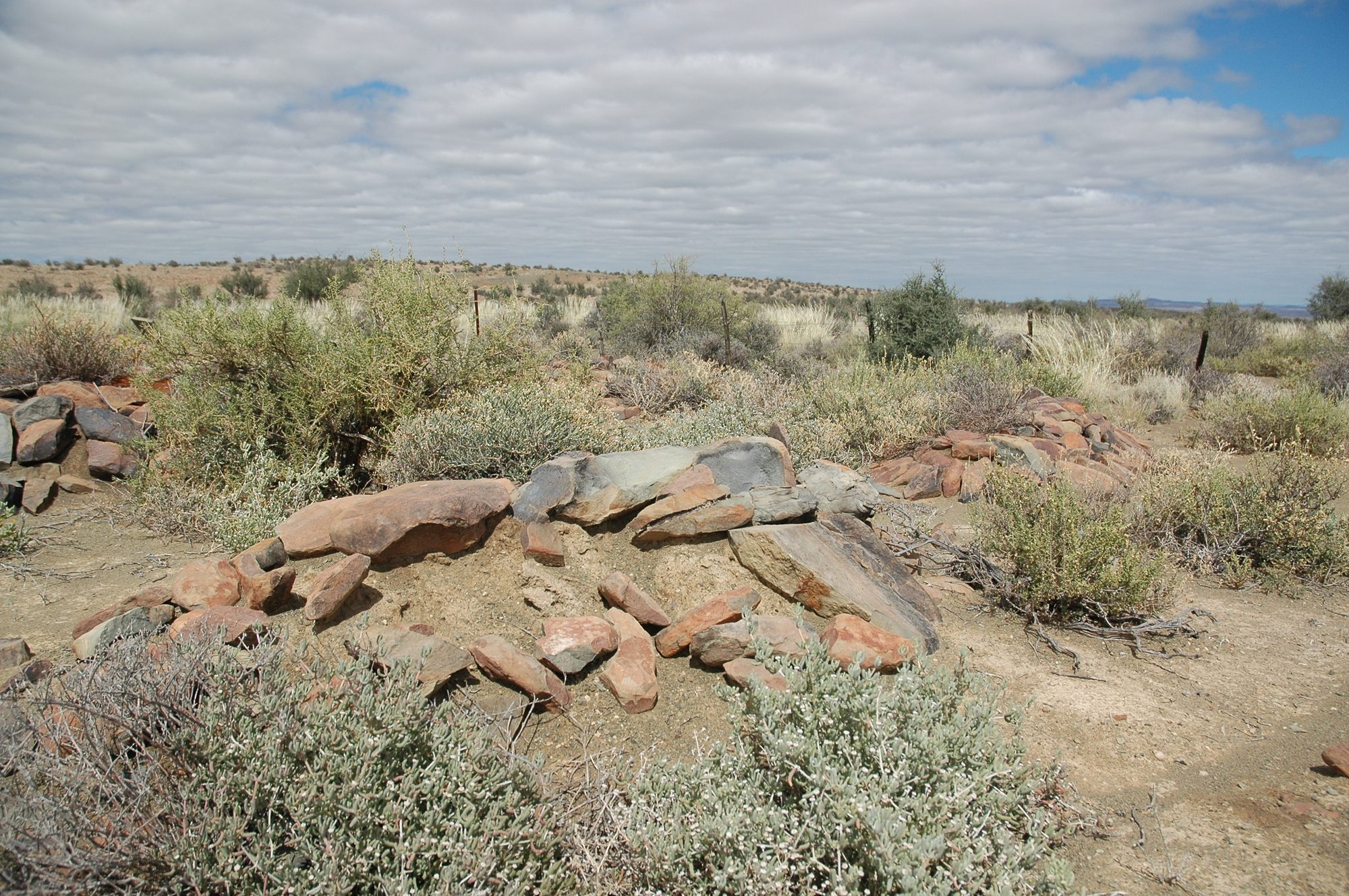
- Varsche Fontein-plaasbegraafplaas 7 grafte opgeteken, 4 in hierdie projek geïdentifiseer
- Varsche Fontein - die enkelgraf in die veld 1 grafte opgeteken · nog geen koördinaat nie
Die begrafnisse verskyn ook op hierdie plaas se tydlyn hierbo, elkeen op sy eie datum.
Foto's
Ook begrens deur, soos die moderne kadaster dit teken
Grond wat aan hierdie plaas raak op die Landmeter-generaal se huidige poligone en wat geen kaart wat hier gehou word, noem nie. Afgelei uit die meetkunde, nie van 'n dokument afgelees nie.
- N Plaat Fontein (Varsche Fontein Nr. 27 Gdlt 3)
- NE Lammers Kraal Nr. 11
- E Varsche Fontein Nr. 27 Restant
- E Lot A (Spreeufontein Nr. 26 Gdlt 3)
- SE Welbedacht (Varsche Fontein Nr. 27 Gdlt 4)
- SE Bokfontein Nr. 94 (formerly Waterfall)
- SW Groot Rivier (Varsche Fontein Nr. 27 Gdlt 2)
- SW Bloukrans Nr. 31
Dokumente
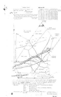 Landmeter-generaal-kaart, No.2 1903 (CL-7), April 1897
11046771.TIF
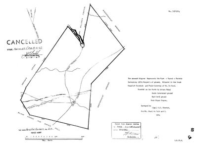 Landmeter-generaal-kaart, 353/1834, 1834
SCAN208 (3).TIF
 Kaart se keersy, 2/1903 (verso), April 1897
11046772.TIF
Kadaster
Die Landmeter-generaal se kaartindeks vir hierdie perseel
Navorsingsnotas
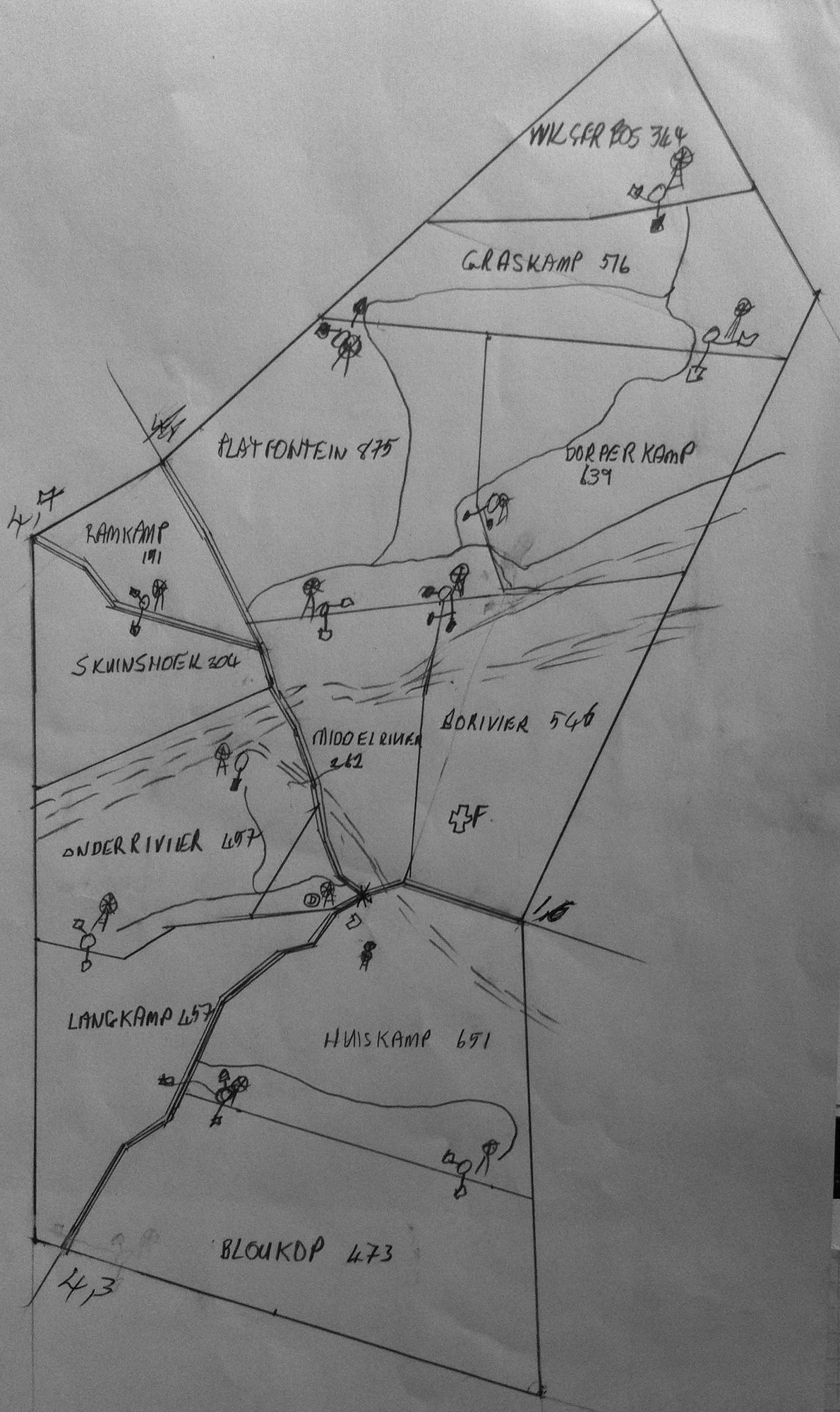
Frans's parents' farm. Originally 12,074 morgen (1834 survey); 13,869 mg 347 sq rds after the 1897 resurvey. Four portions deducted 1913-1925 (PAR-000015..18), leaving the Remainder PAR-000019. Camp plan IMG-0002 records 12 camps totalling 5,795 units; if hectares that is ~6,766 morgen, which exceeds the 1925 Remainder of 4,498mg - so ground was later bought back. [TO VERIFY]
[7 Aug 2026, FS] THE BEUKES WERE ON THIS FARM LONGER THAN THE OWNERSHIP ROWS SHOW. Gerhardus Francois Beukes (PER-000029) was buried here in 1914 and his daughter ALETTA SOPHIA JACOBA, by then married to Pieter Jozua OppermanM, DIED AT VARSCH FONTEIN ON 13 JANUARY 1922 - the place is on her death notice. So a Beukes and then an Opperman household was here into the 1920s. THE OWNERSHIP ROWS RUN du Toit 1841, Luttig 1903, van Rensburg 1973, and the Beukes appear in none of them. Whatever their tenure was - bywoners, lessees, an unrecorded transfer inside the 62-year gap between 1841 and 1903 - the burials say they were here and the deeds do not. That gap is worth reading as a question about the ownership record rather than about the family.
[7 Aug 2026, SRC-308] eGGSA record this cemetery as Cemetery ID 6614 at -32.946167, 22.109533, 118 m from this project's coordinate. Their album has TWO images and ONE headstone; this project holds EIGHT marked graves here. Their note reads 'There are many graves, but only one headstone', which is the same observation this project's own page is built on, reached independently.
[11 Aug 2026] A NEARLY-IDENTICAL NAME HAS BEEN REMOVED FROM THIS PROJECT, and the removal is recorded here because this is the farm it kept being confused with. VARSFONTEIN No. 254 in the BEAUFORT WEST division, formerly PAR-000003, was consolidated in 1921 out of parts of Welgebosch Drift and Hoogeveld Lot B (formerly PAR-000011 and PAR-000012, which existed only to explain it) and transferred to M.M.A. de JagerM in 1922. NOTHING TIED IT TO THIS FAMILY EXCEPT ITS NAME. Varsche Fontein No. 27 in the Prince Albert division is Frans's parents' farm; Varsfontein No. 254 is a different farm in a different division made a century later for a different family. [FAMILY] It has no relevance other than a name similar to Varsche Fontein.. THE IDS PAR-000003, PAR-000011, PAR-000012, DOC-0003 AND OWN-000006 ARE RETIRED AND MUST NOT BE REUSED. The 1921 diagram itself, SG 4103, stays on disk at sources/diagrams/DOC-0003-varsfontein-beaufortwest-no254-1921.tif in case the question ever comes back.
[14 Aug 2026, WinDeed Deeds Office property report, farm 27 ptn 0, searched 20:50] AN INDEPENDENT REPORT DISAGREES WITH THIS EXTENT AND IS WRONG. It gives the previous description of Varsche Fontein as 13569 morgen 347 square roods; this row says 13869. THE MODEL'S FIGURE CLOSES AND THEIRS DOES NOT: the five parcels this farm was cut into - RE 4498 mg 166 sr, Lot A 1731 mg 181, Groot Rivier 3003 mg 284, Plaat Fontein 2100 mg 25, Welbedacht 2536 mg 291 - add to 13869 morgen 347 square roods exactly, to the rood, which is 300 morgen more than the report allows. The disputed field is one the report itself marks with an asterisk, meaning enriched from WinDeed's own database rather than supplied by the Deeds Office, so the two are not equally weighted. NOTHING IS CHANGED HERE; the disagreement is recorded because a later reader will meet the same report.
Werknotas, hier gewys omdat dit 'n private navorsingsbou is.
Die werksnotas op hierdie werf word in Engels gehou en word nie vertaal nie. Hulle verander met elke navorsingsessie, en 'n vertaling sou uit pas raak met die oorspronklike. Alles anders - die stories, die getranskribeerde dokumente en die koppelvlak - is in Afrikaans.
Oop vrae
-
Who is buried in the Varsche Fontein cemetery? Five of seven now named
prioriteit 1 · LEAD-0122
Four marked graves are now recorded and only one is identified. Who are Mariha Eliesabet Freysen (1901-1902), Jacobes Johanes Bukes, and B. STORM 1848? Frans has undertaken to give names.
Wat dit sou uitmaak Names from Frans, or a burial register entry. For the stones themselves: straight-on photographs in raking light, which would probably give the Beukes dates and the Freysen day and surname outright.
-
Two Storms on Varsche Fontein, 1848 and 1849 - who were they, and what put them there?
prioriteit 1 · LEAD-0124
Who is the B. STORM buried on Varsche Fontein in 1848 (GRV-0030), and does the grave connect to either of the two Storm lines this family already touches?
Wat dit sou uitmaak THE LIQUIDATION AND DISTRIBUTION ACCOUNT OF MAGDALENA STORM BORN BOTES, died Prince Albert 10 April 1884. Her death notice says she left IMMOVEABLE PROPERTY to be 'all sold immediately and the account filed'. That account names the land. It is now the single most direct route to whether the Storms held ground on or near Varsche Fontein. Failing that, the estate papers of her husband, died Prince Albert 19 August 1855.
-
Is the lone 1874 stone on Varsche Fontein a thirteenth Beukes child?
prioriteit 1 · LEAD-0126
A hand-cut stone standing apart from the cemetery reads 1874 / G F BEUKES / Juny [15?]. Is it an infant son of Gerhardus Francois Beukes whose name was reused in 1877, and why is he buried away from the others?
Wat dit sou uitmaak A baptism or burial entry, or a death notice.
-
Read the graves ACROSS the farms, and against the online grave indexes
prioriteit 1 · LEAD-0127
Storm, Botes, Niehaus, Botma, Beukes and Freysen appear on stones on Varsche Fontein and on Vredendal/Spreeufontein, and they intermarry. What does the picture look like when the burial grounds are read as one body of evidence rather than farm by farm, and what do the published grave indexes add?
Wat dit sou uitmaak Nothing settles a question this shape. What it produces is a map: which families are buried where, who married whom, and which farms they moved between.
-
Are the Varsche Fontein Beukes related to Christa's Beukes, or is it only the surname?
prioriteit 2 · LEAD-0123
This project has recorded the Varsche Fontein Beukes as 'a cousin line on Frans's wife's side'. Is there an actual path, or was that inferred from the surname?
Wat dit sou uitmaak A shared ancestor with both descents documented, or a demonstration that the two Beukes families are separate at the Cape.
-
Searching a noemnaam against display_name finds nobody
prioriteit P3 · LEAD-0314
Closed on the day it was opened, on a false premise.
Wat dit sou uitmaak Frans's word that she should be in, and her full name.
Wat die rekord kortkom
-
The record stops in 1903 and never resumes
second order · B2 trail-ends
Varsche Fontein was worked as far as 1903, with J.R.G. LuttigH the last owner on record. 123 years follow with nothing. Who held it after that, and is it still one farm?
What would settle it The current title deed traced backwards, each transfer names the one before it, or the Surveyor-General's subdivision diagrams, which are what usually explain a farm going quiet.
-
62 years, and the ground changes hands to nobody we can follow
second order · B1 succession
On Varsche Fontein, Charl du ToitH is the last owner recorded from 1841-04-15, and the next entry is J.R.G. LuttigH from 1903, 62 years later, with no person in common. DOC-0002 records the later arrival but not the 62 years before it.
What would settle it The Deeds Office transfer register for this farm between 1841 and 1903. A transfer names its predecessor in title, so one deed closes the whole gap.
-
“Klein Fontein” is named as a neighbour 4 times and we hold no parcel for it
second order · B3 unheld-farm
4 separate surveys in this model put Klein Fontein on the boundary of ground we do hold (PAR-000002, PAR-000018, PAR-000020). It has no parcel of its own here, so nothing is known about who held it or when, while it borders farms at the centre of the project.
What would settle it The Surveyor-General's farm index for the registration division will give it a farm number and a diagram; the cadastre pull in `fetch_cadastre.py` then places it on the map.
-
“Klein Knoffels Fontein” is named as a neighbour 3 times and we hold no parcel for it
second order · B3 unheld-farm
3 separate surveys in this model put Klein Knoffels Fontein on the boundary of ground we do hold (PAR-000002, PAR-000017). It has no parcel of its own here, so nothing is known about who held it or when, while it borders farms at the centre of the project.
What would settle it The Surveyor-General's farm index for the registration division will give it a farm number and a diagram; the cadastre pull in `fetch_cadastre.py` then places it on the map.
-
“Blaauw-Krantz (part)” is named as a neighbour 2 times and we hold no parcel for it
third order · B3 unheld-farm
2 separate surveys in this model put Blaauw-Krantz (part) on the boundary of ground we do hold (PAR-000002). It has no parcel of its own here, so nothing is known about who held it or when, while it borders farms at the centre of the project.
What would settle it The Surveyor-General's farm index for the registration division will give it a farm number and a diagram; the cadastre pull in `fetch_cadastre.py` then places it on the map.
Found by breaks.py reading the model against itself, not written by hand,
each one is a shape of missing record, not a fault in the data.
The whole set is on the
questions page.