Surveyor-General diagram, 356/1833, August 1833
Surveyor-General diagram, August 1833
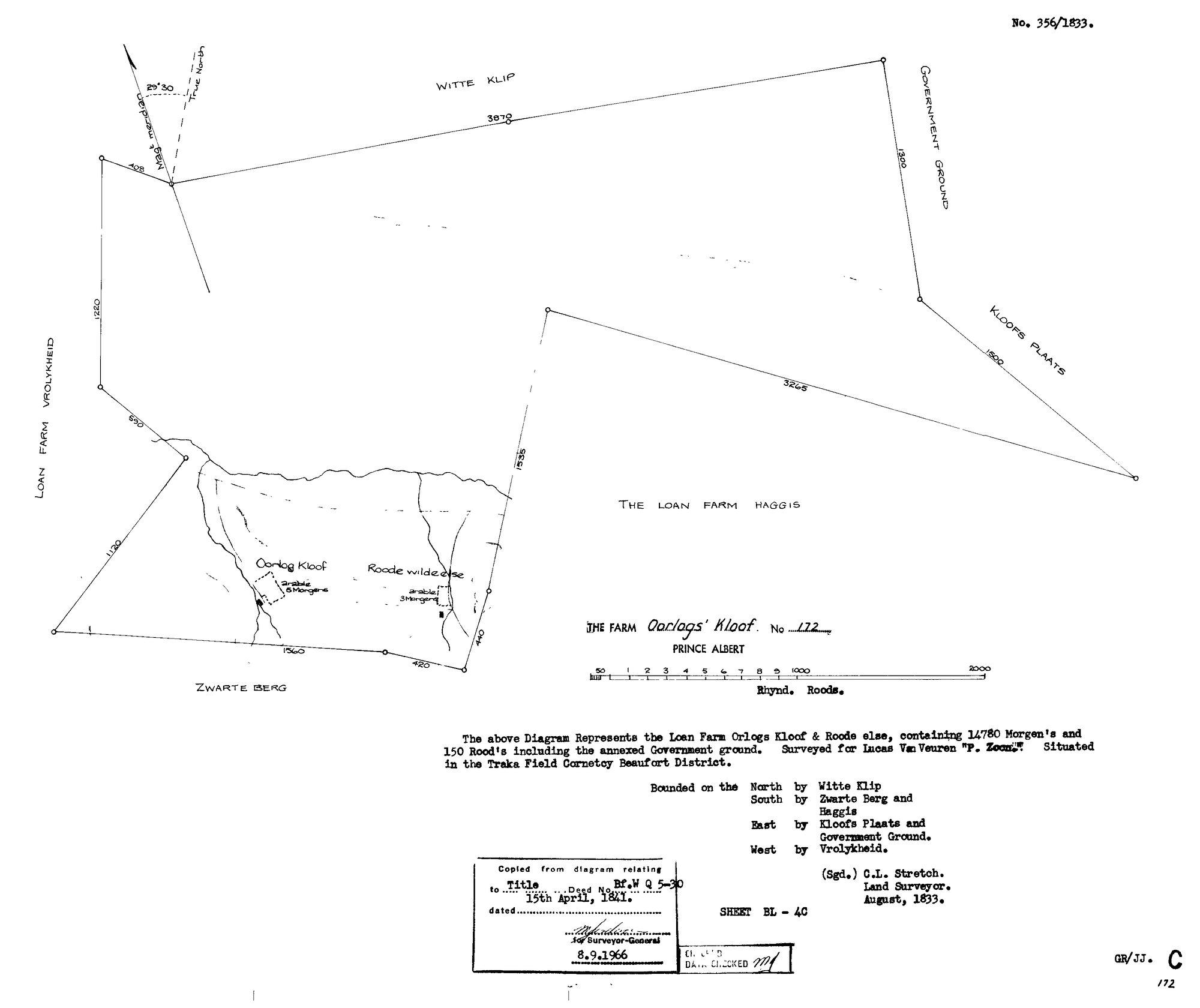
SCAN538.TIF.The record
- Type
- Surveyor-General diagram
- Diagram number
- 356/1833
- Surveyed
- August 1833
- Titled
- 15 April 1841
- Deed
- BF.WQ 5-30
- Surveyor
- C.L. Stretch
- Archive filename
- SCAN538.TIF
Citation
- Title
- Oorlogs Kloof No.172 diagram
- Repository
- Surveyor-General
- Reference
- SG Dgm 356/1833
- Type
- SG diagram
The ground it is about
Oorlogs Kloof No. 172 (Roode Els Bosch and Oorlogs Kloof) 172
Research notes
"The Farm Oorlogs' Kloof No. 172, Prince Albert." Loan Farm 'Orlogs Kloof & Roode wilde else,' 14,780 morgen 150 roods including annexed Government ground, surveyed for Lucas Van Veuren (recorded on the form as "P. Zoon"), Traka Field Cornetcy, Beaufort District. Bounded North by Witte Klip, South by Zwarte Berg and Haggis, East by Kloofs Plaats and Government Ground, West by VROLYKHEID. Surveyed by C.L. Stretch, August 1833; re-copied/re-stamped 8.9.1966 ('for Surveyor-General'). "Copied from diagram relating to Title Deed No. Bf.W Q 5-30, dated 15th April 1841" - the SAME 15 April 1841 grant day as Wit Plaats/Uitkyk Nek/Marinco/Faans Kraal's Hitge title (B.W.Q.5.18) and Reim Hoogte's own quitrent (B.F.W.Q.5-10) - apparently a mass grant/quitrent day across this district, not evidence the farms are otherwise connected. NOT ONE OF THE FIVE CORE FARMS - logged because its own diagram independently corroborates Vrolykheid's (PAR-000014/PAR-000031) existing neighbours.csv entry ('E, Oorlogs Kloof'), currently unlinked to a par_id since we don't track farm 172 itself. No parcel record created for this farm; per §9a this stays boundary evidence for Vrolykheid, not a new tracked farm. [29 Jul 2026] Farm now tracked as PAR-000066 after the 1872 and 1940 diagrams (DOC-0078/0079/0080/0081) arrived via the inbox.
The research behind this page, kept separate from it: dated working notes, open questions, and what is not yet settled.