Surveyor-General diagram, 4932/1934, July 1934
Surveyor-General diagram, July 1934
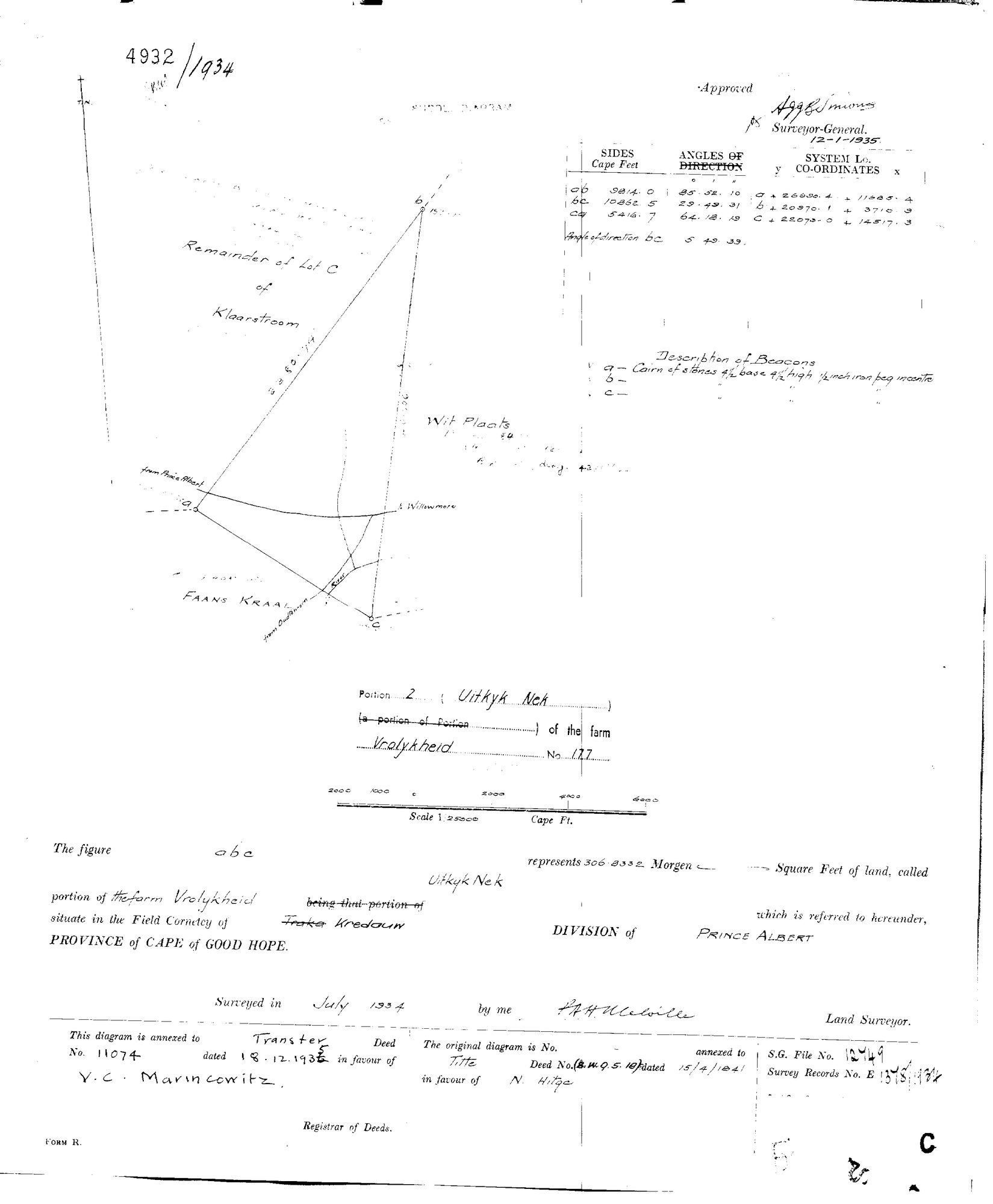
10JL3901.TIF.The record
- Type
- Surveyor-General diagram
- Diagram number
- 4932/1934
- Surveyed
- July 1934
- Titled
- 18 December 1935
- Deed
- 11074
- Surveyor
- J.A.H. Melville (signature, reading uncertain)
- Archive filename
- 10JL3901.TIF
Citation
- Title
- Vrolykheid Portion 2 "Uitkyk Nek" diagram
- Repository
- Surveyor-General
- Reference
- SG Dgm 4932/1934
- Type
- SG diagram
The ground it is about
Uitkyk Nek (Vrolikheid No. 177 Ptn 2)
Research notes
"Portion 2 (Uitkyk Nek), a portion of the farm Vrolykheid No. 177." Approved 12 Jan 1935. Same Traka-struck-through-to-Kredouw field-cornetcy correction as DOC-0068. Extent 306.8332 morgen. "This diagram is annexed to Transfer Deed No. 11074 dated 18.12.1935 in favour of V.C. Marincowitz. The original diagram is No. [blank] annexed to Title Deed No. (B.W.Q.5.18) dated 15/4/1841 in favour of N. HitgeM." Matches DOC-0028's verso deductions entry for Uitkyk Nek exactly (18.12.1935-11074) - no discrepancy here, unlike DOC-0068/Marinco. Same [TO VERIFY] on the antecedent title: traces to the 1841 HITGE grant, not the Oosthuisen grant the model currently treats PAR-000014 (the undivided remainder) as descending from.
The research behind this page, kept separate from it: dated working notes, open questions, and what is not yet settled.