Gamthous Bergh (Gamtoosberg Nr. 170, Oudtshoorn)
170 op die kadaster · op rekord 1765–1818 · wys op die kaart
- Plaasnommer
- Nr. 170
- Ook aangeteken as
- KandelaarsrivierSRC-668, the 1818 surveyGamthous BerghSRC-667, RLR 19 p. 94Gamtoosbergthe cadastre
- Op die kadaster
- 170, heel plaasgeregistreer as GAMTOOSBERG
- Grootte, soos die kaart dit stel
- 2945 morgen 200 sq roods (1818 survey of the loan place)
- Moderne opgemete oppervlakte
- 1683.8 ha
Die historiese grootte en die moderne opgemete oppervlakte is twee aparte metings en word hier nie aangebied asof hulle mekaar bevestig nie. Die eerste is wat 'n landmeter op 'n kaart geskryf het, gewoonlik in morg. Die tweede is wat die moderne kadaster teken.
Waarom hierdie plaas hier is
Jacobus Oosthuizen (b.1722) het dit gehou. 52 km van Klaarstroom.
Jacobus Oosthuizen (b.1722) is regstreeks op hierdie grond aangeteken. Geen spoor nodig nie.
- dokument 'n Dokument in die versameling beskryf hierdie grond DOC-0365
Wat die rekord hou, in volgorde
-
1765
ownership
Jacobus Oosthuizen (b.1722) (1722–1802)
loan farm · loan-farm register · confidence medium
-
21 Januarie 1818
document
SG diagram B 466/1818
Geo.Q.6-50
Begrens deur, soos die kaart hulle noem
- N the farm of A. Olivier
- S Klein Doornrivier
- E the Klippe Rivier
- W the Morasrivier
Dokumente
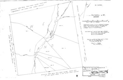 Landmeter-generaal-kaart, B 466/1818, 21 Januarie 1818
SCAN167 gamtoos 170.jpg
Kadaster
Die Landmeter-generaal se kaartindeks vir hierdie perseel
Navorsingsnotas
[SRC-667] THE LOAN PLACE OF JACOBUS OOSTHUIZEN, JAN'S SON, 1765 (RLR 19 p. 94), 'Gamthous Bergh, aan de Canalands rivier'. NO POLYGON, deliberately: the river is not yet identified and TWO cadastral farms carry the name - GAMTOOS BERG No. 172 in the LADISMITH division, 18 km south of Calitzdorp, in the country the modern municipality calls Kannaland; and GAMTOOSBERG No. 299 in OUDTSHOORN, 12 km from that town and 17 km from Welbedagt No. 150 (PAR-000277). 5 rule 4: an unresolved place gets no map pin, because a wrong pin is worse than a missing one. See LEAD-0363. WHICH JACOBUS is also open: the likeliest is PER-000230, Jacobus OosthuizenL b. 1722, a son of the stamvader Johannes 'Jan' Oosthuijsz and Frans's 6x-great-grandfather, who was 43 in 1765, married at Tulbagh in 1749 and stands on the Swellendam rolls of 1751, 1760 and 1770. A son of Jan Hendrik (PER-001828) would also be written 'Jan zoon' [TO VERIFY].
[22 Sep 2026, FRANS] THE MAN IS JACOBUS OF 1722 (PER-000230), on his reasoning and the arithmetic: any Jacobus of Jan Hendrik's would have been about twenty in 1765, since that family's children begin in 1736, while this Jacobus was 43, married at Tulbagh in 1749 and already a householder on the Swellendam rolls of 1751 and 1760. Loan places went to established burghers. AND THE GROUND IS THE OUDTSHOORN SIDE, NOT KANNALAND. Frans put it at -33.71633, 22.15613, which falls inside GAMTOOSBERG No. 170 (Oudtshoorn division, 1,684 ha), with GAMTOOSBERG No. 299 2.2 km away - one name over a small cluster of farms. 'CANALANDS' READS AS KANDELAARS: those coordinates sit on the Kandelaarsrivier, and 7 km off is a farm the cadastre calls CHANDELIER No. 269, which is the same word in French - a surveyor's translation of the local name. [TO VERIFY] against the register page. THE 1850 MAP CORROBORATES THE PLACE: the HSRC sheet of the Gamkasvlakte, Cango and Wynandsrivier wards (SRC-663, p. 150) draws GAMTOOSBERG as a farm east of Oudtshoorn beside Perdedrif, Armoed, Seekoeigat and Allemansdrif - the same neighbours the modern cadastre gives Nos. 170 and 299 (Paardendrift 171, Armoed 159, Zeekoegat 161). It does not name the Kandelaars; that sheet labels only the Olifants, Kammanassie, Wynands, Gamka and Gourits. STILL NO MAP PIN, because the loan place spans ground that later became more than one numbered farm and the register has not been read here.
[22 Sep 2026, SRC-434, FRANS] SPARRMAN'S MAP NAMES THE RIVER. His Mappa Geographica (surveyed 1775-76, published 1779) draws a river 'CANNA' rising at 'CANNAS HOOGTE' and running north into the Oliphants Rivier, between 'Morass r.' to its west and the 't Cam t Nasi Rivr' (Kammanassie) to its east, with Artaquas Cloof, Saffrankraal, Paardecraal and Hagelcraal on the same stretch. THAT IS TEN YEARS AFTER THE GRANT AND IT IS THE CONTEMPORARY NAME: 'aan de Canalands rivier' in RLR 19 p. 94 (SRC-667) is the country of the Canna, and the register's word needs no emendation to Kandelaars. The modern Kandelaarsrivier runs in that same stretch and may be the same water under a later name [TO VERIFY]; the farm CHANDELIER No. 269 sits 7 km from the ground Frans identified. The 1850 HSRC map (SRC-663 p. 150) has a farm KANSA a little west of there, which may carry the old name forward [TO VERIFY].
[22 Sep 2026, FRANS] PINNED TO GAMTOOSBERG No. 170 (Oudtshoorn) at his instruction, on his own coordinates -33.71633, 22.15613, which fall inside this polygon, with Sparrman's Canna river and the 1850 map's Gamtoosberg behind them. THE PIN IS A DECISION, NOT A MATCH: the 1765 loan place was unsurveyed ground and the name also sits on No. 299 next door, so the polygon is where the place was, not its bounds [TO VERIFY against RLR 19 p. 94]. PREQUEL GROUND under 9a and never core - it must not move the map's opening bounds.
[22 Sep 2026, SRC-668, DOC-0365] THE LOAN PLACE'S OWN SURVEY, and it settles the river. Diagram B 466/1818 calls the figure 'de Lenings Plaats KANDELAARSRIVIER', 2945 morgen 200 sq roods, in the veldkornetskap Attacquas Kloof, district George, surveyed 21 January 1818 for J.G. van Loggerenberg by B.J. Duminy. So 'aan de Canalands rivier' in the 1765 grant, Sparrman's 'Canna', and the Kandelaars are one water. THE MODERN FARM IS ONLY PART OF IT: 2945 morgen 200 sq roods is about 2,524 ha against the 1,684 ha the cadastre gives No. 170, because Lots K, L, M, N, O and a No. 1 are drawn inside the 1818 figure and were cut off later. The polygon this parcel is pinned to is therefore the REMAINDER, not the ground Jacobus held in 1765 [TO VERIFY the deduction table]. Its boundaries in 1818: north the farm of A. Olivier, south Klein Doornrivier, east the Klippe Rivier, west the MORASRIVIER - the Morass r. of Sparrman's map.
[22 Sep 2026, SRC-668] THE LOAN PLACE TOOK TITLE ON 30 JUNE 1832, quitrent Geo.Q.6-50, from the copy note on its own diagram - sixty-seven years after Jacobus OosthuizenL held it on loan, and the first cut, No. 1 of 1364 morgen, follows in 1847.
Werknotas, hier gewys omdat dit 'n private navorsingsbou is.
Die werksnotas op hierdie werf word in Engels gehou en word nie vertaal nie. Hulle verander met elke navorsingsessie, en 'n vertaling sou uit pas raak met die oorspronklike. Alles anders - die stories, die getranskribeerde dokumente en die koppelvlak - is in Afrikaans.
Wat die rekord kortkom
-
The record stops in 1765 and never resumes
second order · B2 trail-ends
Gamthous Bergh (Gamtoosberg Nr. 170, Oudtshoorn) was worked as far as 1765, with Jacobus OosthuizenL (b.1722) the last owner on record. 261 years follow with nothing. Who held it after that, and is it still one farm?
What would settle it The current title deed traced backwards, each transfer names the one before it, or the Surveyor-General's subdivision diagrams, which are what usually explain a farm going quiet.
-
“the farm of A. Olivier” held ground next door and we have no tenure for them
third order · B4 unheld-owner
A boundary description for Gamthous Bergh (Gamtoosberg Nr. 170, Oudtshoorn) names the farm of A. Olivier, a surveyor stating on the record that this person held the adjoining ground. We do hold Olivier tenure elsewhere, but none on this boundary and none at this date.
What would settle it The diagram's own date fixes the window. The quitrent or erfpacht register for that year names the holder of the adjoining place, and an estate inventory will name the farm outright.
Found by breaks.py reading the model against itself, not written by hand,
each one is a shape of missing record, not a fault in the data.
The whole set is on the
questions page.