Mistkraal No. 121 (Touwsberg, Ladismith)
121 on the cadastre · on record 1832 · show on the map
- Farm number
- No. 121
- On the cadastre
- 121, whole farmregistered as MISTKRAAL
- District
- Touwsberg (Ladismith division)
- Extent, as the diagram states it
- 1901 morgen 125 sq roods
- Modern surveyed area
- 1447.5 ha
The historic extent and the modern surveyed area are two separate measurements and are not presented here as confirming each other. The first is what a surveyor wrote on a diagram, usually in morgen. The second is what the modern cadastre draws.
Why this farm is here
Here because an open question in this record is about it; who held it is not yet established. 144 km from Klaarstroom.
- document A document in the collection describes this ground DOC-0308
- document A document in the collection describes this ground DOC-0309
- lead An open question in this record is about this ground Do the levels need a second centre now that the prequel grounds carry their communities?
What the record holds, in order
-
1832
document
SG diagram 484/1832
Lad.Q.9-42
- 1832 document SG diagram verso 484/1832 (verso)
Documents
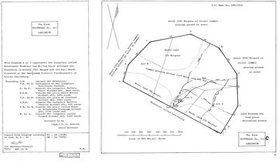 Surveyor-General diagram, 484/1832, 1832
SCAN985 mistkraal 121.jpg
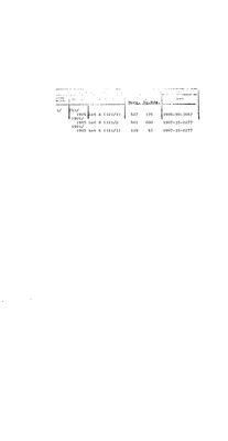 Diagram verso, 484/1832 (verso), 1832
SCAN986 mistkraal 121.jpg
Cadastre
Surveyor-General diagram index for this parcel
Research notes
THE FARM IN JACOBA CORNELIA OOSTHUIZEN'S ESTATE. S.G. 484/1832 (SRC-471, DOC-0308) reads 'the Loanplace called Deverlaate MISKRAAL VAN WILLEM GOOSE geleegen aan TOUWSBERG... Situated in the SWELENDAM DISTRICT FIELDCORNETCY OF GROOTE SWARTEBERG'. MOOC8/56.13, her estate of 28 December 1805 taken by her brother Pieter Cornelis (PER-000242), carries a debt on 'de plaats gen:t de MISTKRAAL VAN WILLEM GOOZEN gelegen aan de TOUWSBERG' (SRC-467).
Whether she or her husband held it, or only owed on it, the estate does not say. [TO VERIFY]
Not the Koup and not core.
The research behind this page, kept separate from it: dated working notes, open questions, and what is not yet settled.
Open questions
-
Do the levels need a second centre now that the prequel grounds carry their communities?
priority 2 · LEAD-0235
Frans admitted the Olifants communityand said 'we can keep our levels and that will help show relevance'. Under LEVELS.md as written those people land in LEVEL 4. Should R2 be pointed at a second centre, and what else comes in if it is?
What would settle it Frans choosing between a second centre, a second centre plus the maternal one, and a separate time axis - after the numbers for each are measured rather than guessed.
What the record is missing
-
Nobody is on record as ever having held this
third order · B8 never-held
Mistkraal No. 121 (Touwsberg, Ladismith) is in the model and drawn on the map, and carries no ownership record of any kind, not a grant, not a transfer, not an occupation.
What would settle it The Surveyor-General's diagram for the farm number names the grantee and the date; the deed reference on it opens the transfer chain.
Found by breaks.py reading the model against itself, not written by hand,
each one is a shape of missing record, not a fault in the data.
The whole set is on the
questions page.