Rietfontein No. 95
95 on the cadastre · on record 1925 · show on the map
- Farm number
- No. 95
- On the cadastre
- 95, whole farmregistered as RIETFONTEIN
- District
- Prince Albert
- Modern surveyed area
- 7173.2 ha
Why this farm is here
Described by a document in this collection. 54 km from Klaarstroom.
- document A document in the collection describes this ground DOC-0346
What the record holds, in order
- September 1925 document SG diagram B416/1927
On the 1915 divisional map
As the Surveyor-General printed this farm in 1915: the registered holder, the date the title was issued and its quitrent reference, copied off the sheet as written. The whole map, farm by farm
| Farm, as printed | Holder | Title | Quitrent | Note |
|---|---|---|---|---|
| RIET FONTEIN OR STINK FONTEIN | D. J. L. Hattingh J. son | 15 April 1841 | B.W.Q. 5.20 · fol. 967 |
Also bordered by, as the modern cadastre draws it
Ground that touches this farm on the Surveyor-General's current polygons and that none of the diagrams held here names. Derived from the geometry, not read off a document.
- NE Bokfontein No. 94 (formerly Waterfall)
- NE Rietfontein No. 96
- NE Ganna Vlakte Annex No. 97
- NE Ganna Vlakte No. 98
- E Ganna Vlakte No. 99
- S Zacharias Fontein No. 135
- S Swartrivier No. 214
- W Klipfontein No. 93
Documents
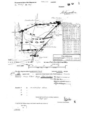 Surveyor-General diagram, B416/1927, September 1925
10148928.jpg
Cadastre
Surveyor-General diagram index for this parcel
Research notes
[13 Aug 2026] DISTRICT CONTEXT, AND NOTHING MORE. Added from the Surveyor-General's cadastre, to fill in the farms lying among the ground this project actually follows - bounded west at 15 km west of Prince Albert, north to Vlakfontein, east to Rietkuil. The name is the Surveyor-General's own P_FARMNAME (RIETFONTEIN) and the polygon is his; the cadastre gives the whole farm as 7178.6 ha. NOTHING HERE RECORDS WHO HELD THIS GROUND, WHEN, OR ANY TIE TO THE FAMILIES THIS SITE FOLLOWS, and its page says so in those words. Portions are deliberately not imported: the farm outline is the useful context and 271 portion slivers are not.
The research behind this page, kept separate from it: dated working notes, open questions, and what is not yet settled.
What the record is missing
-
Nobody is on record as ever having held this
third order · B8 never-held
Rietfontein No. 95 is in the model and drawn on the map, and carries no ownership record of any kind, not a grant, not a transfer, not an occupation.
What would settle it The Surveyor-General's diagram for the farm number names the grantee and the date; the deed reference on it opens the transfer chain.
Found by breaks.py reading the model against itself, not written by hand,
each one is a shape of missing record, not a fault in the data.
The whole set is on the
questions page.