De Wilgeboom No. 892
· on record 1834 · show on the map
- Farm number
- No. 892
- District
- Calvinia (division)
- Extent, as the diagram states it
- 5996 morgen 555 sq roods
- Modern surveyed area
- 5272.9 ha
The historic extent and the modern surveyed area are two separate measurements and are not presented here as confirming each other. The first is what a surveyor wrote on a diagram, usually in morgen. The second is what the modern cadastre draws.
Why this farm is here
Described by a document in this collection. 282 km from Klaarstroom.
- document A document in the collection describes this ground DOC-0285
- document A document in the collection describes this ground DOC-0286
What the record holds, in order
- 12 March 1834 document SG diagram 389/1834
- 12 March 1834 document SG diagram 389/1834 (deduction table)
Also bordered by, as the modern cadastre draws it
Ground that touches this farm on the Surveyor-General's current polygons and that none of the diagrams held here names. Derived from the geometry, not read off a document.
Documents
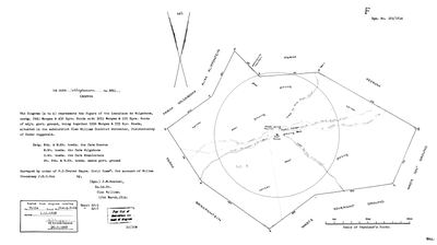 Surveyor-General diagram, 389/1834, 12 March 1834
10056747 892.jpg
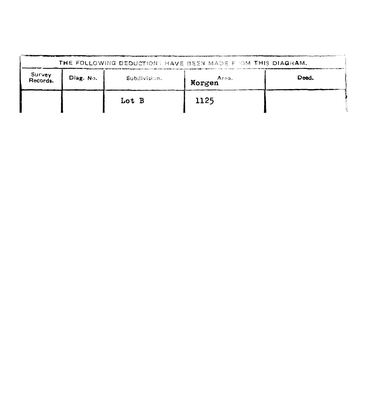 Surveyor-General diagram, 389/1834 (deduction table), 12 March 1834
10056748 892.jpg
Research notes
[10 Aug 2026, SRC-371/DOC-0285] A LOANPLACE SURVEYED 12 MARCH 1834 BY J. M. WENTZEL - the same surveyor who measured Tygerhoek for the Commissie van Inspectie eleven years earlier. 2943 morgen 450 roods of loan place with 3053 morgen 105 roods of adjoining government ground, 5996 morgen 555 roods together, 'situated in the subdistrict Clan William District WORCESTER, fieldcornetcy of Under roggeveld'. Surveyed by order of P. J. Truter Esqre., Civil Commissioner, FOR ACCOUNT OF WILLEM STEENKAMP J.H.C.SON. Title Clw. Q. 2-24 of 1.11.1838. Deduction: Lot B, 1125 morgen. Bounded N and NE towards KEEROM, NW towards the farm Wilgeboom, SW towards Brakfontein, E S and SE towards waste government ground. The face records a weak permanent fountain, a Public Outspan, the road to the Fish River and a public waggon and cattle road, with the veld written good grazing, poor, karroo and winter. NO VAN DER MERWE IS NAMED ON IT. This is Steenkamp ground and is recorded as such. The Keerom here is the Calvinia one and is NOT the Free State Keerom of LEAD-0045.
The research behind this page, kept separate from it: dated working notes, open questions, and what is not yet settled.
What the record is missing
-
Nobody is on record as ever having held this
third order · B8 never-held
De Wilgeboom No. 892 is in the model and drawn on the map, and carries no ownership record of any kind, not a grant, not a transfer, not an occupation.
What would settle it The Surveyor-General's diagram for the farm number names the grantee and the date; the deed reference on it opens the transfer chain.
Found by breaks.py reading the model against itself, not written by hand,
each one is a shape of missing record, not a fault in the data.
The whole set is on the
questions page.