Surveyor-General diagram, 1732/1863 (Part 2), October 1862
Surveyor-General diagram, October 1862
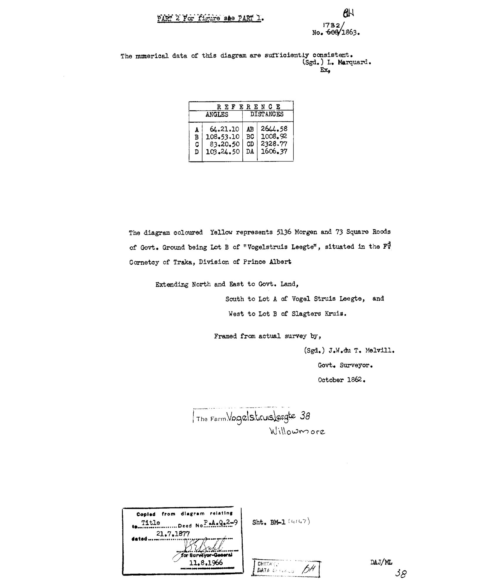
10KZ2D01 willowmore 38.jpg.The record
- Type
- Surveyor-General diagram
- Diagram number
- 1732/1863 (Part 2)
- Surveyed
- October 1862
- Titled
- 21 July 1877
- Deed
- P.A.Q.2-9
- Surveyor
- J.W. du T. Melvill
- Examiner
- L. Marquard
- Archive filename
- 10KZ2D01 willowmore 38.jpg
Citation
- Title
- SG diagram 1732/1863 Part 2 - the data and description of Vogelstruis Leegte No. 38
- Repository
- Chief Surveyor-General / Western Cape Surveyor-General, diagram archive; supplied by Frans via _inbox
- Reference
- SG 1732/1863, Part 2; title deed P.A.Q.2-9 of 21.7.1877; sheet BM-1; copy 11.8.1966
- Type
- SG diagram
- Retrieved
- 2026-08-23
The ground it is about
Vogelstruis Leegte Lot B No. 38
Research notes
PART 2, the data and description - 'For figure see PART 1' (DOC-0335). A SEPARATE SHEET AND THEREFORE ITS OWN ROW; it is not a verso and does not carry the (verso) suffix, because it holds its own full dates and needs no inheritance.
VERBATIM: 'The diagram coloured Yellow represents 5136 Morgen and 73 Square Roods of Govt. Ground being Lot B of "Vogelstruis Leegte", situated in the Fd Cornetcy of Traka, Division of Prince Albert / Extending North and East to Govt. Land, / South to Lot A of Vogel Struis Leegte, and / West to Lot B of Slagters Kruis. / Framed from actual survey by, (Sgd.) J.W. du T. MelvillM. Govt. Surveyor. October 1862.'
Reference table - angles A 64.21.10, B 108.53.10, C 83.20.50, D 103.24.50; distances AB 2644.58, BC 1008.92, CD 2328.77, DA 1606.37 Cape Roods.
NOTE THE SHEET CONTRADICTS ITSELF ON THE WESTERN NEIGHBOUR: Part 2 writes 'Lot B of Slagters KRUIS' where Part 1's figure and SG 1911/1862 both have Slagters KUIL. Kuil is on two independent sheets and is almost certainly right, but the transcription records what Part 2 says. [TO VERIFY]
The research behind this page, kept separate from it: dated working notes, open questions, and what is not yet settled.