Surveyor-General diagram, 1732/1863, October 1862
Surveyor-General diagram, October 1862
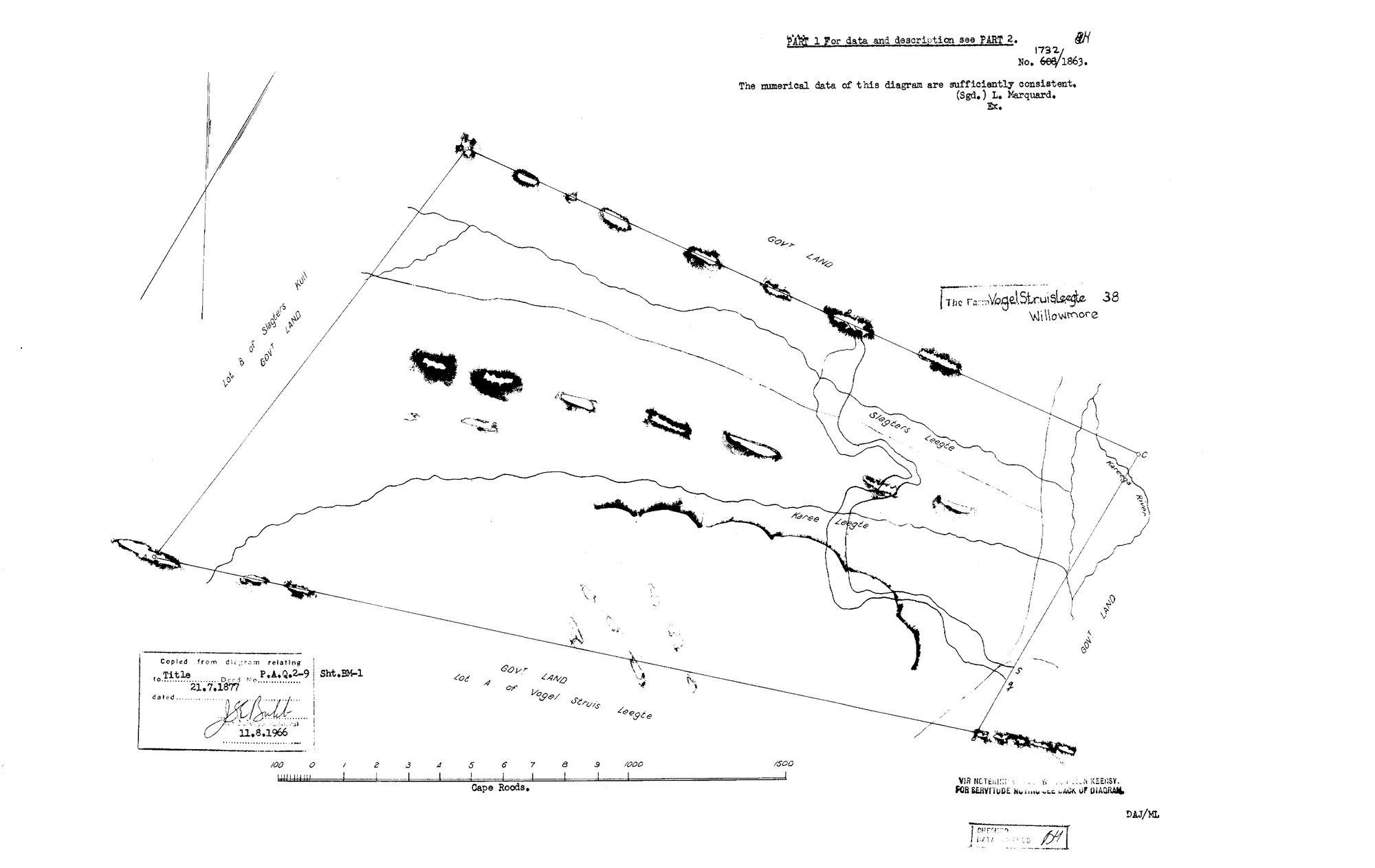
10KZ2B01 willowmore 38.jpg.The record
- Type
- Surveyor-General diagram
- Diagram number
- 1732/1863
- Surveyed
- October 1862
- Titled
- 21 July 1877
- Deed
- P.A.Q.2-9
- Surveyor
- J.W. du T. Melvill
- Examiner
- L. Marquard
- Archive filename
- 10KZ2B01 willowmore 38.jpg
Citation
- Title
- SG diagram 1732/1863 Part 1 - the figure of Vogelstruis Leegte No. 38, Willowmore
- Repository
- Chief Surveyor-General / Western Cape Surveyor-General, diagram archive; supplied by Frans via _inbox
- Reference
- SG 1732/1863 (668/1863 struck through), Part 1; title deed P.A.Q.2-9 of 21.7.1877; sheet BM-1; copy certified for the Surveyor-General 11.8.1966
- Type
- SG diagram
- Retrieved
- 2026-08-23
The ground it is about
Vogelstruis Leegte Lot B No. 38
Research notes
PART 1, the figure - 'For data and description see PART 2' (DOC-0336). Titled in a later hand 'The Farm Vogelstruis Leegte 38, Willowmore'. Diagram number 668/1863 struck through and replaced by 1732. Bounded: Lot B of Slagters Kuil west, Govt Land north and east, Lot A of Vogel Struis Leegte south; Slagters Leegte, Karee Leegte and the [?Kareedou] River drawn across it. Copied from the diagram relating to title deed P.A.Q.2-9 dated 21.7.1877, sheet BM-1, copy certified for the Surveyor-General 11.8.1966 - so image_edtf 1966 is the COPY date and 1862 is the survey. 'For servitude noting see back of diagram' - that back is DOC-0337.
The research behind this page, kept separate from it: dated working notes, open questions, and what is not yet settled.