Surveyor-General diagram, 219/1821, 1821
Surveyor-General diagram, 1821
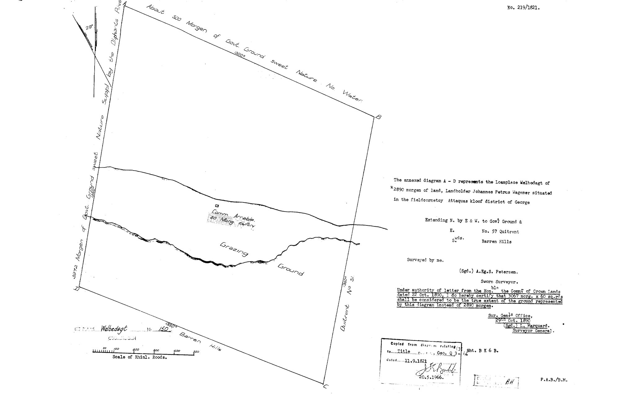
10Q9MG01 welbedacht oudtshoorn.jpg.The record
- Type
- Surveyor-General diagram
- Diagram number
- 219/1821
- Surveyed
- 1821
- Titled
- 11 September 1821
- Deed
- Geo.Q3-64
- Surveyor
- A.Eg.S. Petersen
- Archive filename
- 10Q9MG01 welbedacht oudtshoorn.jpg
Citation
- Title
- S.G. Diagram 219/1821: the LOANPLACE WELBEDAGT, fieldcornetcy Attaquas kloof, district of George - now Welbedagt No. 150, Oudtshoorn
- Repository
- Surveyor-General, Western Cape. Supplied by Frans in the inbox
- Reference
- Diagram 219/1821; title deed Geo.Q3-64
- Type
- SG diagram
- Retrieved
- 2026-08-18
The ground it is about
Welbedagt No. 150 (Attaquaskloof, Oudtshoorn) 150
Research notes
Filed from the inbox 18 Aug 2026. NOT TIED TO A PARCEL: this farm is in the old Swellendam district and not in the Koup, so it gets a bounded set of records and no parcel row, the same treatment as Modderfontein 417 in SRC-466. Read in full on its source row.
Filed from the inbox 18 Aug 2026. Read in full on its source row.
[22 Sep 2026] TIED TO PAR-000277. This row carried 'NOT TIED TO A PARCEL: this farm is in the old Swellendam district and not in the Koup, so it gets a bounded set of records and no parcel row' - true when it was written, and out of date within days: the parcel was created and pinned as PAR-000277, and the sheet is that farm's own diagram. A second, smaller scan of the same sheet arrived on 22 Sep 2026 and went to _inbox/_discard: a sheet is a row.
The research behind this page, kept separate from it: dated working notes, open questions, and what is not yet settled.