Surveyor-General diagram, 1567/1912, August 1912
Surveyor-General diagram, August 1912
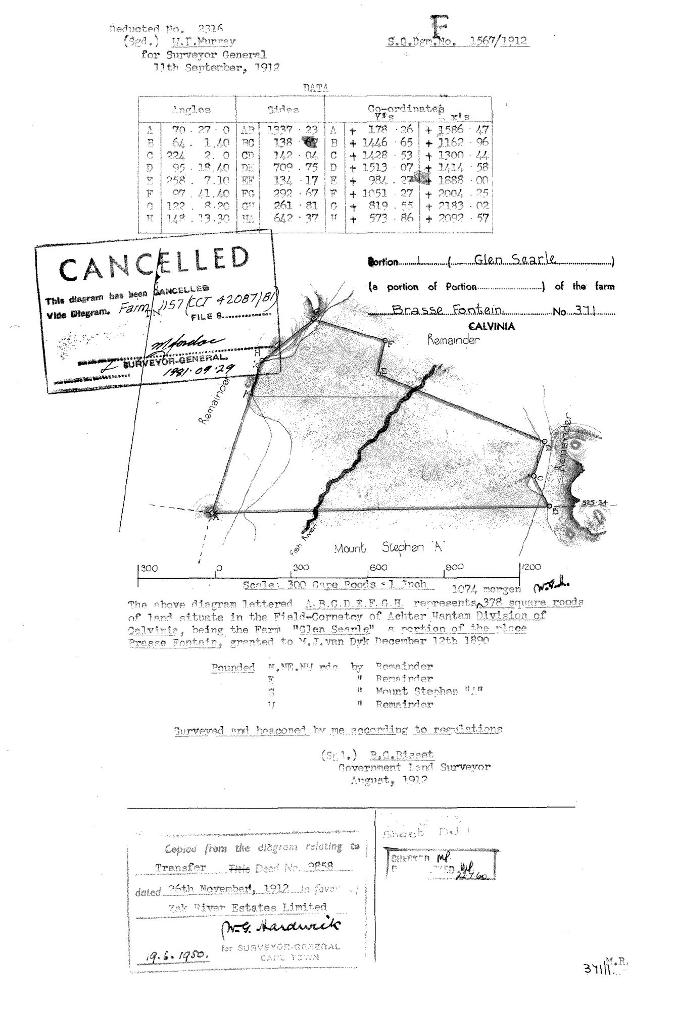
10051901 371 1.jpg.The record
- Type
- Surveyor-General diagram
- Diagram number
- 1567/1912
- Surveyed
- August 1912
- Titled
- 26 November 1912
- Deed
- Transfer 9858 (26 Nov 1912)
- Surveyor
- R.G. Bisset
- Examiner
- W.I. Murray (deduction)
- Archive filename
- 10051901 371 1.jpg
Citation
- Title
- SG diagram 1567/1912 - Portion 1 (Glen Searle) of Brasse Fontein No. 371, Calvinia
- Repository
- Surveyor-General, Cape Town (Western Cape)
- Reference
- S.G. Dgm. No. 1567/1912; deducted no. 2316; sheet DJ 1
- Type
- SG diagram
- Retrieved
- 2026-08-11
The ground it is about
Research notes
PORTION 1 OF BRASSE FONTEIN No. 371, NAMED "GLEN SEARLE", 1074 morgen 378 square roods, Field-Cornetcy of ACHTER HANTAM, Division of Calvinia. Transcribed from the sheet: "being the Farm 'Glen Searle' a portion of the place Brasse Fontein, granted to M.J. van Dyk December 12th 1890". THE GRANTEE IS VAN DYK, NOT VAN WYK - the initial letter matches the D of December on the same typed line. Bounded N, NE, NW by Remainder; E by Remainder; S by MOUNT STEPHEN "A"; W by Remainder. The Fish River crosses it. Cancelled 1981 into Farm 1157. Coordinate A (+178.26, +1586.47) is the same beacon as coordinate E on DOC-0290, so the two portions adjoin and share a survey framework.
The research behind this page, kept separate from it: dated working notes, open questions, and what is not yet settled.