Surveyor-General diagram, 949/1914, January 1914
Surveyor-General diagram, January 1914
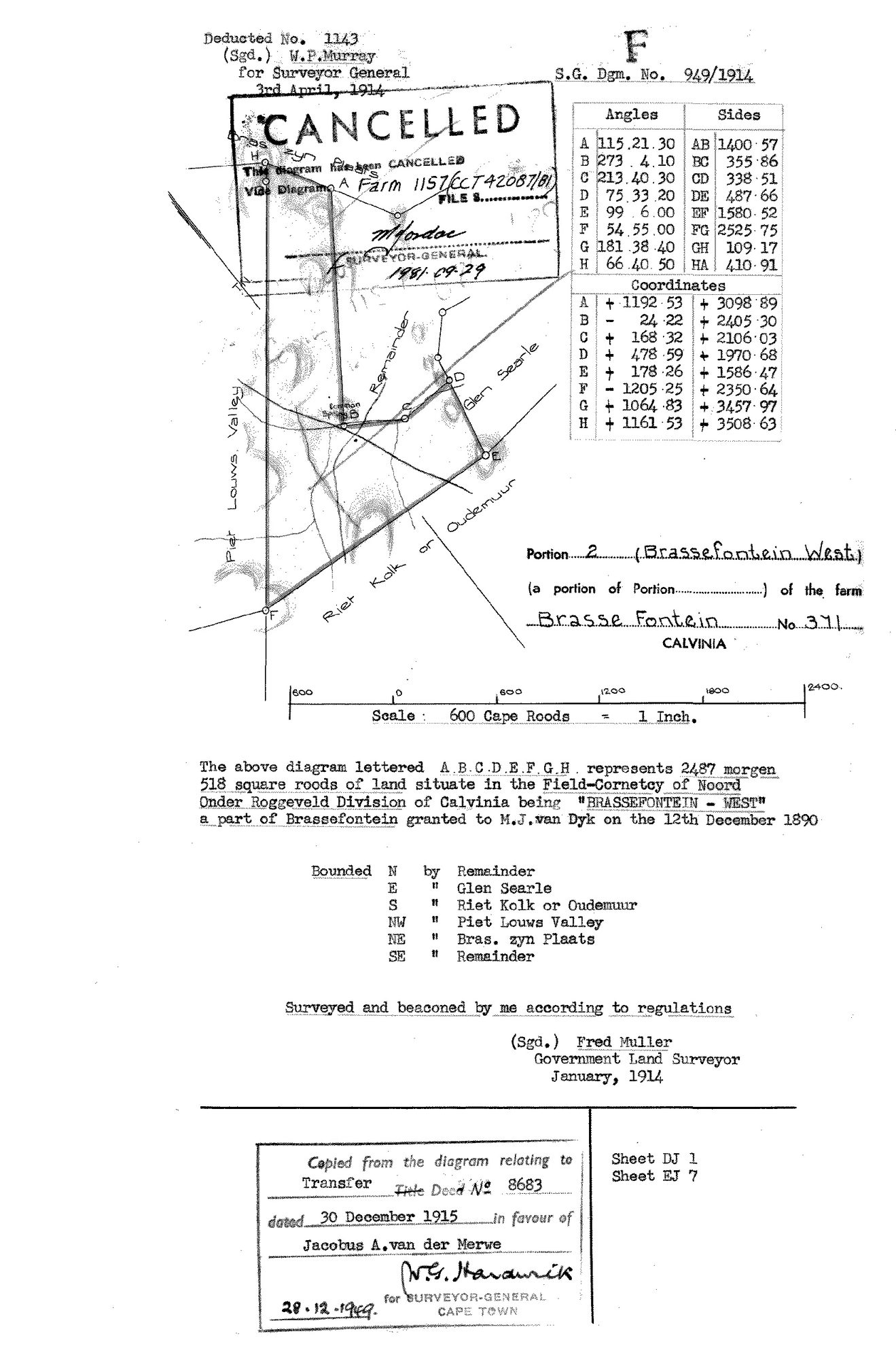
10051902 371 2.jpg.The record
- Type
- Surveyor-General diagram
- Diagram number
- 949/1914
- Surveyed
- January 1914
- Titled
- 30 December 1915
- Deed
- Transfer 8683 (30 Dec 1915)
- Surveyor
- Fred Muller
- Examiner
- W.P. Murray (deduction)
- Archive filename
- 10051902 371 2.jpg
Citation
- Title
- SG diagram 949/1914 - Portion 2 (Brassefontein West) of Brasse Fontein No. 371, Calvinia
- Repository
- Surveyor-General, Cape Town (Western Cape)
- Reference
- S.G. Dgm. No. 949/1914; deducted no. 1143; sheets DJ 1 and EJ 7
- Type
- SG diagram
- Retrieved
- 2026-08-11
The ground it is about
Research notes
PORTION 2 OF BRASSE FONTEIN No. 371, NAMED "BRASSEFONTEIN WEST", 2487 morgen 518 square roods, Field-Cornetcy of NOORD ONDER ROGGEVELD, Division of Calvinia. "a part of Brassefontein granted to M.J. van Dyk on the 12th December 1890". A VAN DER MERWE IS ON THIS TITLE: the copy stamp reads "copied from the diagram relating to Transfer Title Deed No. 8683 dated 30 December 1915 in favour of Jacobus A. van der Merwe". Bounded N by Remainder, E by GLEN SEARLE, S by RIET KOLK OR OUDEMUUR, NW by PIET LOUWS VALLEY, NE by BRAS. ZYN PLAATS, SE by Remainder. NOTE the field-cornetcy differs from Portion 1 on the same farm (Achter Hantam there, Noord Onder Roggeveld here); recorded as read and not reconciled. [TO VERIFY]
The research behind this page, kept separate from it: dated working notes, open questions, and what is not yet settled.