SG diagram, 124/1823, 1823
SG diagram, 1823
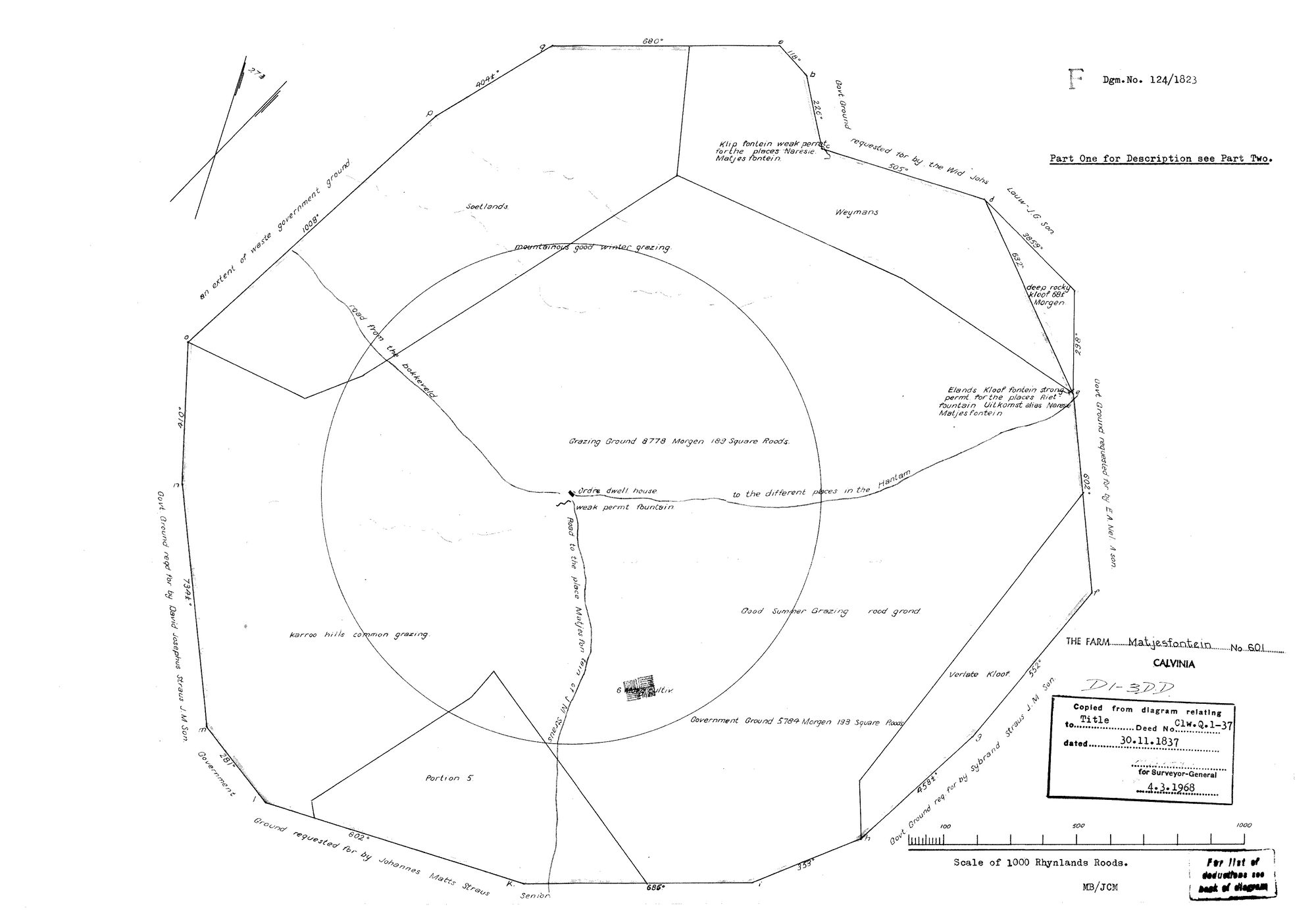
10054381 601.jpg.The record
- Type
- SG diagram
- Diagram number
- 124/1823
- Surveyed
- 1823
- Titled
- 30 November 1837
- Deed
- Clw. Q. 1-37
- Archive filename
- 10054381 601.jpg
Citation
- Title
- S.G. Diagram 124/1823: the farm MATJESFONTEIN No. 601, division of Calvinia, Part One
- Repository
- Chief Surveyor-General, document index at csg.dlrrd.gov.za, registration division C0150000 (Calvinia), office SGKIM. Fetched by Frans
- Reference
- Dgm. No. 124/1823, Part One ("for Description see Part Two"), file 10054381.TIF. The sheet is a 1968 office copy: "Copied from diagram relating to Title Deed No. Clw. Q. 1-37 dated 30.11.1837", certified for the Surveyor-General 4.3.1968, MB/JCM.
- Type
- SG diagram
- Retrieved
- 2026-08-11
The ground it is about
Research notes
READ IN FULL, 11 Aug 2026. Part One of three; the description is on Part Two, which is not held. The surveyor is not named on this sheet. Fetched by Frans from the CSG index after LEAD-0151 named it as one of the two 1823 sheets that would settle which Matjesfontein this family came from. It does not settle it, and it says why: the diagram names a second Matjesfontein belonging to J. M. Straus a short way south, and a third called Naresie Matjesfontein. Six boundary annotations, no van der Merwe among them. See SRC-387 for the full transcription. PUBLISHABLE: the survey is 1823 and the title 1837, both far before the 1936 cut-off; the image is a 1968 office copy of them, which 11a treats by the date of the SURVEY.
The research behind this page, kept separate from it: dated working notes, open questions, and what is not yet settled.