Surveyor-General diagram, 2092/1912, December 1911
Surveyor-General diagram, December 1911
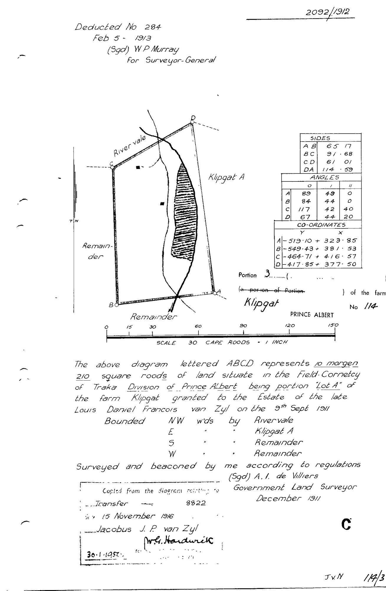
10TSOI01 114 3.jpg.The record
- Type
- Surveyor-General diagram
- Diagram number
- 2092/1912
- Surveyed
- December 1911
- Titled
- 9 September 1911
- Deed
- Transfer 8822 of 15.11.1916
- Surveyor
- A.I. de Villiers
- Examiner
- W.P. Murray
- Archive filename
- 10TSOI01 114 3.jpg
Citation
- Title
- SG Dgm 2092/1912 - Portion 3 "Lot A" of the farm Klipgat No. 114, Prince Albert
- Repository
- Landmeter-Generaal, Kaapstad
- Reference
- No. 2092/1912; surveyed and beaconed December 1911 by A.I. de Villiers; deducted No. 284, 5 Feb 1913, W.P. Murray for Surveyor-General; copied from the diagram relating to Transfer 8822 of 15 November 1916; endorsed 30.1.1950; scale 30 Cape Roods to 1 inch
- Type
- SG diagram
- Retrieved
- 2026-08-03
The ground it is about
Research notes
[SRC-229] The reading is on PAR-000106: 10 morgen 210 square roods, Lot A, drawn at thirty Cape roods to the inch (sixteen times its neighbours' scale) with two solid structures and a watercourse on it, which is what makes it a werf rather than a share. Granted with the rest on 9 Sept 1911 and transferred on deed 8822 of 15 November 1916 to JACOBUS J.P. VAN ZYL, who took Klipgat A the same day.
The research behind this page, kept separate from it: dated working notes, open questions, and what is not yet settled.