Surveyor-General diagram, 388/1816, 25 January 1816
Surveyor-General diagram, 25 January 1816
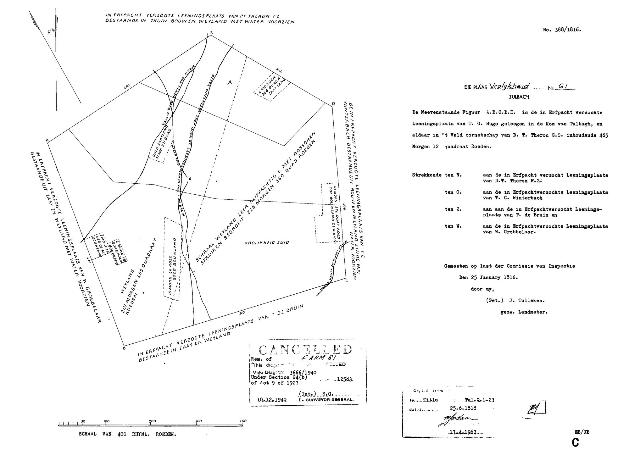
SCAN676.TIF.The record
- Type
- Surveyor-General diagram
- Diagram number
- 388/1816
- Surveyed
- 25 January 1816
- Titled
- 25 June 1818
- Deed
- Tul.Q.1-23
- Surveyor
- J. Tulleken
- Archive filename
- SCAN676.TIF
Citation
- Title
- Vrolykheid No.61 (Tulbagh) diagram, 1816
- Repository
- Surveyor-General
- Reference
- SG Dgm 388/1816
- Type
- SG diagram
The ground it is about
Research notes
"Die Plaas Vrolykheid Nr. 61, Tulbach [Tulbagh]." Erfpacht (hereditary-lease) survey of the loan-place of T.G. HugoM, "gelegen in de Kom van Tulbagh," in the veld-cornetcy of D.T. Theron, 465 morgen 12 square roods. Bounded N by the loan-place of D.T. Theron F.Z.M, E (O) by T.C. WinterbachM, S (Z) by T. de BruinM, W by W. GrobbelaarM. Measured 25 January 1816 by sworn land surveyor J. TullekenM, by order of the Commission of Inspection. The figure itself is labelled "VROLIKHEID SUID" on the face of the diagram. Stamped CANCELLED: "Rem. of Farm 61, this diagram [cancelled], vide Diagram 3666/1940, under Section 24(b) of Act 9 of 1927," 10.12.1940. A second stamp: copied from/to Title Tul.Q.1-23, dated 25.6.1818, re-copied 17.4.1967 (EB/JB C). NOT ONE OF THE FIVE CORE FARMS, and no document yet ties any named Oosthuizen to this specific farm or to T.G. HugoM/Theron/Winterbach/de Bruin/Grobbelaar. Logged for the name: this is a genuine, independently surveyed farm called Vrolykheid in exactly the district (Tulbagh / Land van Waveren, PLC-000007) where the Oosthuizen family is already documented living for two generations before their move to the Koup - Jacobus OosthuizenL (PER-000230) married Dina Carolina BritzM at Tulbagh in 1749, and their son Ockert (PER-000118, b.1755, baptised 'vader Jacobus Oosthuijsen, moeder Diena Carola Brits') is the root ancestor's own father. See LEAD-0010: whether the Koup's Vrolykheid (PAR-000014) was named for this place, carried by memory rather than by any documented land connection.
The research behind this page, kept separate from it: dated working notes, open questions, and what is not yet settled.