Surveyor-General diagram, 891/1921, 1921
Surveyor-General diagram, 1921
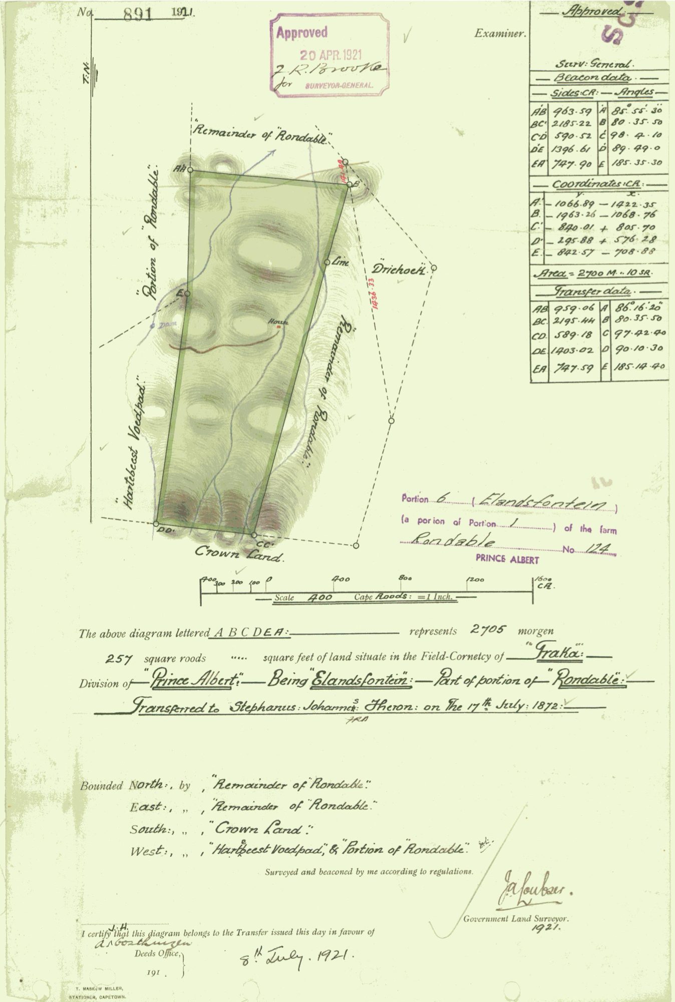
10767696 (2).PDF.The record
- Type
- Surveyor-General diagram
- Diagram number
- 891/1921
- Surveyed
- 1921
- Titled
- 8 July 1921
- Surveyor
- J.A. Loubser
- Archive filename
- 10767696 (2).PDF
Citation
- Title
- Rondabel Portion 6 "Elandsfontein" diagram
- Repository
- Surveyor-General
- Reference
- SG Dgm 891/1921
- Type
- SG diagram
The ground it is about
Rondabel 124
Research notes
Portion 6 "ELANDSFONTEIN", 2705 morgen 257 sq roods, F.C. Traka. Bounded S by Crown Land, W by Hartebeest Voedpad. "I certify that this diagram belongs to the Transfer issued this day in favour of A. OOSTHUIZEN." Approved 20 Apr 1921.
The research behind this page, kept separate from it: dated working notes, open questions, and what is not yet settled.