Surveyor-General diagram, 1654/1910, August 1910
Surveyor-General diagram, August 1910
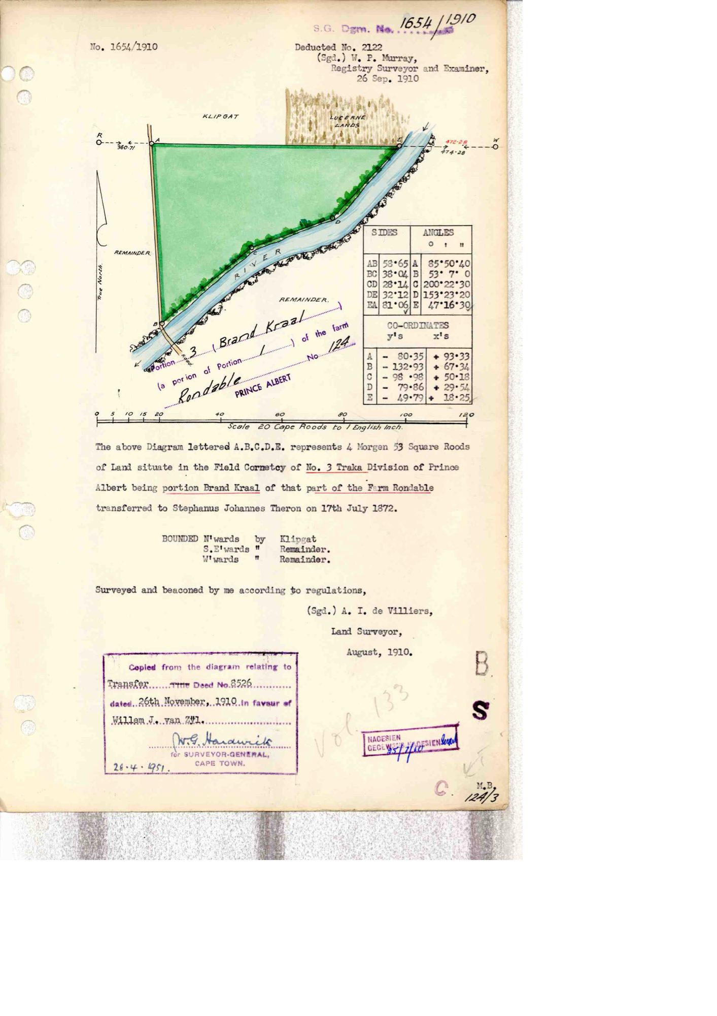
10676575 (1).PDF.The record
- Type
- Surveyor-General diagram
- Diagram number
- 1654/1910
- Surveyed
- August 1910
- Titled
- 26 November 1910
- Deed
- 8326
- Surveyor
- A.J. de Villiers
- Examiner
- W.P. Murray
- Archive filename
- 10676575 (1).PDF
Citation
- Title
- Rondabel Portion 3 "Brand Kraal" diagram
- Repository
- Surveyor-General
- Reference
- SG Dgm 1654/1910
- Type
- SG diagram
The ground it is about
Rondabel 124
Research notes
Portion 3 "Brand Kraal", 4 morgen 33 sq roods, F.C. of No.3 Traka. "being portion Brand Kraal of that part of the Farm Rondable transferred to Stephanus Johannes TheronL on 17th July 1872". Bounded E by Klipgat.
The research behind this page, kept separate from it: dated working notes, open questions, and what is not yet settled.