Surveyor-General diagram, 502/1867, November 1863
Surveyor-General diagram, November 1863
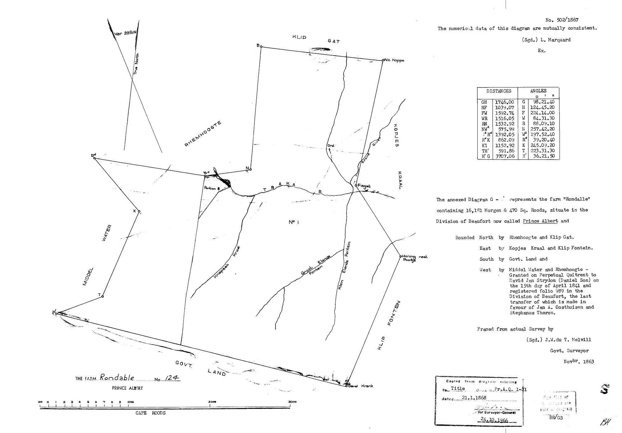
11025624.TIF.The record
- Type
- Surveyor-General diagram
- Diagram number
- 502/1867
- Surveyed
- November 1863
- Titled
- 21 January 1868
- Deed
- P.A.Q.1-21
- Surveyor
- J.W. de T. Melvill
- Examiner
- L. Marquard
- Archive filename
- 11025624.TIF
Citation
- Title
- Rondabel No.124 diagram 502/1867
- Repository
- Surveyor-General
- Reference
- SG Dgm 502/1867
- Type
- SG diagram
The ground it is about
Rondabel 124
Research notes
16151 morgen 470 sq roods. "Granted on Perpetual Quitrent to David Jan StrydomM (Daniel Son) on the 15th day of April 1841, folio 989, Division of Beaufort; the last transfer of which is made in favour of Jan A. Oosthuizen and Stephanus Theron." Bounded N Rhemhoogte & Klip Gat, E Kopjes Kraal & Klip Fontein, S Govt Land, W MIDDEL WATER and Rhemhoogte.
The research behind this page, kept separate from it: dated working notes, open questions, and what is not yet settled.