Deugas No. 73 (Uniondale)
· on record 1819 · show on the map
- Farm number
- No. 73
- Modern surveyed area
- 2222.2 ha
Why this farm is here
Described by a document in this collection. 64 km from Klaarstroom.
- document A document in the collection describes this ground DOC-0386
What the record holds, in order
- 1819 document SG diagram 303/1819
Also bordered by, as the modern cadastre draws it
Ground that touches this farm on the Surveyor-General's current polygons and that none of the diagrams held here names. Derived from the geometry, not read off a document.
Documents
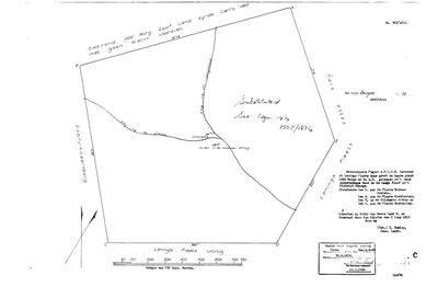 Surveyor-General diagram, 303/1819, 1819
SCAN718.TIF
Cadastre
Surveyor-General diagram index for this parcel
Research notes
In the model because this project holds its original survey diagram: the loan place QUAS, 2566 morgen 64 QR, surveyed 2 June 1819 for Jan Oelofse by B. Duminy; veldcornetcy voor in de Langekloof, district George [SG 303/1819]
The research behind this page, kept separate from it: dated working notes, open questions, and what is not yet settled.
What the record is missing
-
Nobody is on record as ever having held this
third order · B8 never-held
Deugas No. 73 (Uniondale) is in the model and drawn on the map, and carries no ownership record of any kind, not a grant, not a transfer, not an occupation.
What would settle it The Surveyor-General's diagram for the farm number names the grantee and the date; the deed reference on it opens the transfer chain.
Found by breaks.py reading the model against itself, not written by hand,
each one is a shape of missing record, not a fault in the data.
The whole set is on the
questions page.