Surveyor-General diagram, B 355/1831, November 1831
Surveyor-General diagram, November 1831
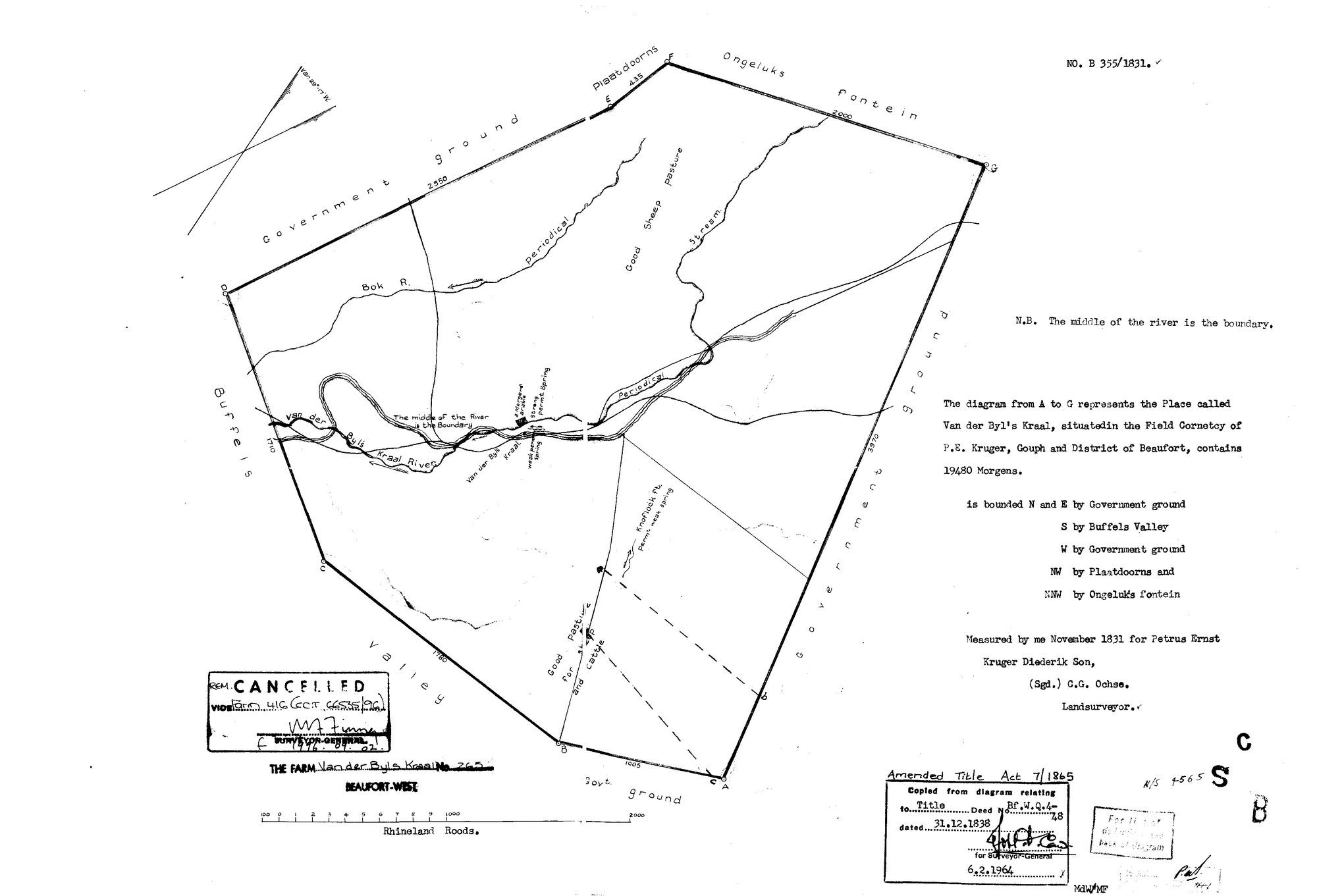
SCAN627.TIF.The record
- Type
- Surveyor-General diagram
- Diagram number
- B 355/1831
- Surveyed
- November 1831
- Titled
- 31 December 1838
- Deed
- Bf.W.Q. 4-28, 31 December 1838
- Surveyor
- C.G. Ochse, landsurveyor
- Archive filename
- SCAN627.TIF
Citation
- Title
- S.G. Diagram B 355/1831: the Place called VAN DER BYL'S KRAAL, 19 480 morgen, Field Cornetcy of P.E. Kruger, Gouph, district of Beaufort
- Repository
- Chief Surveyor-General, esio document index (csg.dlrrd.gov.za/esio), Western Cape office SGCTN, Beaufort West division C0090000, farm 265 portion 0.
- Reference
- No. B 355/1831, two pages. furl /contex/26/SCAN627.TIF (face) and /contex/26/SCAN628.TIF (verso). Title Bf.W.Q. 4-28 dated 31.12.1838; stamped under the Amended Title Act 7 of 1865.
- Type
- SG diagram
- Retrieved
- 2026-11-02
The ground it is about
Van der Byls Kraal No. 265 (Beaufort West) 265
Research notes
The face. Figure A to G, 19 480 morgen, measured November 1831 for Petrus Ernst KrugerM Diederik Son. The name is on the place and on the river. Neighbours lettered: Government ground north, east and west; Buffels Valley south; Plaatdoorns north-west; Ongeluks Fontein north-north-west.
The research behind this page, kept separate from it: dated working notes, open questions, and what is not yet settled.