Surveyor-General diagram, 638/1831, 1831
Surveyor-General diagram, 1831
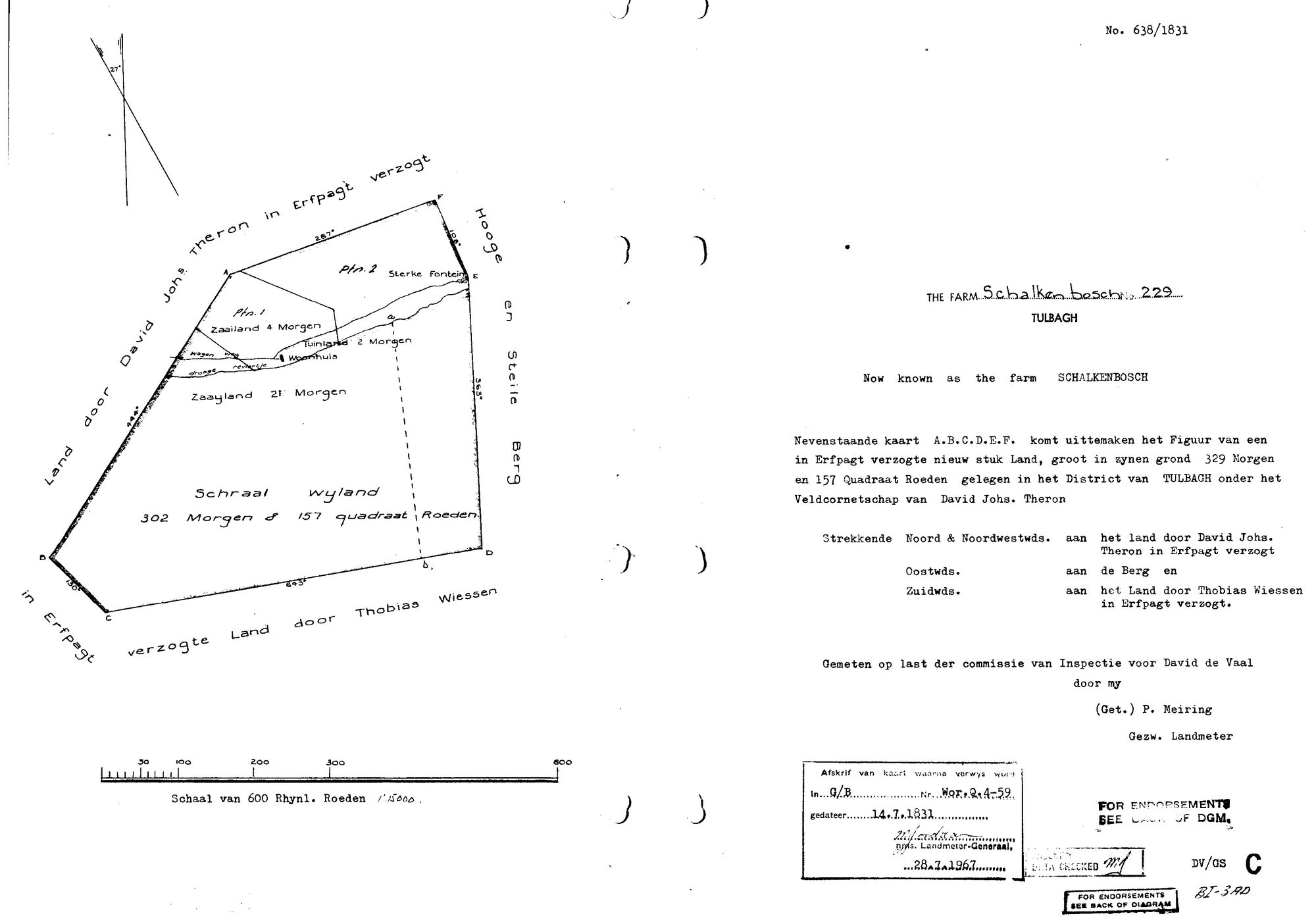
10QKEX01.TIF.The record
- Type
- Surveyor-General diagram
- Diagram number
- 638/1831
- Surveyed
- 1831
- Titled
- 14 July 1831
- Deed
- Wor. Q. 4-59, 14 July 1831
- Surveyor
- P. Meiring, gesworen landmeter
- Archive filename
- 10QKEX01.TIF
Citation
- Title
- S.G. Diagram 638/1831: the farm SCHALKEN-BOSCH No. 229, Tulbagh, 329 morgen 157 roods - a new piece of erfpacht land measured for DAVID DE VAAL
- Repository
- Chief Surveyor-General, esio document index (csg.dlrrd.gov.za/esio), Western Cape office SGCTN, Tulbagh division C0750000, farm 229 portion 0
- Reference
- No. 638/1831, two pages. furl /images3/56/10QKEX01.TIF (face) and /images3/56/10QKF001.TIF (verso, modern deduction and servitude endorsements of 1972-1989). A 1967 office copy: 'Afskrif van kaart waarna verwys word in Q/B, nr. Wor.Q.4-59, gedateer 14.7.1831', for the Landmeter-Generaal 28.7.1967.
- Type
- SG diagram
- Retrieved
- 2026-09-30
Research notes
THE FARM Schalken-bosch No. 229, Tulbagh, a new piece of erfpacht land of 329 morgen 157 roods measured for DAVID DE VAAL in the veldcornetschap of David Johannes Theron. Filed with no par_id because this project holds no parcel for Schalkenbosch and should not create one: it is a neighbour of the Zachte Vally and the reason it was fetched is LEAD-0390, which it answers in the negative. The verso, /images3/56/10QKF001.TIF, carries only 1972-1989 endorsements and is not filed.
The research behind this page, kept separate from it: dated working notes, open questions, and what is not yet settled.