Surveyor-General diagram, 521/1816 Part I, 23 March 1816
Surveyor-General diagram, 23 March 1816
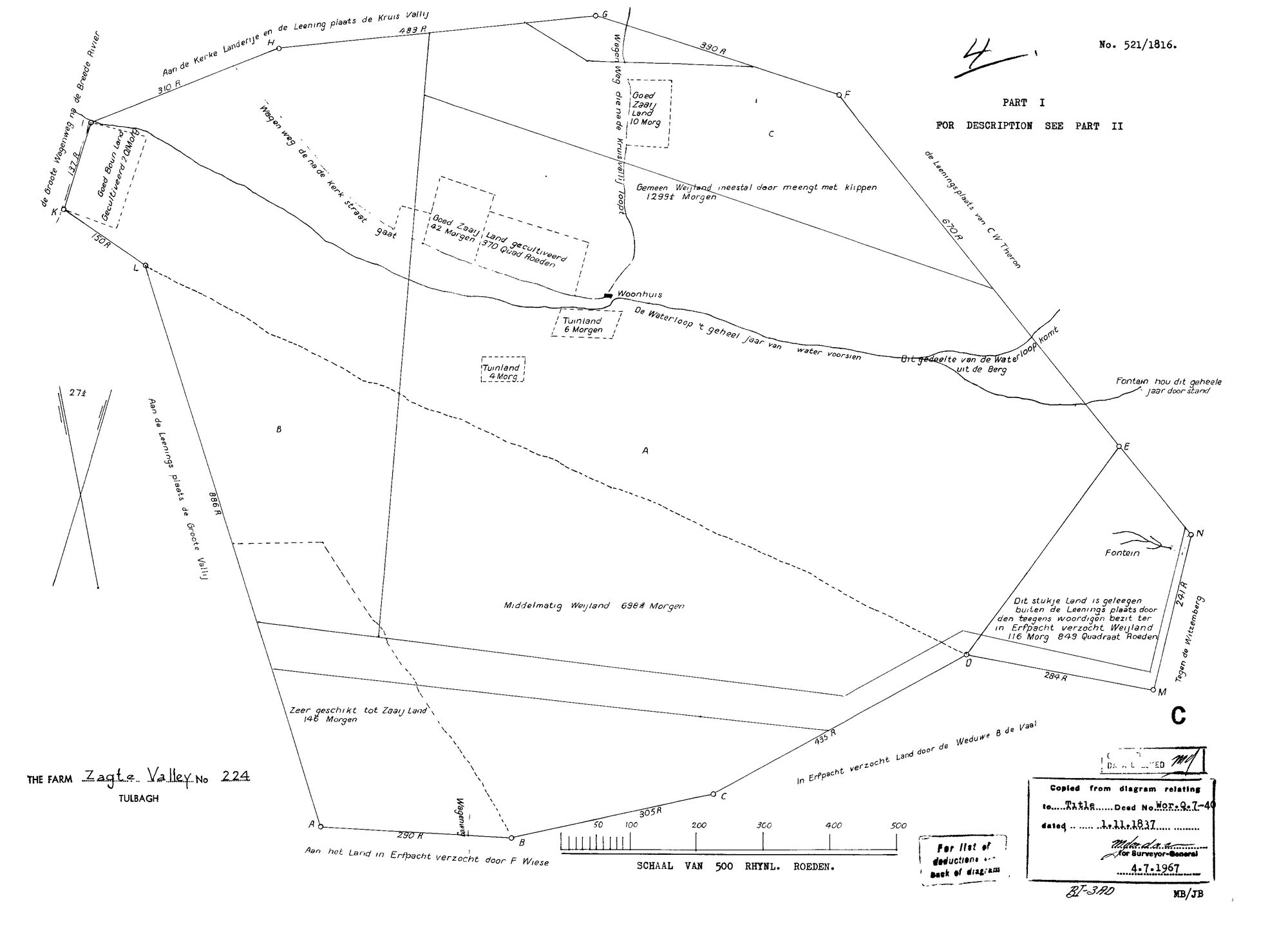
SCAN338.TIF.The record
- Type
- Surveyor-General diagram
- Diagram number
- 521/1816 Part I
- Surveyed
- 23 March 1816
- Titled
- 1 November 1837
- Deed
- Wor. Q. 7-40, 1 November 1837
- Surveyor
- J. Tulleken, gesworen landmeter
- Archive filename
- SCAN338.TIF
Citation
- Title
- S.G. Diagram 521/1816: the leeningsplaats DE ZACHTE VALLY, 2227 morgen 476 roods, district Tulbagh - surveyed for D. J. Theron G.Z. on 23 March 1816
- Repository
- Chief Surveyor-General, esio document index (csg.dlrrd.gov.za/esio), Western Cape office SGCTN, Tulbagh division C0750000, farm 224 portion 0
- Reference
- No. 521/1816, three pages. furl /contex/10/SCAN338.TIF (Part I, the figure), /contex/10/SCAN339.TIF (Part II, the description) and /contex/10/SCAN340.TIF. Both sheets are 1967 office copies: 'Copied from diagram relating to Title Deed No. Wor.Q.7-40 dated 1.11.1837', for the Surveyor-General 4.7.1967, MB/JB.
- Type
- SG diagram
- Retrieved
- 2026-09-30
The ground it is about
De Sagte Valleij (Land van Waveren)
Research notes
PART I, the figure. 'THE FARM Zagte Valley No. 224, TULBAGH', figure A.B.C.D.E.F.G.H.I.K.L. with the outlying piece D.M.N.E. Scale 500 Rhynland roods. Carries the farm detail: Woonhuis, the waterleiding that runs the whole year, a fountain strong all year, the zaailanden and tuinlanden in morgen, and the Breede River at the north-west. Neighbours lettered on the face: de Kerke Landerije and de leeningsplaats de Kruis Vally to the north, de leenings plaats van C. W. Theron to the east, de leeningsplaats de Groote Vally to the west, and land in erfpacht requested by P. Wieze and the Weduwe B. de Vaal to the south.
The research behind this page, kept separate from it: dated working notes, open questions, and what is not yet settled.