Surveyor-General diagram, 18/1717, 1717
Surveyor-General diagram, 1717
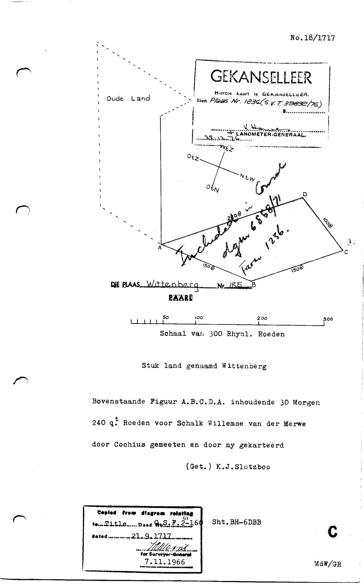
10NWVT01.TIF.The record
- Type
- Surveyor-General diagram
- Diagram number
- 18/1717
- Surveyed
- 1717
- Titled
- 21 September 1717
- Deed
- O.S.F. 2-160, 21 September 1717
- Surveyor
- Cochius (surveyed); K. J. Slotzboo (drawn)
- Archive filename
- 10NWVT01.TIF
Citation
- Title
- Diagram 18/1717: the farm Wittenberg No. 185, Paarl, 30 morgen 240 roods for Schalk Willemse van der Merwe
- Repository
- Surveyor-General, Cape Town. Copied for the Surveyor-General 7 November 1966, sheet BH-6DBB.
- Reference
- Diagram No. 18/1717; title deed O.S.F. 2-160 dated 21 September 1717. Archive scan 10NWVT01.
- Type
- SG diagram
- Retrieved
- 2026-09-30
The ground it is about
Wittenberg No. 185 (Paarl, now in Farm 1236)
Research notes
THE FARM WITTENBERG No. 185, PAARL, SURVEYED FOR SCHALK WILLEMSE VAN DER MERWE, 30 morgen 240 square roods, on title deed O.S.F. 2-160 of 21 September 1717. Figure A.B.C.D.A. Cancelled: see Paarl Farm No. 1236. The sheet held here is the Surveyor-General's copy of 7 November 1966, sheet BH-6DBB, so image_edtf is 1966 and the content is 1717 - 11a, the copy date is not the content date.
The research behind this page, kept separate from it: dated working notes, open questions, and what is not yet settled.