Surveyor-General diagram, 237/1821, 1821
Surveyor-General diagram, 1821
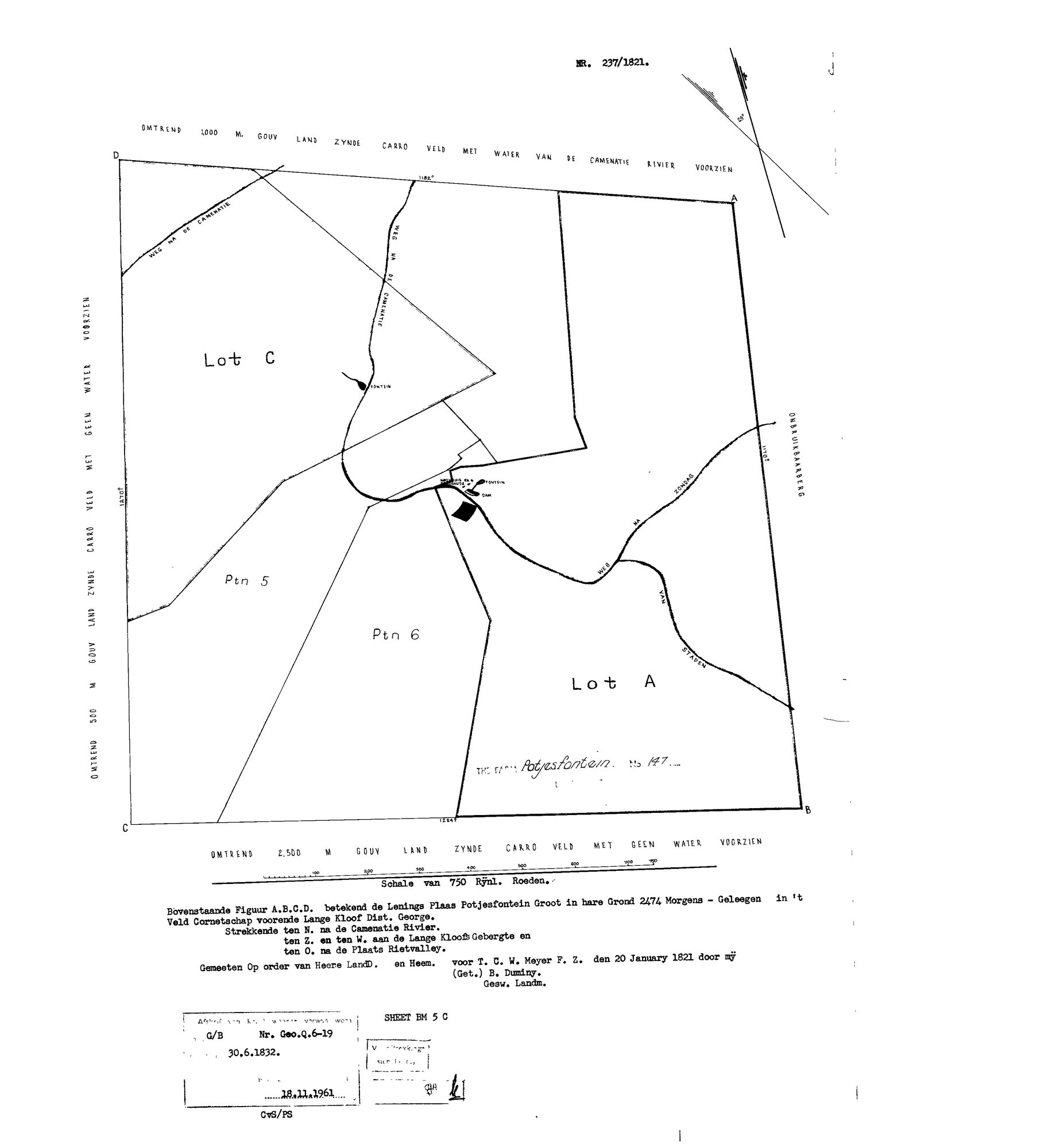
SCAN508.TIF.The record
- Type
- Surveyor-General diagram
- Diagram number
- 237/1821
- Surveyed
- 1821
- Titled
- 1821
- Archive filename
- SCAN508.TIF
Citation
- Title
- The eleven Uniondale diagrams older than 1823 - including WELBEDACHT No. 131, erfpacht land surveyed in 1819 for Piet Terblans H.z. beside 'the owner's place'
- Repository
- Chief Surveyor-General, esio document index (csg.dlrrd.gov.za/esio), Western Cape office SGCTN, Uniondale division C0770000
- Reference
- Deugas 73 303/1819 (SCAN718.TIF); Naugusfontein 75 301/1819 (SCAN725.TIF); Oudepost 78 291/1819 (SCAN967.TIF); Uitvlugt 102 290/1819 (SCAN070.TIF); Rietfontein 107 298/1819 (11763205.TIF); Zand Drift 118 316/1819 (11137627.TIF, 11137630.TIF); Groot Fontein 123 302/1819 (10TOFY01.TIF); Welbedacht 131 294/1819 (10WNGT01.TIF, 10WNGV01.TIF); Potjesfontein 147 237/1821 (SCAN508.TIF, SCAN509.TIF); Ongelegen 219 B195/1821 (10LMJM01.TIF, 10LMJX01.TIF); Welgelegen 229 B200/1821 (10S0XT01.TIF, 10S0XU01.TIF). Files in _inbox/2026-09-16-csg-uniondale-pre1823/.
- Type
- SG diagram
- Retrieved
- 2026-09-16
The ground it is about
Potjesfontein No. 147 (Uniondale)
Research notes
Sheet 1. Potjesfontein No. 147 (Uniondale). From the Chief Surveyor-General's esio index, fetched 16 Sep 2026.
The research behind this page, kept separate from it: dated working notes, open questions, and what is not yet settled.