Surveyor-General diagram, B 466/1818, 21 January 1818
Surveyor-General diagram, 21 January 1818
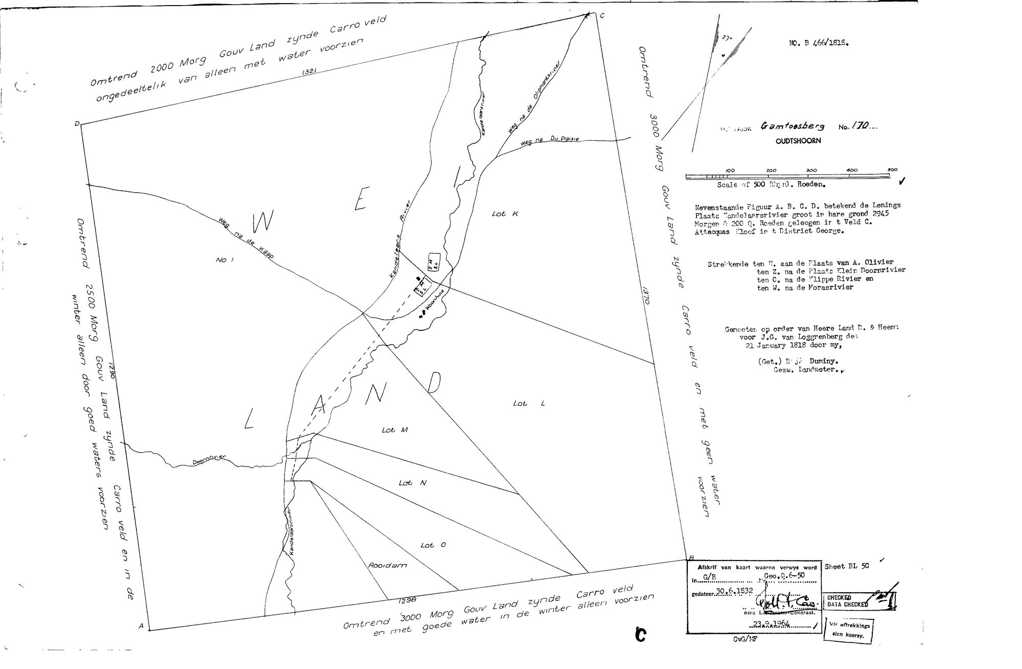
SCAN167 gamtoos 170.jpg.The record
- Type
- Surveyor-General diagram
- Diagram number
- B 466/1818
- Surveyed
- 21 January 1818
- Titled
- 30 June 1832
- Deed
- Geo.Q.6-50
- Surveyor
- B.J. Duminy
- Archive filename
- SCAN167 gamtoos 170.jpg
Citation
- Title
- S.G. diagram B 466/1818 - the LEENINGS PLAATS KANDELAARSRIVIER, 2945 morgen 200 sq roods, veldkornetskap Attacquas Kloof, district George; now Gamtoosberg No. 170, Oudtshoorn
- Repository
- Surveyor-General, Western Cape. Supplied by Frans in the inbox
- Reference
- Diagram B 466/1818; copy of the map referred to in G/B Geo.Q.6-50 dated 30 June 1832, sheet BL 50; data checked 23 August 1964
- Type
- SG diagram
- Retrieved
- 2026-09-22
The ground it is about
Gamthous Bergh (Gamtoosberg No. 170, Oudtshoorn) 170
Research notes
Read in full on SRC-668. The sheet is a later copy: 'Afskrif van kaart waarna verwys word in G/B Geo.Q.6-50 gedateer 30.6.1832', sheet BL 50, data checked 23 August 1964.
Read in full on SRC-668. The sheet is a later copy: 'Afskrif van kaart waarna verwys word in G/B Geo.Q.6-50 gedateer 30.6.1832', sheet BL 50, data checked 23 August 1964.
[22 Sep 2026] TITLE DATE ADDED from that copy note: the quitrent title Geo.Q.6-50 is dated 30 JUNE 1832, so the loan place Kandelaarsrivier took title fourteen years after this survey and nine years before the Koup's own grants of 15 April 1841.
The research behind this page, kept separate from it: dated working notes, open questions, and what is not yet settled.