Surveyor-General diagram, 2545/1880, 1879
Surveyor-General diagram, 1879
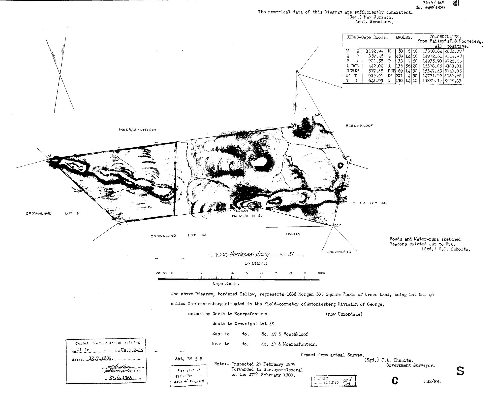
10DW3I01.TIF.The record
- Type
- Surveyor-General diagram
- Diagram number
- 2545/1880
- Surveyed
- 1879
- Titled
- 12 July 1882
- Archive filename
- 10DW3I01.TIF
Citation
- Title
- The farms touching Moerasfontein No. 27 and their oldest diagrams - Roodeklip 352/1832 applied for by Salomon Terblans Steph.zn beside 'Loanplace Moerasfontyn', and Misgund B354/1832 beside 'Government ground applied for by S. Terblans'
- Repository
- Chief Surveyor-General, esio document index (csg.dlrrd.gov.za/esio), Western Cape office SGCTN, Uniondale division C0770000; neighbours found by intersecting Moerasfontein's polygon with the national cadastre (csggis Property_Viewer layer 5, 150 m tolerance)
- Reference
- Roodeklip 26: 352/1832, Geo.Q. 5-42 (10467436.TIF, 10467438.TIF = DOC-0359/0360). Misgund 25: B354/1832, title Geo.Q. 5-44 dated 30.6.1832 (11762976.TIF, 11759435.TIF = DOC-0361/0362). Mordenaarsberg 81: 2545/1880, title Un.Q. 2-12 dated 12.7.1882 (10DW3I01.TIF, 10DW3J01.TIF = DOC-0363/0364). Bakenskop 30: A4430/1926 (5 PDF pages). Georgida Laagte 36: 6737/1951. Farm 468: 5932/2007. Farm 478: 2070/2014. All in _inbox/2026-09-16-csg-moerasfontein-neighbours/; the 1926 and later sheets are NOT filed as documents (post-1936, not read for living people).
- Type
- SG diagram
- Retrieved
- 2026-09-16
The ground it is about
Mordenaarsberg No. 81 (Uniondale)
Research notes
Crown land Lot 46 called Mordenaarsberg, 1638 morgen 305 sq roods, Antoniesberg field-cornetcy; north and west to Moerasfontein. J.A. Thwaits. Title Un.Q. 2-12, 12.7.1882. SRC-649.
The research behind this page, kept separate from it: dated working notes, open questions, and what is not yet settled.