Surveyor-General diagram, B 459/1870, June 1870
Surveyor-General diagram, June 1870
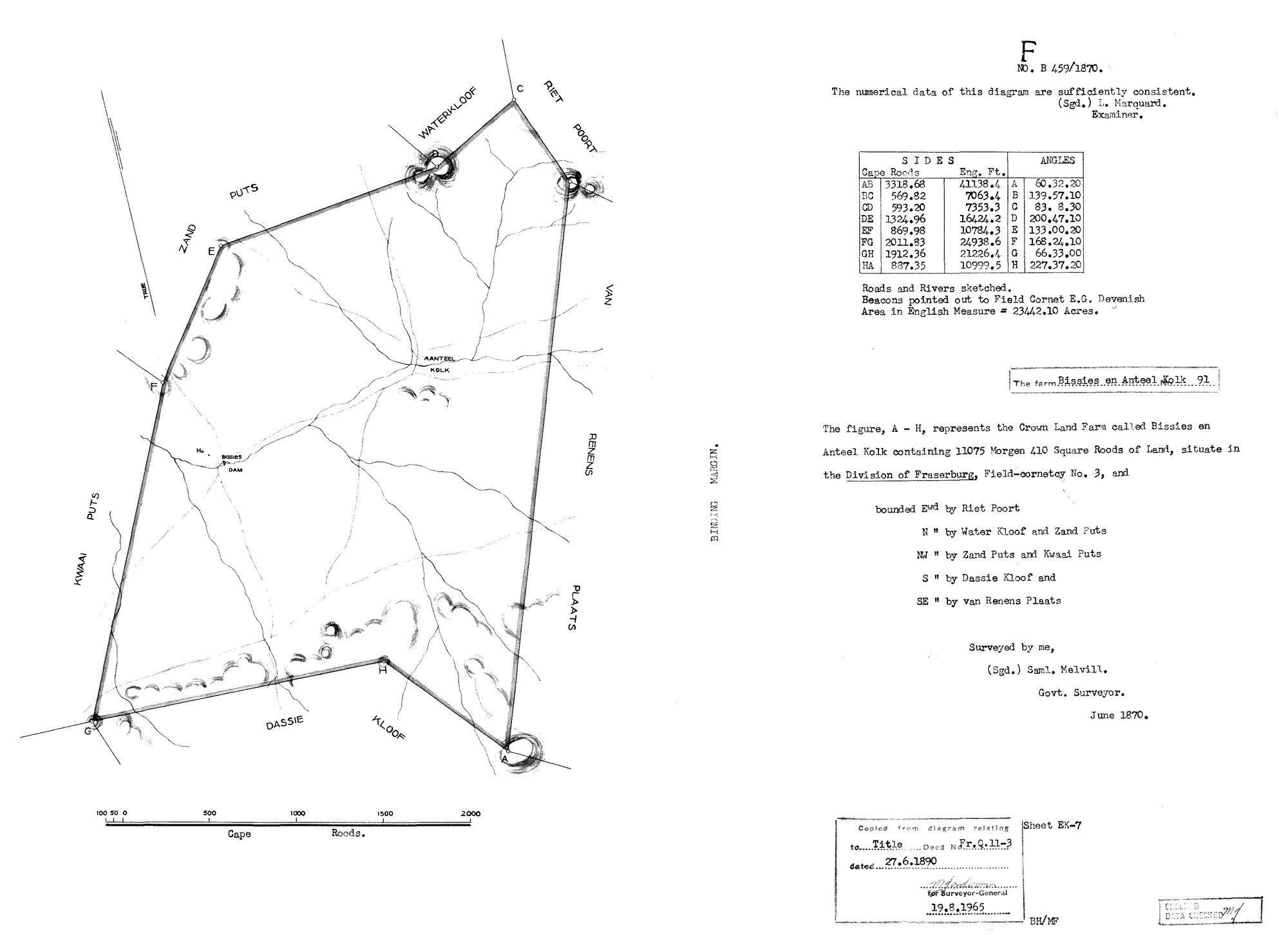
10034222 91 fraserburg bissies.jpg.The record
- Type
- Surveyor-General diagram
- Diagram number
- B 459/1870
- Surveyed
- June 1870
- Titled
- 27 June 1890
- Deed
- Fr.Q.11-3
- Surveyor
- Saml. Melvill., Govt. Surveyor
- Examiner
- L. Marquard
- Archive filename
- 10034222 91 fraserburg bissies.jpg
Citation
- Title
- SG diagram B 459/1870: the farm Bissies en Anteel Kolk No. 91, Division of Fraserburg
- Repository
- Chief Surveyor-General / Deeds Registries, Republic of South Africa
- Reference
- SG Diagram No. B 459/1870, Sheet EK-7; re-certified 19 August 1965 relating to Title Deed No. Fr.Q.11-3 of 27 June 1890
- Type
- SG_diagram
- Retrieved
- 2026-09-06
The ground it is about
Biesies (Bissies en Anteel Kolk No. 91)
Research notes
The farm Bissies en Anteel Kolk No. 91, Division of Fraserburg, Field-cornetcy No. 3. 11,075 morgen 410 square roods (23,442.10 acres). Re-certified for the Surveyor-General 19 Aug 1965; that date is a re-stamp, not content.
The research behind this page, kept separate from it: dated working notes, open questions, and what is not yet settled.