Surveyor-General diagram, 581/1873, 1872
Surveyor-General diagram, 1872
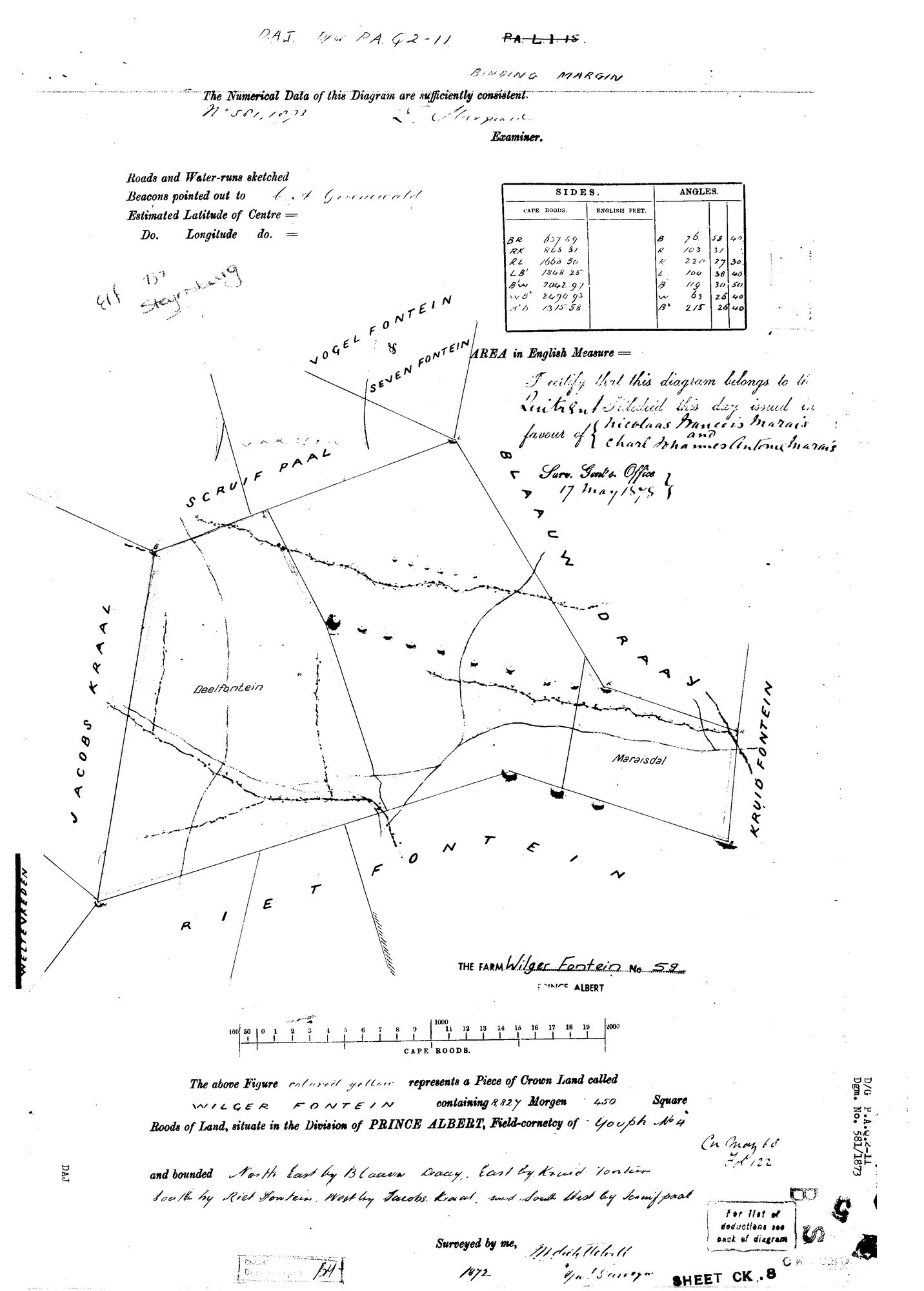
11025620 PA 59.jpg.The record
- Type
- Surveyor-General diagram
- Diagram number
- 581/1873
- Surveyed
- 1872
- Titled
- 17 May 1875
- Deed
- P.A.Q.2-11
- Surveyor
- [?M. de Villiers], Gov't Surveyor
- Examiner
- [?] , No. 581, 1873
- Archive filename
- 11025620 PA 59.jpg
Citation
- Title
- Diagram 581/1873: the farm Wilger Fontein No. 59, Prince Albert, surveyed 1872, quitrent to two Marais brothers
- Repository
- Surveyor-General, Cape Town; sheet CK.8, filed D/G P.A.Q.2-11
- Reference
- Dgm. No. 581/1873; title P.A.Q.2-11 (an earlier reference P.A.L.1.15 struck through)
- Type
- SG diagram
- Retrieved
- 2026-08-27
The ground it is about
Research notes
THE FACE OF THE SHEET for Wilger Fontein No. 59, Prince Albert: boundary, beacons, sides and angles, the scale in Cape roods, and the certificate that the diagram belongs to the QUITRENT TITLE issued 17 May 1875 in favour of NICOLAAS FRANCOIS MARAIS and CHARL JOHANNES ANTONE MARAIS. Crown land, [?8]827 morgen 450 sq rds, Field-cornetcy of Gouph No. 4. Bounded NE by Blaauw Draay, E by Kruid Fontein, S by Riet Fontein, W by Jacobs Kraal, SW by Scruif Paal. The names DEELFONTEIN and MARAISDAL are written inside the farm's own boundary and become its two portions in 1906 and 1911.
The research behind this page, kept separate from it: dated working notes, open questions, and what is not yet settled.