Surveyor-General diagram, February 1935
Surveyor-General diagram, February 1935
10TOFU01.jpg.The record
- Type
- Surveyor-General diagram
- Surveyed
- February 1935
- Titled
- 1 October 1937
- Surveyor
- W.J. [?Dribbelhorn]
- Archive filename
- 10TOFU01.jpg
Citation
- Title
- Keurfontein No. 45 consolidated-title diagram, surveyed 1935
- Repository
- Surveyor-General
- Reference
- SG File 3023/5, Survey Records E 1432/35
- Type
- SG diagram
- Retrieved
- 2026-08-23
The ground it is about
Keurfontein No. 45 (Uniondale)
Research notes
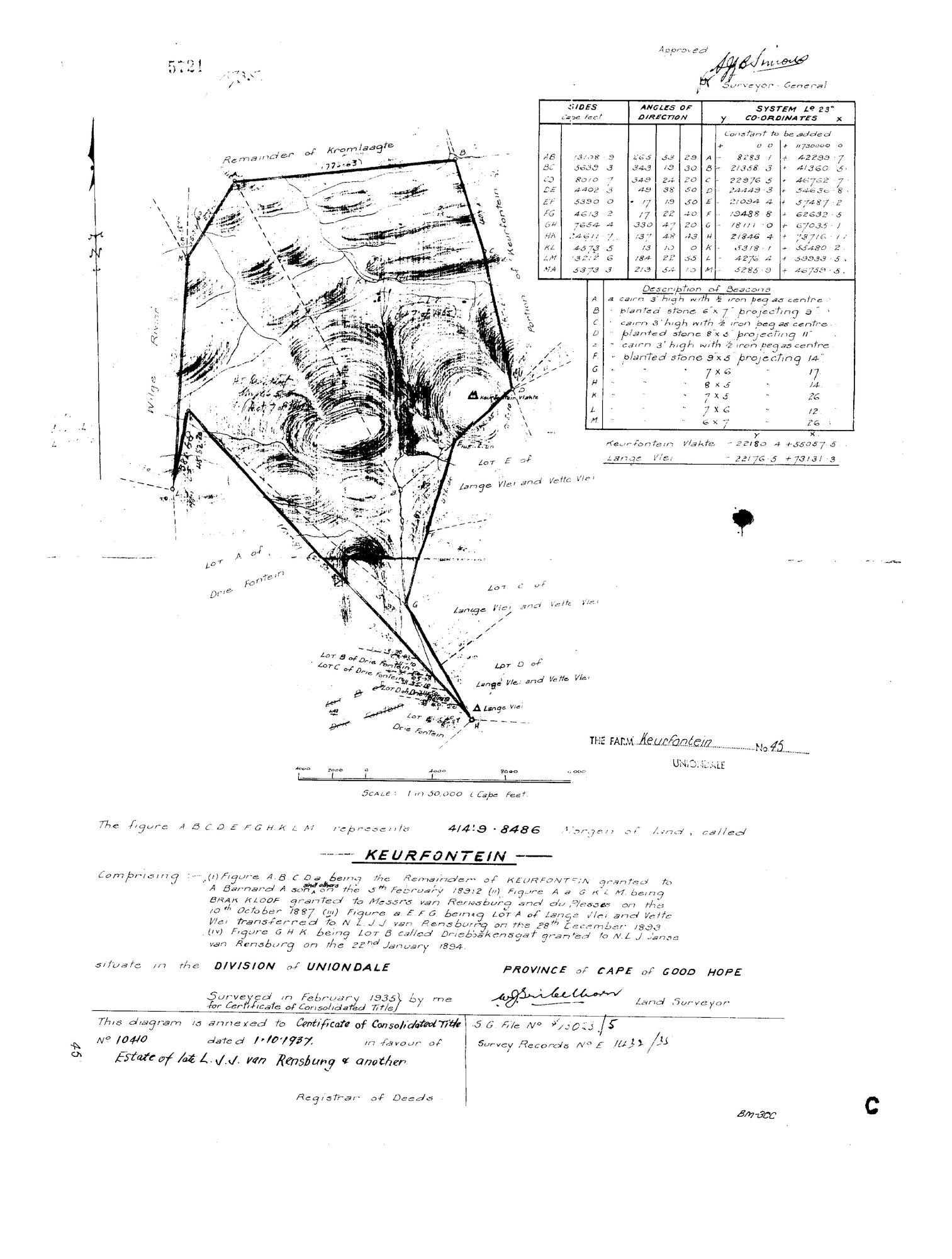
4141 morgen 9 roods 8486 sq ft, Division of UNIONDALE, Cape of Good Hope. Surveyed February 1935 for Certificate of Consolidated Title; annexed to Certificate of Consolidated Title No. 10410 dated 1.10.1937 in favour of the Estate of the late L.J.J. van Rensburg & another. CONSOLIDATES FOUR OLDER GRANTS and that is what it is worth here: (i) Remainder of KEURFONTEIN granted to A. Barnard A. son and others, 5 February 1892; (ii) BRAK KLOOF granted to Messrs van Rensburg and du Plessis, 10 October 1887; (iii) Lot A of Lange Vlei and Vette Vlei transferred to N.L.J.J. van Rensburg, 28 December 1893; (iv) Lot B called Driebbakensgat granted to N.L.J. Janse van Rensburg, 22 January 1894. Neighbours on the face: Remainder of Kromlaagte, Portion of Keurfontein, Lots A-E of Lange Vlei and Vette Vlei, Lots A-D of Drie Fontein, the Wilge River. Trig: Keurfontein Vlakte, Lange Vlei. Coordinates are SYSTEM Lo 23 - Cape Datum, so any georeferencing needs a proper transform. Surveyor's signature not confidently read.
The research behind this page, kept separate from it: dated working notes, open questions, and what is not yet settled.