Surveyor-General diagram, 342/1832, 1832
Surveyor-General diagram, 1832
10615796.jpg.The record
- Type
- Surveyor-General diagram
- Diagram number
- 342/1832
- Surveyed
- 1832
- Archive filename
- 10615796.jpg
Citation
- Title
- Fontyn No. 70 diagram 342/1832
- Repository
- Surveyor-General
- Reference
- SG Dgm 342/1832
- Type
- SG diagram
- Retrieved
- 2026-08-23
The ground it is about
Research notes
'fieldcornetcy of Olyphantsrivier' - the shortest of the three name-forms, on a sheet numbered one after Wilgehoute Rivier's. PLC-000089.
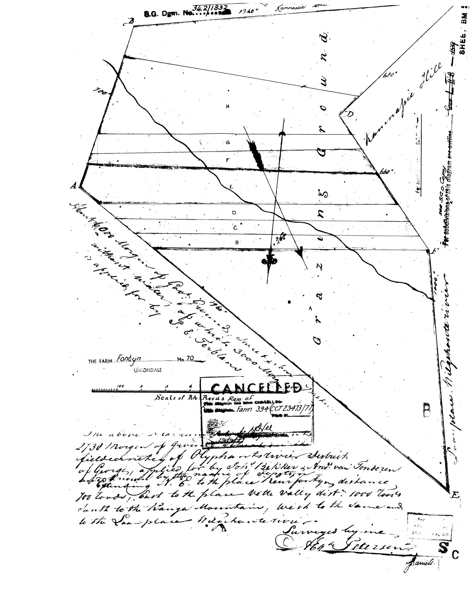
[16 Sep 2026] READ IN FULL: 'The above diagram represents 2738 Morgen of Ground in the fieldcornetcy of Olyphantsrivier, District of George, applied for by Johs Bekker & Andrs van Tonderen and known by the name of Fontyn, extending N.E. to the place Keurfontyn distance 700 roods, East to the place Witte Valley dist. 1000 roods, South to the Kanga Mountains, West to the same and to the Loan-place Wilgehouterivier. Surveyed by me, [A.] Egs Petersen.' Written diagonally: 'About 6000 Morgen of Govt Ground, [illegible] square roods, without water, of which 3000 Morgen is applied for by [?J.] E. Terblans.' Right margin: 'Loan place Wilgehouterivier'; top 'Kammassie'; 'Grazing Ground'. Stamped CANCELLED, Rem. of Farm 394 (CCT 23473/77). Deduction table: DOC-0358.
The research behind this page, kept separate from it: dated working notes, open questions, and what is not yet settled.