Surveyor-General diagram, 341/1832, 1832
Surveyor-General diagram, 1832
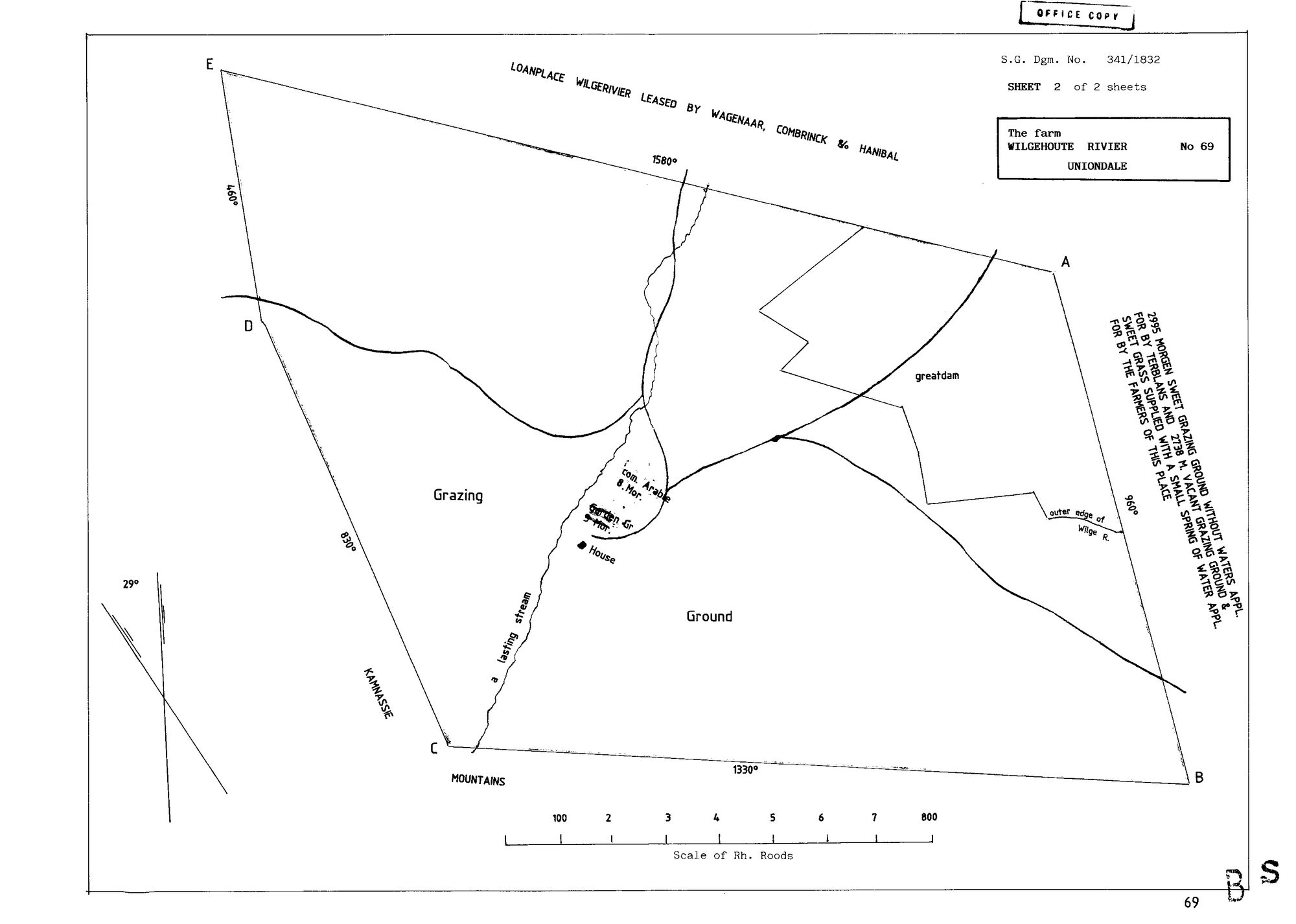
10DU4X01.jpg.The record
- Type
- Surveyor-General diagram
- Diagram number
- 341/1832
- Surveyed
- 1832
- Archive filename
- 10DU4X01.jpg
Citation
- Title
- Wilgehoute Rivier No. 69 diagram 341/1832, sheet 2 of 2
- Repository
- Surveyor-General
- Reference
- SG Dgm 341/1832
- Type
- SG diagram
- Retrieved
- 2026-08-23
The ground it is about
Wilgehoute Rivier No. 69 (Uniondale)
Research notes
SHEET 2 OF 2 - sheet 1 is not held here. Marked 'OFFICE COPY'. Carries a lease legend across the northern boundary: 'LOANPLACE WILGERIVIER LEASED BY WAGENAAR, COMBRINCK & HANIBAL' - three lessees on the adjoining loan place. 2995 morgen sweet grazing without waters, and 2738 morgen vacant grazing applied for by Terblans. Features: a lasting stream, greatdam, com. Arable 8 morgen, Garden Gr. 5 morgen, House, the outer edge of the Wilge R., the KAMNASSIE MOUNTAINS on the south-west.
The research behind this page, kept separate from it: dated working notes, open questions, and what is not yet settled.