Surveyor-General diagram, 2439/1894, 1894
Surveyor-General diagram, 1894
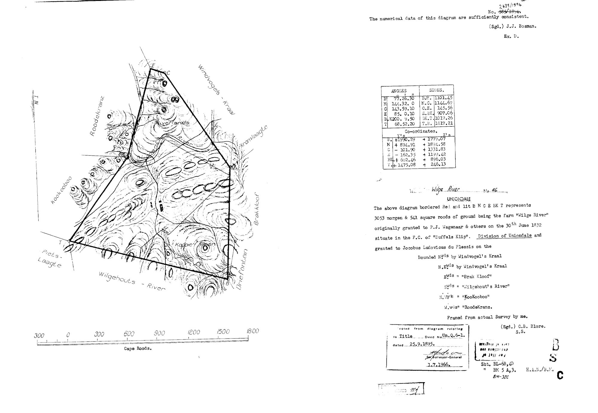
10DW2V01.jpg.The record
- Type
- Surveyor-General diagram
- Diagram number
- 2439/1894
- Surveyed
- 1894
- Titled
- 1894–1 July 1966
- Surveyor
- C. B. Blore
- Archive filename
- 10DW2V01.jpg
Citation
- Title
- SG diagram 2439/1894 - the farm Wilge River No. 46, Division of Uniondale
- Repository
- Chief Surveyor-General, Cape Town (SGCTN). Supplied by Frans.
- Reference
- No. 2439/1894, over a struck 595/1894. Numerical data certified by J. J. Bosman, Ex. D. Copied from the diagram relating to Title Deed No. Un.Q.6-1 dated 25 September 1895; copy 1 July 1966. Sheets BL-6B, 4D and BM 5 A,3.
- Type
- SG diagram
- Retrieved
- 2026-08-20
The ground it is about
Wilge River No. 46 (Uniondale)
Research notes
The 1894 resurvey and grant. ITS OWN DOC- ID, not a verso: it is a separate diagram of the same ground sixty-two years later, with its own surveyor, extent and field-cornetcy.
The research behind this page, kept separate from it: dated working notes, open questions, and what is not yet settled.