Surveyor-General diagram, 482/1832, 1832
Surveyor-General diagram, 1832
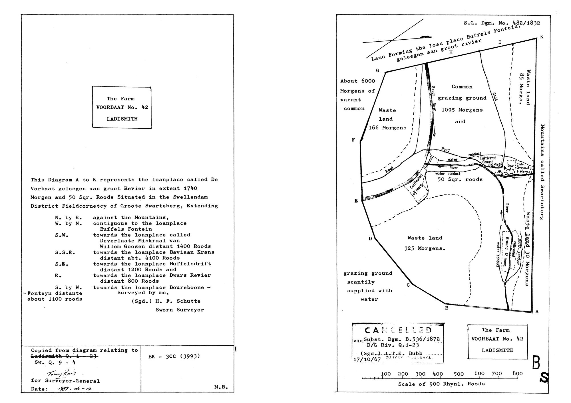
10427522.jpg.The record
- Type
- Surveyor-General diagram
- Diagram number
- 482/1832
- Surveyed
- 1832
- Titled
- 1832–14 June 1989
- Surveyor
- H. F. Schutte
- Archive filename
- 10427522.jpg
Citation
- Title
- SG diagram 482/1832 - the loan place De Voorbaat, aan Groot Revier, Ladismith
- Repository
- Chief Surveyor-General, Cape Town (SGCTN). Supplied by Frans.
- Reference
- S.G. Dgm. No. 482/1832. Copied from the diagram relating to Sw. Q. 9-4, the earlier reference Ladismith Q. 1-23 struck through. BK-3CC (3993). Copy certified for the Surveyor-General 14 June 1989. Cancelled: 'Vide Subst. Dgm. B.536/1872, D/G Riv. Q.1-23, (Sgd.) J.T.E. Bubb, 17/10/67'.
- Type
- SG diagram
- Retrieved
- 2026-08-20
The ground it is about
Voorbaat No. 42 (Ladismith) 42
Research notes
The loan place De Voorbaat aan Groot Revier, 1740 morgen 50 sq roods. Two panels on one sheet: the written description left, the plot right. Withheld from the site by the 1989 copy certification, which is what scan_is_publishable reads.
The research behind this page, kept separate from it: dated working notes, open questions, and what is not yet settled.