SG_map, 301/1817, 1882–1911
SG map, 1882–1911
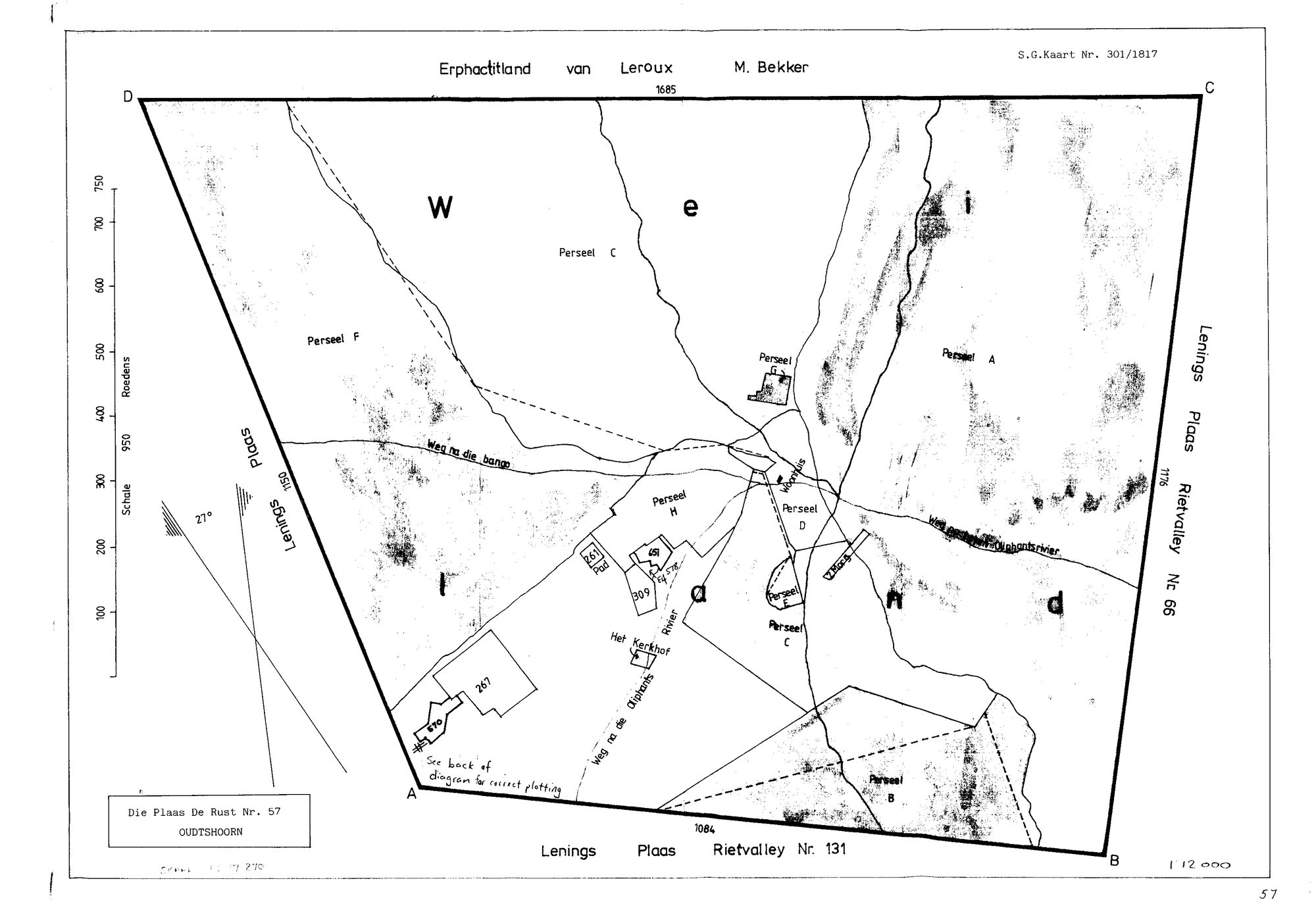
11348385.jpg.The record
- Type
- SG map
- Diagram number
- 301/1817
- Titled
- 1882–1911
- Archive filename
- 11348385.jpg
Citation
- Title
- S.G. Kaart 301/1817 - Die Plaas De Rust No. 57, Oudtshoorn, with its deduction table
- Repository
- Chief Surveyor-General, Cape Town (SGCTN). Supplied by Frans via the CSG esio index.
- Reference
- S.G. Kaart Nr. 301/1817, scale 1:12000, two sheets (face and deduction table). Filed by Frans as 'oudt 57'.
- Type
- SG diagram
- Retrieved
- 2026-08-19
Research notes
Face of the De Rust No. 57 plan, Oudtshoorn, scale 1:12000. Percelen A-H, Het Kerkhof, 'Weg na die Oliphantsrivier', and the Oliphants Rivier itself. Neighbours: Erfpachtland van Leroux/M. Bekker; Lenings Plaas Rietvalley Nr. 66; Lenings Plaas Rietvalley Nr. 131.
The research behind this page, kept separate from it: dated working notes, open questions, and what is not yet settled.