Surveyor-General diagram, 2920, January 1911
Surveyor-General diagram, January 1911
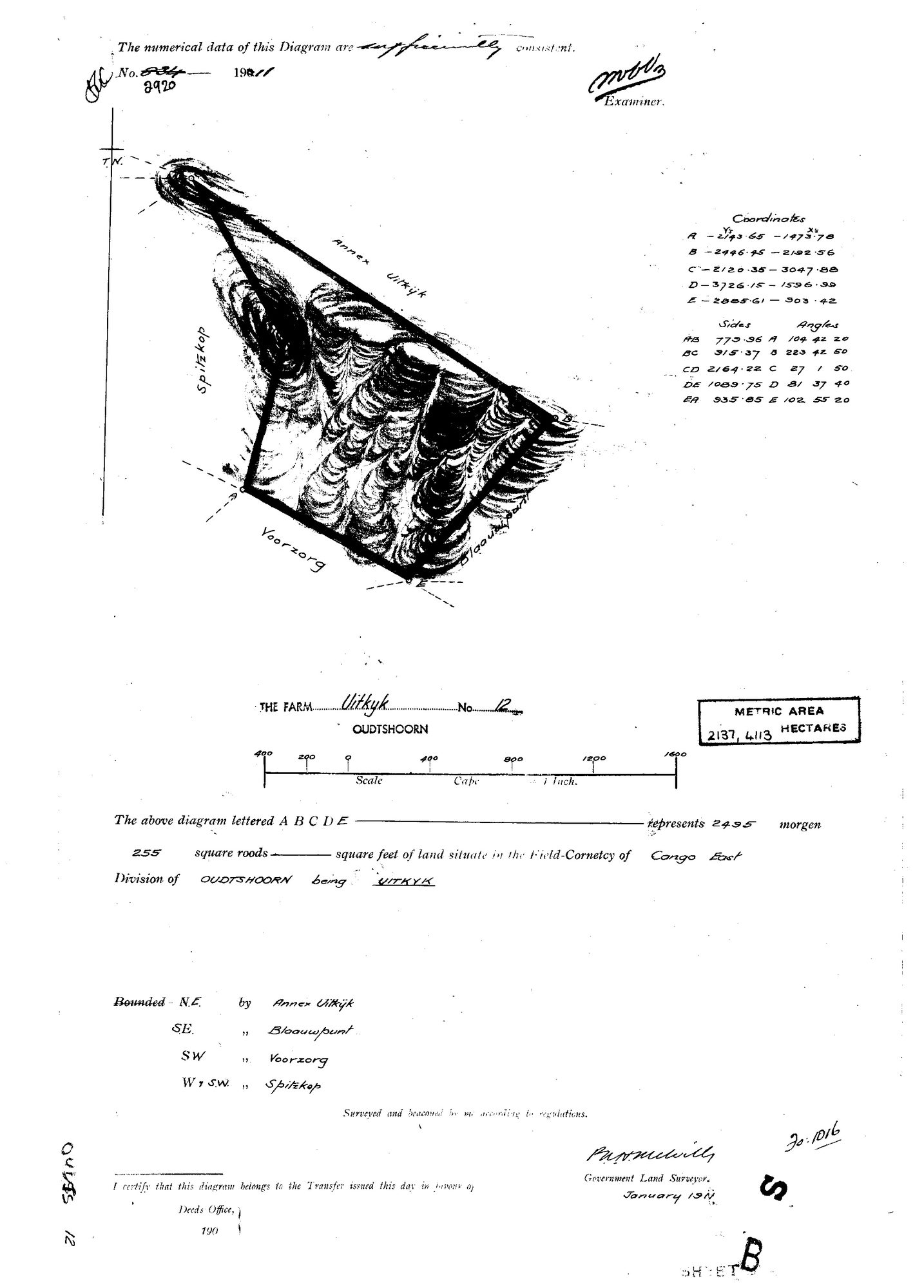
10068042.jpg.The record
- Type
- Surveyor-General diagram
- Diagram number
- 2920
- Surveyed
- January 1911
- Archive filename
- 10068042.jpg
Citation
- Title
- SG diagram 2920 - Uitkyk No. 12, Oudtshoorn, Field Cornetcy of Cango East, 1911
- Repository
- Surveyor-General, Cape Town (via Frans, inbox Original filename 10068042.
- Reference
- Diagram no. 2920. Surveyed and beaconed January 1911. Examiner's note: 'The numerical data of this Diagram are sufficiently consistent.'
- Type
- SG diagram
- Retrieved
- 2026-08-19
The ground it is about
Research notes
Inbox 19 Aug 2026. Filename hint 'oudtshoorn 12' read before the image, per 8, which is what kept it apart from Rietfontein No. 12 in Prince Albert.
The research behind this page, kept separate from it: dated working notes, open questions, and what is not yet settled.