Surveyor-General diagram, 421/1834, 13 January 1834
Surveyor-General diagram, 13 January 1834
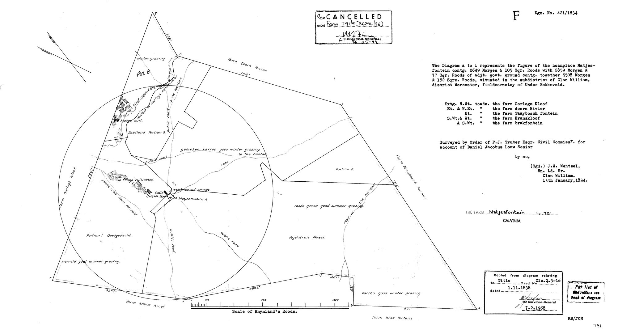
10055722 matjes 791.jpg.The record
- Type
- Surveyor-General diagram
- Diagram number
- 421/1834
- Surveyed
- 13 January 1834
- Titled
- 1 November 1838
- Deed
- Clw.Q.3-16
- Surveyor
- J.W. Wentzel
- Archive filename
- 10055722 matjes 791.jpg
Citation
- Title
- S.G. Diagram 421/1834: the loanplace MATJESFONTEIN, subdistrict of Clanwilliam, district Worcester, fieldcornetcy of Under Bokkeveld - now Matjesfontein No. 791, Calvinia
- Repository
- Surveyor-General. Supplied by Frans in the inbox
- Reference
- Diagram 421/1834; title deed Clw.Q.3-16
- Type
- SG diagram
- Retrieved
- 2026-08-18
Research notes
Filed from the inbox 18 Aug 2026 for LEAD-0151. No parcel row: Calvinia is in as ancestry, not as a community.
The research behind this page, kept separate from it: dated working notes, open questions, and what is not yet settled.