Surveyor-General diagram, B352/1833, August 1833
Surveyor-General diagram, August 1833
10OUR301.The record
- Type
- Surveyor-General diagram
- Diagram number
- B352/1833
- Surveyed
- August 1833
- Titled
- 15 April 1841
- Deed
- Bf.W.Q.5-11
- Surveyor
- C. Lennox Stretch
- Archive filename
- 10OUR301
Citation
- Title
- S.G. Diagram B.352/1833, the farm Vrisch Gewagt No. 163, Prince Albert
- Repository
- Surveyor-General, Cape Town (Western Cape)
- Reference
- S.G. Dgm No. B. 352/1833; sheet marked 163
- Type
- SG diagram
- Retrieved
- 2026-08-15
The ground it is about
Research notes
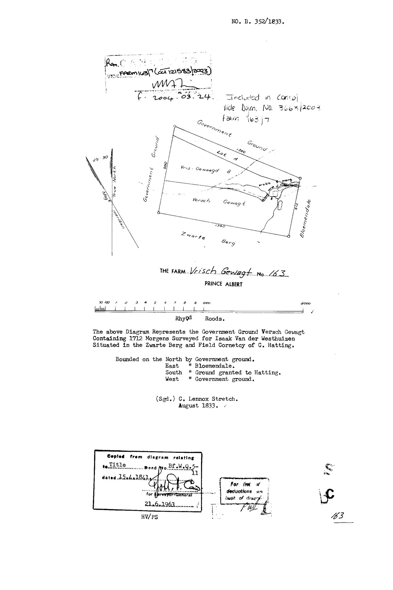
1712 morgen of Government Ground called VERSCH GEWAGT, "Surveyed for ISAAK VAN DER WESTHUIZEN", situated in the Zwarte Berg and FIELD CORNETCY OF C. HATTING. Signed C. Lennox Stretch, August 1833. Bounded N by Government ground, E by Bloemendale, S by ground granted to Hatting, W by Government ground. Copy stamp for the Surveyor-General 21.6.1963.
A GRANT-DAY TITLE: "Copied from diagram relating to Title Deed No. Bf.W.Q.5-11 dated 15.4.1841" - the same afternoon as Middelwater, Vrolikheid, Rondabel, Klaarstroom and the rest (STO-0007). Bf.W.Q.5-11 sits in the same volume and folio run as Uitnood's 5-32, Oorlogs Kloof's 5-30 and Haggas's 5-31, which strengthens the mass-grant reading.
THE FILENAME SAID 165 AND THE SHEET SAYS 163. Frans's hint read "10OUR301 165", but the title block is unambiguous - "THE FARM Vrisch Gewagt No 163, PRINCE ALBERT" - and Bloemendaal No. 165 is named on this diagram as the EASTERN NEIGHBOUR, which is very likely how the two got crossed. 5a-ii applies: what the page says and which record it is are two separate claims, and the page wins.
THE FACE NAMES ITS OWN PARTS: Lot A, Vris-Gewaagd B, Versch Gewagt, an arable of about 8 morgen, and the Zwarte Berg along the southern boundary.
CANCELLED, "Included in consol vide Dgm. No. 3663/2003, farm 163/7", CCT 121583/2003, endorsed 2004.03.24.
The research behind this page, kept separate from it: dated working notes, open questions, and what is not yet settled.