Surveyor-General diagram, 114/1823, 2 June 1823
Surveyor-General diagram, 2 June 1823
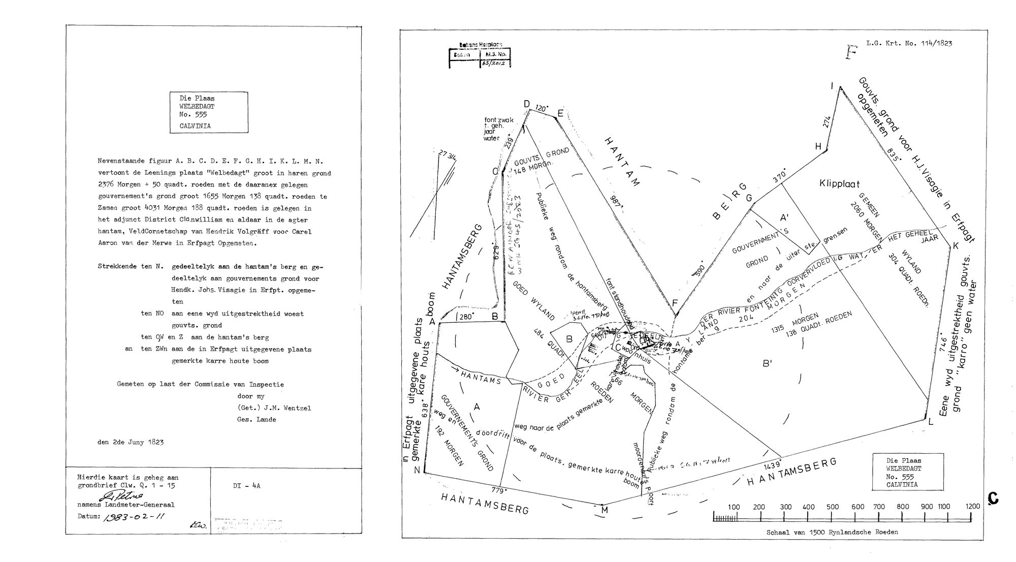
10053943 555.jpg.The record
- Type
- Surveyor-General diagram
- Diagram number
- 114/1823
- Surveyed
- 2 June 1823
- Deed
- grondbrief Clw. Q. 1-15
- Surveyor
- J.M. Wentzel
- Archive filename
- 10053943 555.jpg
Citation
- Title
- L.G. Krt. 114/1823 - the loan place Welbedagt No. 555, Calvinia, measured for Carel Aaron van der Merwe
- Repository
- Surveyor-General, Cape Town (Western Cape)
- Reference
- L.G. Krt. No. 114/1823; grondbrief Clw. Q. 1-15; sheet DI-4A
- Type
- SG diagram
- Retrieved
- 2026-08-11
The ground it is about
Research notes
THE LOAN PLACE WELBEDAGT, MEASURED IN ERFPACHT FOR CAREL AARON VAN DER MERWE (PER-001639), 2 JUNE 1823. Transcribed: "Nevenstaande figuur A. B. C. D. E. F. G. H. I. K. L. M. N. vertoont de Leenings plaats 'Welbedagt' groot in haren grond 2376 Morgen + 50 quadt. roeden met de daaranex gelegen gouvernement's grond groot 1655 Morgen 138 quadt. roeden te Zamen groot 4031 Morgen 188 quadt. roeden is gelegen in het adjunct District Clanwilliam en aldaar in de agter hantam, VeldCornetschap van Hendrik Volgraeff voor Carel Aaron van der MerweL in Erfpagt Opgemeten." Boundaries as written: ten N. partly the hantam's berg and partly government ground measured in erfpacht FOR HENDK. JOHS. VISAGIE; ten NO a wide expanse of waste government ground; ten OW en Z the hantam's berg; ten ZWn the place given out in erfpacht marked karre houte boom. On the face: Klipplaat, lettered blocks A, A', B, B' and C, "der Rivier Fonteintg. oorvloedig water" 204 morgen, a woonhuis, Moordenaars Poort, the Hantams Rivier, a publieke weg rondom de hantamsberg, and two fountains, one "sterk houdend" and one "zwak t. geh. jaar water". SAME SURVEYOR AS OUDE MUUR, LOKENBURG AND TYGERHOEK: this is the FOURTH Wentzel sheet for this family and it is dated three weeks after Tygerhoek.
The research behind this page, kept separate from it: dated working notes, open questions, and what is not yet settled.