Surveyor-General diagram, 1932-11 Kouveld, November 1932
Surveyor-General diagram, November 1932
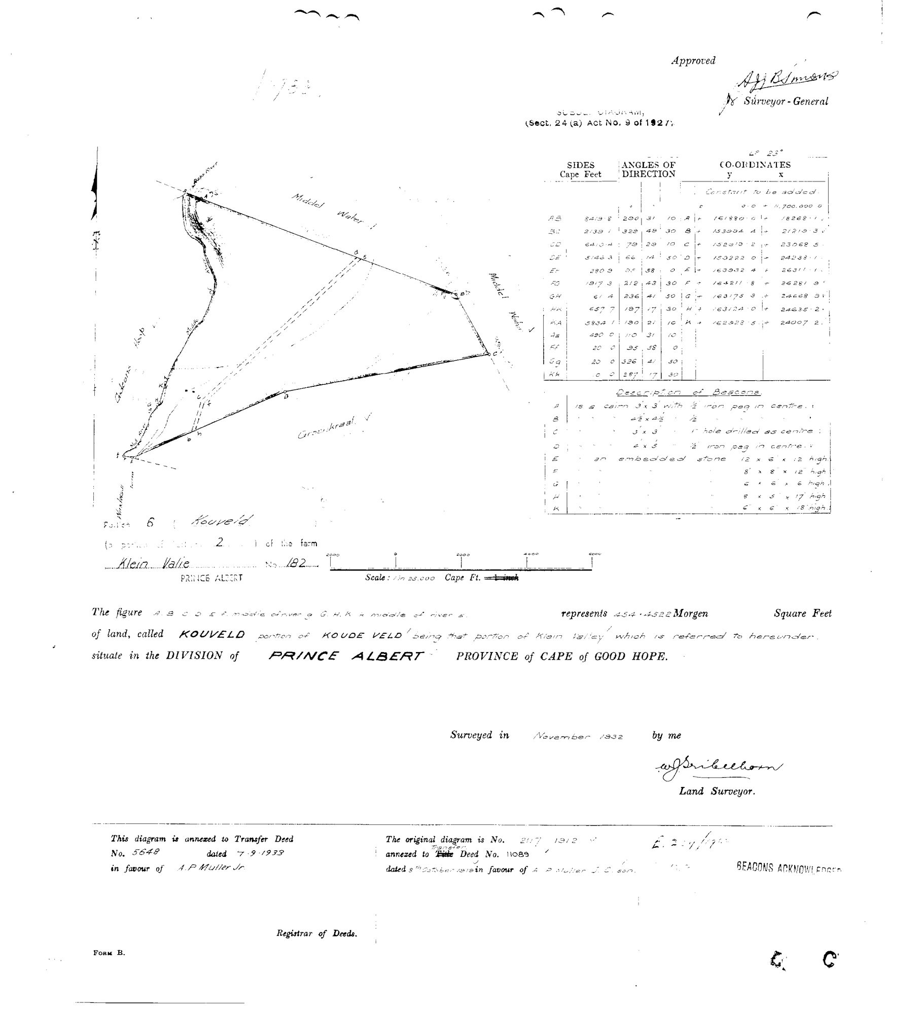
101BEC01.jpg.The record
- Type
- Surveyor-General diagram
- Diagram number
- 1932-11 Kouveld
- Surveyed
- November 1932
- Titled
- 7 September 1933
- Archive filename
- 101BEC01.jpg
Citation
- Title
- 1932-11 Kouveld, Klein Valie No. 182, Prince Albert
- Repository
- Surveyor-General, Cape Town (SGCTN)
- Reference
- 1932-11 Kouveld
- Type
- SG diagram
- Retrieved
- 2026-08-05
The ground it is about
Kouveld (Klein Valie No. 182 Ptn 6)
Research notes
[5 Aug 2026 inbox] Portion 6 KOUVELD, 454.4522 morgen, 'portion of KOUDE VELD being that portion of Klein Valley which is referred to hereunder'. Subdivisional diagram under Sect. 24(a) of Act 9 of 1927, surveyed November 1932 by W.J. Tribelhorn, approved by Surveyor-General A.J.B. Simons. Neighbours on the face: Middel Water, Gideons Hoop, Grootkraal. Annexed to Transfer Deed 5648 dated 7.9.1933 in favour of A.P. Muller Jr. The original diagram is 2117/1912 annexed to Transfer Deed 11089 dated 8 Oct 1919 in favour of A.P. Muller J.C. sonM.
The research behind this page, kept separate from it: dated working notes, open questions, and what is not yet settled.