Surveyor-General diagram, 2118/1912, July 1912
Surveyor-General diagram, July 1912
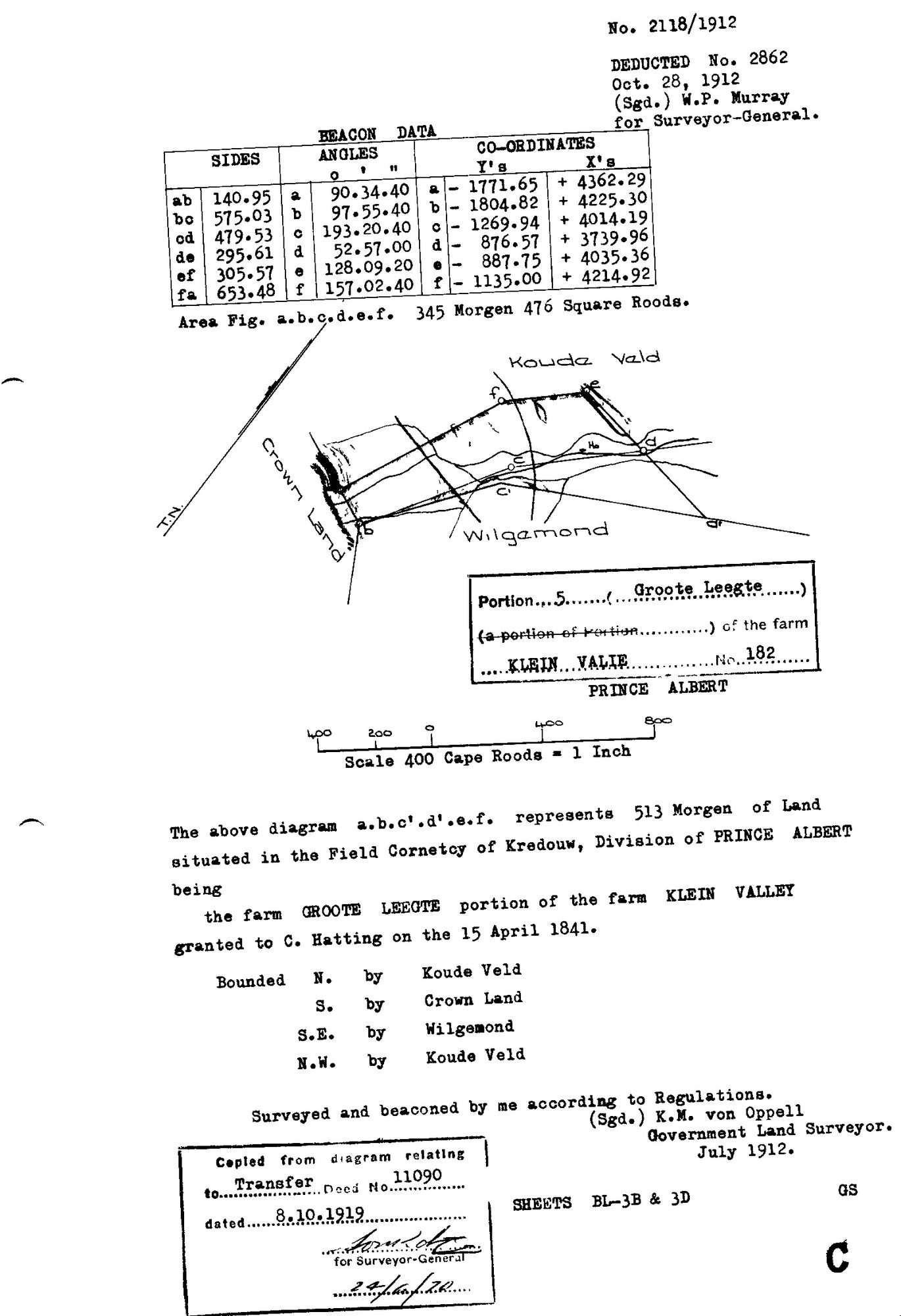
10TVVF01.jpg.The record
- Type
- Surveyor-General diagram
- Diagram number
- 2118/1912
- Surveyed
- July 1912
- Titled
- 8 October 1919
- Archive filename
- 10TVVF01.jpg
Citation
- Title
- 2118/1912, Klein Valie No. 182, Prince Albert
- Repository
- Surveyor-General, Cape Town (SGCTN)
- Reference
- 2118/1912
- Type
- SG diagram
- Retrieved
- 2026-08-05
The ground it is about
Groote Leegte (Klein Valie No. 182 Ptn 5)
Research notes
[5 Aug 2026 inbox] Portion 5 GROOTE LEEGTE, 513 morgen, Field-Cornetcy of Kredouw. K.M. von OppellM, July 1912. Figure a.b.c.d.e.f measures 345 mg 476 sq rds; the diagram a.b.c'.d'.e.f represents 513 mg. Bounded N by Koude Veld; S by Crown Land; SE by Wilgemond; NW by Koude Veld. Deducted No. 2862, 28 Oct 1912. Copied from the diagram relating to Transfer 11090 dated 8.10.1919, sheets BL-3B & 3D. A second, poorer scan of this same sheet arrived under archive reference 10696213 and is held in _inbox/_discard rather than given its own row - it is one sheet.
The research behind this page, kept separate from it: dated working notes, open questions, and what is not yet settled.