Surveyor-General diagram, 522/1839, 1839
Surveyor-General diagram, 1839
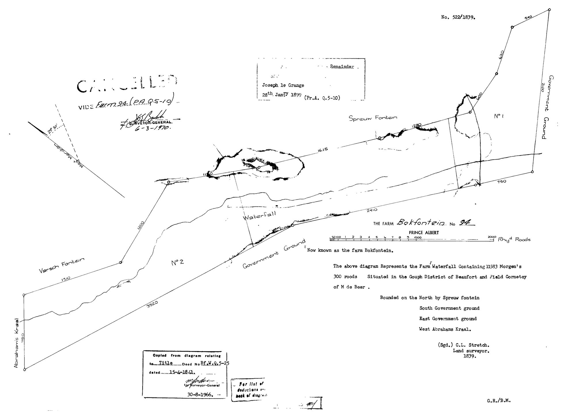
SCAN459 94 0.jpg.The record
- Type
- Surveyor-General diagram
- Diagram number
- 522/1839
- Surveyed
- 1839
- Titled
- 15 April 1841
- Deed
- Bf.W.Q. 5-25
- Surveyor
- C. Lennox Stretch
- Archive filename
- SCAN459 94 0.jpg
Citation
- Title
- SG Dgm 522/1839 - the farm Waterfall, later Bokfontein No. 94, Prince Albert
- Repository
- Landmeter-Generaal, Kaapstad
- Reference
- No. 522/1839; C.L. Stretch, Land surveyor, 1839; title Bf.W.Q. 5-25 of 15 April 1841; copied 30 August 1966; CANCELLED 6 March 1970, vide Farm 94 (P.A.Q. 5-19)
- Type
- SG diagram
- Retrieved
- 2026-08-04
The ground it is about
Bokfontein No. 94 (formerly Waterfall) 94
Research notes
[8 Aug 2026, read] SG 522/1839, C. L. STRETCH, Land surveyor, 1839. 'The above diagram Represents the FARM WATERFALL Containing 11583 Morgen's 300 roods. Situated in the GOUPH DISTRICT OF BEAUFORT and FIELD CORNETCY OF M DE BEER.' A second hand adds 'Now known as the farm Bokfontein'. Bounded N Spreeuw fontein, S and E Government ground, W Abrahams Kraal; a WATERFALL is drawn on the figure, which is what the farm was named for. Copied from the diagram to title Bf.W.Q.5-25 of 15 APRIL 1841 - the grant day - and stamped 30 Aug 1966. Endorsed: Remainder to JOSEPH LE GRANGE, 28 January 1899, Pr.A. Q.5-10. CANCELLED by the Surveyor-General on 6 March 1970 vide Farm 94 (P.A.Q.5-19). M DE BEER IS THE FIELD CORNET who took Pieter Johannes SwanepoelL's beacon declaration on Vlakfontein in July 1833, quoted in STO-0007 - the same official, six years apart, on two sheets here.
The research behind this page, kept separate from it: dated working notes, open questions, and what is not yet settled.