Surveyor-General diagram, 361/1833, September 1833
Surveyor-General diagram, September 1833
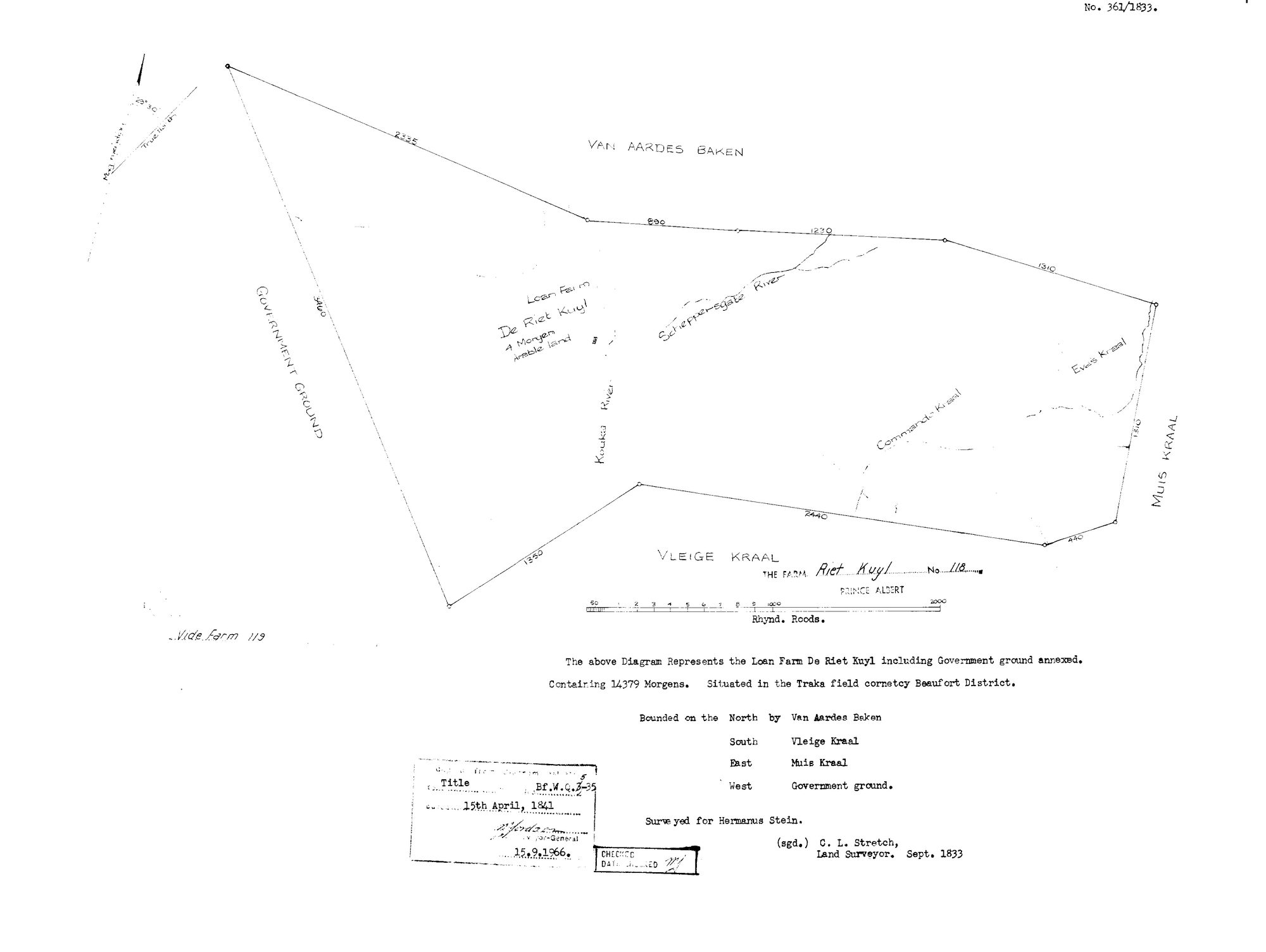
10N1PP01 119 0.jpg.The record
- Type
- Surveyor-General diagram
- Diagram number
- 361/1833
- Surveyed
- September 1833
- Titled
- 15 April 1841
- Deed
- Bf.W.Q. 3-35
- Surveyor
- C. L. Stretch
- Archive filename
- 10N1PP01 119 0.jpg
Citation
- Title
- SG Dgm 361/1833 - the loan farm De Riet Kuyl, later Rietkuil No. 119, Beaufort District
- Repository
- Landmeter-Generaal, Kaapstad
- Reference
- No. 361/1833; surveyed September 1833 by C. L. Stretch, Land Surveyor; Title Bf.W.Q. 3-35 dated 15th April 1841; endorsed 15.9.1966; scale in Rhynland Roods
- Type
- SG diagram
- Retrieved
- 2026-08-03
The ground it is about
Research notes
[8 Aug 2026, read] SG 361/1833, C. L. STRETCH, Land Surveyor, September 1833. 'The above Diagram Represents the Loan Farm DE RIET KUYL including Government ground annexed. Containing 14379 Morgens. Situated in the TRAKA FIELD CORNETCY BEAUFORT DISTRICT.' Bounded N Van Aardes Baken, S Vleige Kraal, E Muis Kraal, W Government ground. 'SURVEYED FOR HERMANUS STEIN' [PER-001603]. FOUR MORGEN of arable land marked. Named on the figure: the KOUKA RIVER, the Schepperegate River, Commando Kraal and Eve's Kraal. Copied from the diagram to title Bf.W.Q.3-35 of 15 APRIL 1841 - the grant day - and stamped 15 Sept 1966. By 1841 the ground is Rietkuil No. 119 and the grantee is Pieter Johannes SwanepoelL, so the loan farm changed hands between the survey and the grant and this project does not know how. 'Vide farm 119' is written in the margin.
The research behind this page, kept separate from it: dated working notes, open questions, and what is not yet settled.