Surveyor-General diagram, 1350/1883, July 1883
Surveyor-General diagram, July 1883
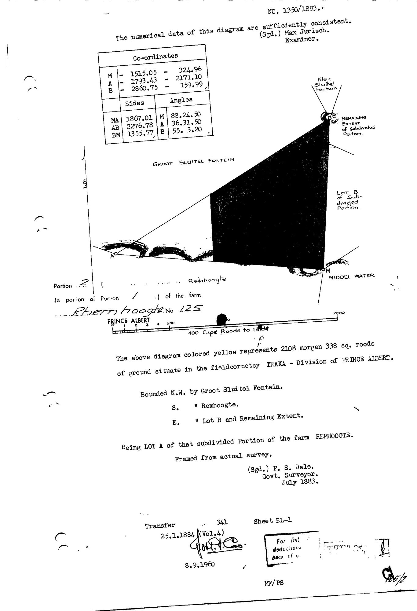
10TSWK01 125 port 2.jpg.The record
- Type
- Surveyor-General diagram
- Diagram number
- 1350/1883
- Surveyed
- July 1883
- Titled
- 25 January 1884
- Deed
- 341/1884
- Surveyor
- P. S. Dale
- Examiner
- Max Jurisch
- Archive filename
- 10TSWK01 125 port 2.jpg
Citation
- Title
- SG Dgm 1350/1883 - Portion 2 of Rhemhoogte No. 125, Lot A of the subdivided Portion 1
- Repository
- Landmeter-Generaal, Kaapstad
- Reference
- No. 1350/1883; surveyed July 1883; surveyor P. S. Dale, Govt. Surveyor; examiner Max Jurisch; Transfer 341, 25.1.1884 (Vol. 4); Sheet BL-1; endorsed 8.9.1960
- Type
- SG diagram
- Retrieved
- 2026-08-03
The ground it is about
Groot Sleutelfontein (Rhemhoogte No. 125 Ptn 2)
Research notes
ITS VERSO carries a single deduction line, and it is the one this project needed: "E.771/1937 4241/1937 Kareemoerhoek 1654,0080 - 13528/1937". Survey record, diagram number, name, extent in morgen, and transfer deed, all on one row.
[5 Aug 2026] This row used to list 2 filenames under one id, which made every sheet after the first unreachable - see 8. The others (10TSWN01 125 port 2.jpg) were re-pulled and now have their own rows: DOC-0243. LEAD-0095 closed.
The research behind this page, kept separate from it: dated working notes, open questions, and what is not yet settled.