Surveyor-General diagram, B.352/1833, August 1833
Surveyor-General diagram, August 1833
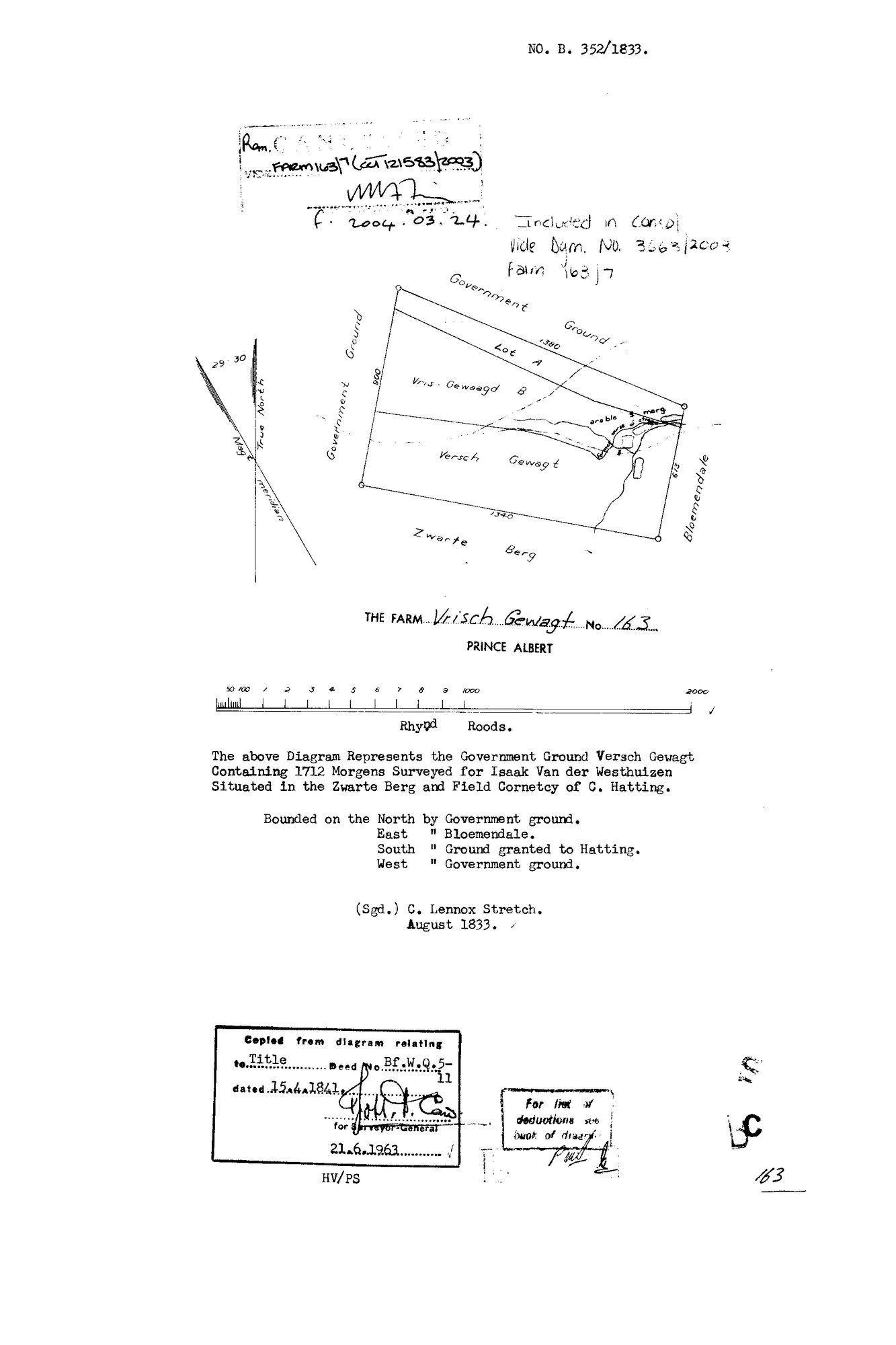
10OUR301 vrisch 1.jpg.The record
- Type
- Surveyor-General diagram
- Diagram number
- B.352/1833
- Surveyed
- August 1833
- Titled
- 15 April 1841
- Deed
- Bf.W.Q.5-11
- Surveyor
- C. Lennox Stretch
- Archive filename
- 10OUR301 vrisch 1.jpg
Citation
- Title
- SG Dgm B.352/1833 - the Government ground Versch Gewagt (Vrisch Gewagt No. 163), Prince Albert, with its deduction verso
- Repository
- Surveyor-General, Cape Town
- Reference
- SG Dgm B.352/1833; title Bf.W.Q.5-11 of 15 Apr 1841; copied 21.6.1963
- Type
- SG diagram
- Retrieved
- 2026-08-02
The ground it is about
Research notes
"The above Diagram Represents the Government Ground Versch Gewagt Containing 1712 Morgens Surveyed for Isaak Van der Westhuizen Situated in the Zwarte Berg and Field Cornetcy of C. HattingM. Bounded on the North by Government ground. East Bloemendale. South Ground granted to Hatting. West Government ground." Cancelled 2004 vide Farm 163/7.
The research behind this page, kept separate from it: dated working notes, open questions, and what is not yet settled.