Surveyor-General diagram, 371/1833, August 1833
Surveyor-General diagram, August 1833
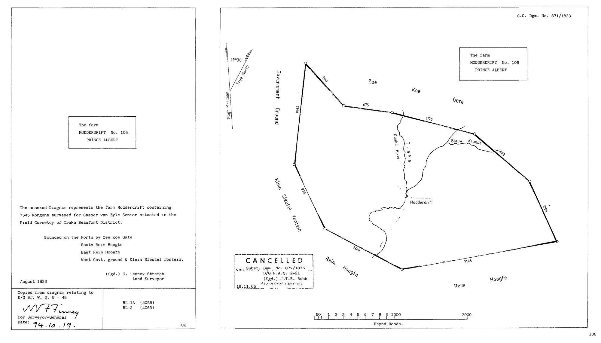
SCAN595 modderdrift 1.jpg.The record
- Type
- Surveyor-General diagram
- Diagram number
- 371/1833
- Surveyed
- August 1833
- Titled
- about 1841
- Deed
- D/G Bf.W.Q. 5-45
- Surveyor
- C.L. Stretch
- Archive filename
- SCAN595 modderdrift 1.jpg
Citation
- Title
- Modderdrift No. 106 diagram, 1833
- Repository
- Surveyor-General
- Reference
- SG Dgm 371/1833
- Type
- SG diagram
- Retrieved
- 2026-08-01
The ground it is about
Research notes
"The annexed Diagram represents the farm Modderdrift containing 7545 Morgens surveyed for Casper van ZylMe Senior situated in the Field Cornetcy of Traka Beaufort District." Bounded N by Zee Koe Gate, S Reim Hoogte, E Reim Hoogte, W Govt. ground & Klein Sleutel fontein. Signed C. Lennox Stretch, Land Surveyor, August 1833. "Copied from diagram relating to D/G Bf. W. Q. 5-45", re-signed for the Surveyor-General 94.10.19. CANCELLED, "vide Subst. Dgm. No. 877/1875, D/G P.A.Q. 2-21", signed J.T.E. Bubb for Surveyor-General 18.11.66. Sheets BL-1A (4056), BL-2 (4063). The map names the Kouka River, the Traka, Blauw Kranse and Modderdrift itself. NOTE ON THE ARRIVAL FILENAME: it begins SCAN595, which is also DOC-0003's original filename (Varsfontein 1921). The stem is a viewer download name, not a stable archive identifier, so it does not identify a document on its own. Recorded as it arrived, per 3.
The research behind this page, kept separate from it: dated working notes, open questions, and what is not yet settled.