Surveyor-General diagram, (illegible), February 1937
Surveyor-General diagram, February 1937
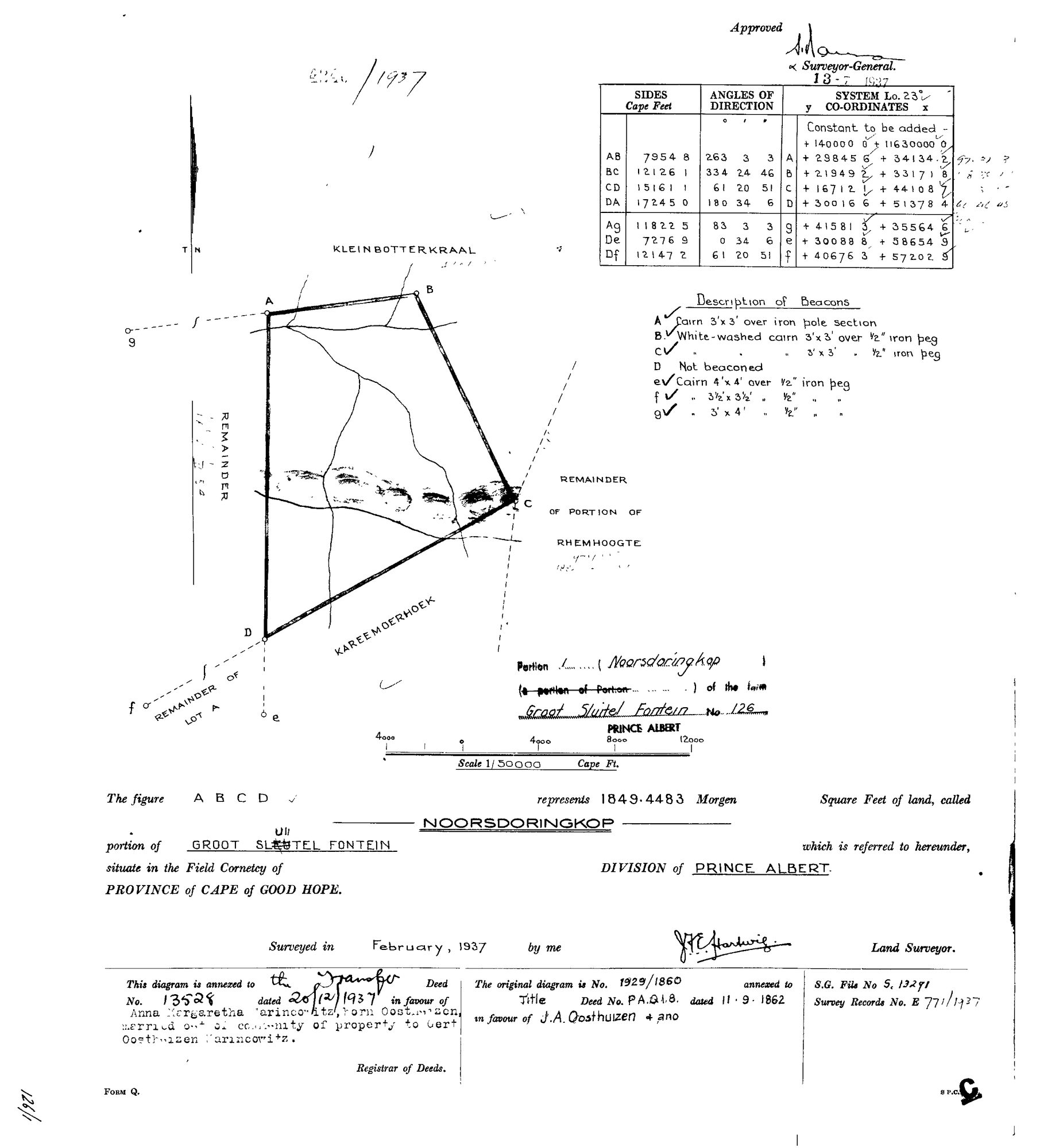
SCAN341.jpg.The record
- Type
- Surveyor-General diagram
- Diagram number
- (illegible)
- Surveyed
- February 1937
- Titled
- 13 July 1937
- Deed
- T13528/1937
- Surveyor
- J.H.E. Hartwig
- Archive filename
- SCAN341.jpg
Citation
- Title
- Noorsdoringkop, Portion 1 of Groot Sluitel Fontein No.126, diagram (1937)
- Repository
- Surveyor-General
- Reference
- S.G. File S.13291; Survey Records E 771/1937; diagram number illegible
- Type
- SG diagram
- Retrieved
- 2026-07-30
The ground it is about
Noorsdoringkop (Groot Sluitel Fontein No. 126 Ptn 1)
Research notes
NOORSDORINGKOP, 1849.4483 morgen. Annexed to transfer deed 13528 of 20 Dec 1937 - the deed that put this ground in Anna Margaretha Marincowitz born Oosthuizen's name. [31 Jul 2026] ID COLLISION REPAIRED. This diagram was assigned DOC-0090 in the 30 Jul inbox, but that id was afterwards issued again to a TANAP corpus inventory. Ids are permanent and never reused, so the diagram takes a NEW id here and the old one keeps whatever it now holds. The five SG diagrams of the Sleutelfontein group had no document rows at all until now, which is why their sources sat unreferenced and their files sat on disk with nothing pointing at them.
[3 Aug 2026] publish_ok=yes. This is an OLD FARM DIAGRAM held back only because a TRANSFER ENDORSEMENT on its face crosses the 1936 scan cut-off - the survey itself is from the 1920s or 1930s. The names on it are the surveyor, the neighbouring farms and a transferee of the 1930s or 1940, all long dead and most of them already published as person records here. Reviewed individually, not opened as a category.
The research behind this page, kept separate from it: dated working notes, open questions, and what is not yet settled.